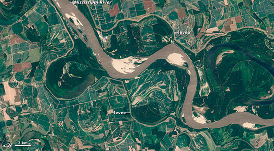
Mississippi River during last year’s floods taken with NASA’s Landsat 5 in August.
Last year, the USA was hit with floods in the Mississippi River, caused by major storms and melting snow. More than 3,000 square miles (7,800 square kilometers) were flooded as the Army Corps of Engineers lifted the floodgates of the Morganza Spillway.
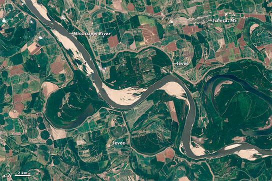
The first photo was taken in August 2011 by NASA’s Landsat 5 satellite of the swollen river. This year, more than 60% of the lower 48 states were in drought and the Mississippi River is running low. An 11-mile (18-kilometer) stretch of the river had to be closed off since August 11th and more than 100 boats were lined up near Greenville, Mississippi, waiting permission to pass.

Mississippi River during this year’s drought, taken by NASA’s Landsat 7 this August.
Water levels near Memphis are 2.4 to 8.3 feet (0.7 to 2.5 meters) below the river stage compared to 11.7 feet (3.6 meters) above at the same time in 2011. The floods also deposited a huge amount of sediment on the river bed, reconfiguring the existing channels and making matters worse.
Closed ports, river sections, and the resulting traffic jams will continue until October. An inch less of draft requires a ship to run with 17 tons less of cargo, resulting in huge losses to the barge industry.


Be the first to comment on "Effects of Drought in the U.S. are Now Visible from Space"