A new geological map based on NASA images shows signs of ancient lakes and quakes on Mars.
This animation simulates a flyover of a portion of a Martian canyon detailed in a geological map produced by the U.S. Geological Survey and based on observations by the HiRISE camera on NASA’s Mars Reconnaissance Orbiter. The landforms include a series of hills called Candor Colles.
Long ago, in the largest canyon system in our solar system, vibrations from “marsquakes” shook soft sediments that had accumulated in Martian lakes.
The shaken sediments formed features that now appear as a series of low hills apparent in a geological map based on NASA images. The map was released today by the U.S. Geological Survey (USGS).
This map of the western Candor Chasma canyon within Mars’ Valles Marineris is the highest-resolution Martian geological map ever released by USGS. It is derived from images taken by the High Resolution Imaging Science Experiment (HiRISE) camera on NASA’s Mars Reconnaissance Orbiter, which reveal details smaller than a desk.
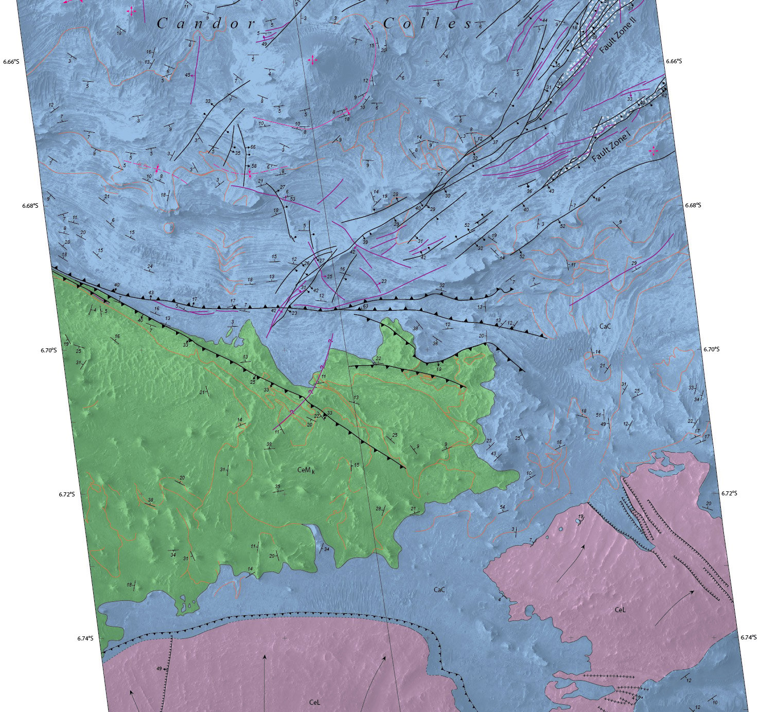
Details of hilly terrain within a large Martian canyon are shown on a geological map based on observations from NASA’s Mars Reconnaissance Orbiter and produced by the U.S. Geological Survey. Credit: NASA/JPL-Caltech/University of Arizona/USGS
“This new map shows that at the time these sediments were deposited, a part of west Candor Chasma, specifically Condor Colles, contained numerous shallow, spring-fed lakes,” said map author Chris Okubo of the USGS Astrogeology Science Center, Flagstaff, Arizona. “These lakes helped to trap wind-blown sand and dust, which accumulated over time and formed the extensive sedimentary deposits we see today.”
The wet sediments experienced seismic shaking in “marsquakes” related to movement along several large geological faults in the area. A series of low hills resulted.
Valles Marineris is more than 2,500 miles (4,000 kilometers) long. The conditions under which sedimentary deposits in it formed have been an open issue for decades. Possibilities proposed have included accumulation in lakebeds, volcanic eruptions under glaciers within the canyons, and accumulation of wind-blown sand and dust.
HiRISE is operated by the University of Arizona, Tucson. The instrument was built by Ball Aerospace & Technologies Corp. of Boulder, Colorado. The Mars Reconnaissance Orbiter Project is managed for NASA’s Science Mission Directorate in Washington, by NASA’s Jet Propulsion Laboratory, Pasadena, California, a division of the California Institute of Technology, also in Pasadena.


Be the first to comment on "New Map of Mars Shows Signs of Ancient Lakes and Quakes"