
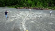
Illegal felling of teak and sal trees in northeastern India has devastated forest cover.
India’s official forest surveys indicate that the country’s 1.2 billion people are managing to preserve its rich forests, even in the face of growing demands for timber and agricultural land. However, Ranjit Gill, a senior official of the Forest Survey of India, states that the nation’s forests have been overestimated and that illegal felling of teak and sal trees in the northeast of the country has devastated forests.
India’s biennial survey, the India State of Forest Report 2011, by the FSI, part of the Ministry of Environment and Forests, estimated that forests cover 692,027 square kilometers (267,193 square miles) of the country, which is about 23% of India’s land area. That’s a decline of only 367 km2 (142 mi²) on the report of 2009. In comparison, in Brazil, more than 13,000 km2 (5,000 mi²) were lost during that same period.

Gill alleges that the government of the Meghalaya state in northeast India has failed to act on the evidence of illegal felling and coal mining, which is ravaging the region’s protected forests. Much of the land that is declared as open or dense forest in Meghalaya has been cleared and allowed to regrow saplings or bamboo.
Illegal sawmills are operating in the area. Similar illegal deforestation is happening in the nearby Rongrenggre protected forest, where 60-70% of the tree cover has been lost. Local rangers are involved in the trade of illegal timber, which fuels coal mining. This could be happening elsewhere.
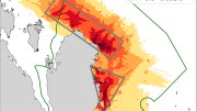
The attrition and loss is quite widespread, states William Laurance, a conservation biologist at the James Cook University in Cairns, Queensland, Australia. The official line is that the forest cover hasn’t been overestimated. However, selected felling of trees would not register in satellite imagery, since the sensors used have a resolution of 23.5 meters (77 feet) per pixel. This is too coarse to unequivocally identify small-scale deforestation.


Be the first to comment on "Reliance on Satellite Data Blamed for Overestimation of India’s Forest Cover"