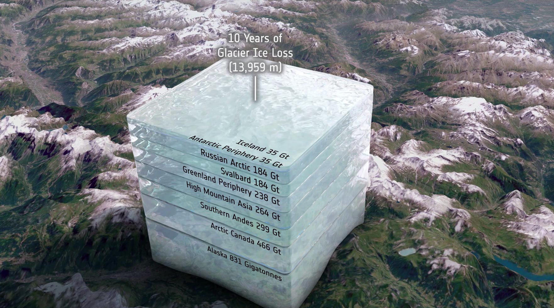
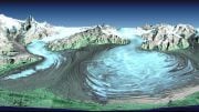
While Greenland and Antarctica are losing masses of ice, so too are most of the glaciers around the world, but it’s tricky to measure how much ice they are shedding. Thanks to ESA’s CryoSat satellite and a breakthrough way of using its data, scientists have discovered that glaciers worldwide have shrunk by a total of 2% in just 10 years. That adds up to 2720 Gigatonnes in all. This can be imagined as a giant ice cube, bigger than Europe’s highest mountain. Credit: ESA/Planetary Visions
Scientists have used data from ESA’s CryoSat satellite to reveal that global glaciers shrunk by 2%, losing 2720 Gigatonnes of ice from 2010 to 2020, with 89% of the loss due to higher air temperatures. This glacier reduction, which threatens freshwater supply and contributes more to sea-level rise than the ice loss from polar ice sheets, was presented at the European Geosciences Union General Assembly in Austria.
When one thinks of the damage that climate change is doing, it’s probable that what comes to mind is a vision of huge lumps of ice dropping off one of the polar ice sheets and crashing into the ocean. While Greenland and Antarctica are losing masses of ice, so to are most of the glaciers around the world, but it’s tricky to measure how much ice they are shedding.
Thanks to ESA’s CryoSat satellite and a breakthrough way of using its data, scientists have discovered that glaciers worldwide have shrunk by a total of 2% in just 10 years, and it’s because of higher air temperatures.
A paper, published on April 26, 2023, in the journal Geophysical Research Letters, describes how scientists have used a particular technique of processing CryoSat data to reveal that glaciers lost a whopping 2720 Gigatonnes of ice between 2010 and 2020.
Their research also demonstrates that higher air temperatures are responsible for 89% of this ice loss.
Thanks to ESA’s CryoSat satellite and a breakthrough way of using its data, scientists have discovered that glaciers worldwide have shrunk by a total of 2% in just 10 years, and it’s because of higher air temperatures. Credit: ESA/Planetary Visions
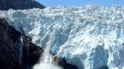
Glaciers are found on all continents except Australia. They provide an essential source of freshwater. For example, glaciers in high-mountain Asia alone provide water for over 1.3 billion people. Glaciers are also important for industries such as hydropower.
The demise of glaciers around the world is, therefore, set to cause serious problems for local populations and those relying on outflow water further downstream.
In addition, ice being lost from glaciers is contributing more to sea-level rise than the ice being lost from either of the giant ice sheets on Greenland and Antarctica.
Despite mountain glaciers being key indicators of climate change and being important to society, estimates of global glacier mass loss have remained limited to a few scientific studies. This is because there are numerous practical challenges in mapping and monitoring glaciers, which tend to lie in complex rugged terrain, and because there isn’t a specific satellite mission dedicated to doing this.
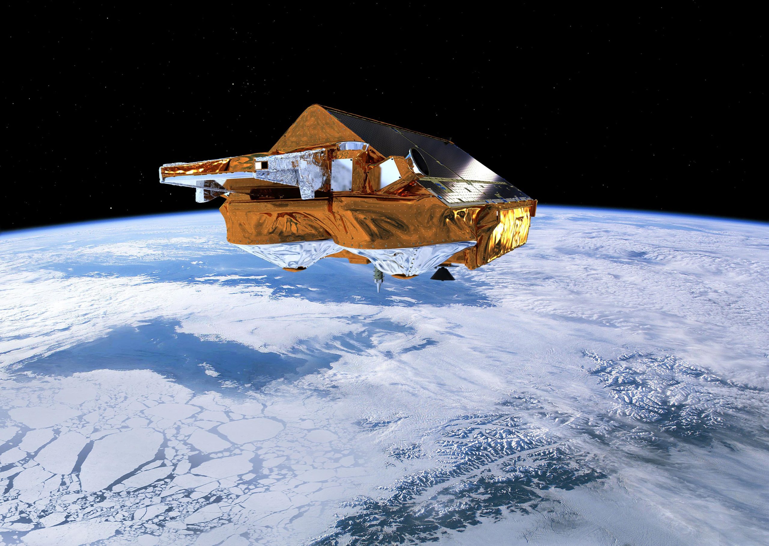
ESA’s Earth Explorer CryoSat mission is dedicated to precise monitoring of changes in the thickness of marine ice floating in the polar oceans and variations in the thickness of the vast ice sheets that blanket Greenland and Antarctica. Credit: ESA/AOES Medialab
Noel Gourmelen, from the University of Edinburgh in the UK, said, “I’m sure most people have seen photographs taken at different times that show how a glacier terminus has retreated over time. And we can see this from satellite images too.
“But we need to measure how a glacier’s volume is changing to really make sense of what is happening.”
The research team turned to ESA’s CryoSat satellite, which carries a radar altimeter to measure the height of ice surfaces. This works well for measuring sea level and the height of sea ice, which is used to work out how ice thickness changes, and for measuring vast polar ice sheets.
However, the footprint of this type of instrument is too coarse to measure and monitor mountain glaciers.
“Some years ago, we developed a technique of processing CryoSat data, called swath processing, which has revolutionized the use of CryoSat data over complex icy terrains. It unveils a wealth of new detail on glaciers,” noted Dr Gourmelen.
Livia Jakob, from Earthwave in the UK, explained, “We’ve been able to use this technique to study glaciers all over the world and we can report that, in total, mountain glaciers lost 2% of their volume between 2010 and 2020.
“That adds up to 2720 Gigatonnes in all. This can be imagined as a giant ice cube, bigger than Europe’s highest mountain, which is quite shocking. Importantly, we also found that air temperature, which causes the ice surface to melt, accounts for 89% of this ice loss.”
While warmer air temperatures are responsible for this decreasing ‘surface mass balance’, the research team found that something called ‘ice discharge’ was responsible for the other 11% of ice lost.
This is associated with glaciers that terminate at the coast, where warmer ocean waters are largely responsible for thinning the front of the ice flow.
Dr. Gourmelen said, “The relative contribution of decreasing surface mass balance and increasing ice discharge to sea-level change is well known for the Greenland and Antarctic ice sheets. Now we know more about how the atmosphere and ocean are teaming up to melt glaciers. There is still plenty of work to do to refine these numbers, and to incorporate this knowledge into our glacier projections.”
Stephen Plummer from ESA explains, “The innovative work using CryoSat in swath altimetry mode demonstrates the value of its altimeter for monitoring glaciers, thus achieving one of the mission’s secondary objectives.
“This work laid the basis for the Glacier Mass Balance intercomparison Exercise, Glambie, to reconcile the different estimates of glacier mass balance from a multitude of satellite and in-situ methods. It also helps in guiding the design of the Copernicus Sentinel Expansion CRISTAL mission for monitoring land ice, ensuring continuity in monitoring glaciers globally.”
Reference: “Glacier Mass Loss Between 2010 and 2020 Dominated by Atmospheric Forcing” by Livia Jakob and Noel Gourmelen, 26 April 2023, Geophysical Research Letters.
DOI: 10.1029/2023GL102954
The team’s research, which is supported by ESA’s Earth Observation Science for Society program, was presented at the European Geosciences Union General Assembly, taking place this week in Austria.


“They provide an essential source of freshwater. For example, glaciers in high-mountain Asia alone provide water for over 1.3 billion people.”
Consider that if we should be successful in eliminating warming, attributed to anthropogenic greenhouse gases, the amount of meltwater would be reduced, creating hardships for those 1.3 billion people. If we induced cooling, the meltwater would be further reduced, perhaps eliminated all together.
Be careful what you wish for!
But just think of how much less their environmental impact would be if the 1.3 billion people dried away. With all of Earth’s glaciers expected to disappear by 2020, can we really afford to wait for these people to dehydrate? VHEMT is taking too long.