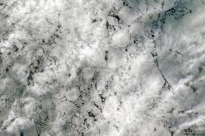
Natural color – February 23, 2022. (Click image for wide view.)
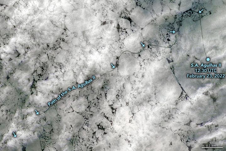
Enhanced natural color – February 23, 2022.
An icebreaker cut through persistent sea ice in the Weddell Sea during an expedition that ultimately located Shackleton’s lost ship.
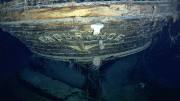
An international expedition has located the lost ship of Antarctic explorer Ernest Shackleton more than 100 years after it was crushed by ice and sank. The discovery of Endurance on the floor of the Weddell Sea occurred on March 5, 2022—late in the austral summer, after much of the sea ice around Antarctica had melted away.
Even during this annual low point for sea ice, the Weddell Sea retains at least some ice. One reason is that the Weddell reaches farther south than other parts of the Southern Ocean. This keeps the water colder and ice growing for a longer period in winter.
But the main reason relates to how the ice circulates with the winds and currents. Elsewhere around Antarctica, ice tends to drift north into warmer water and melt; in the Weddell Sea, it is usually caught up in a clockwise gyre. “This helps the ice to stay around and become multi-year ice,” said Walt Meier, a sea ice researcher at the National Snow and Ice Data Center (NSIDC).
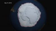
First-year ice, and likely some thicker multi-year ice and icebergs, are visible in this image acquired on February 23, 2022, with the Operational Land Imager-2 (OLI-2) on Landsat 9. Notice the line meandering through the ice on the Weddell Sea. This is the path cut by the South African polar research and logistics vessel S.A. Agulhas II during the expedition team’s search for Endurance. (Note that the line has been enhanced to help it stand out.)
March 5, 2022
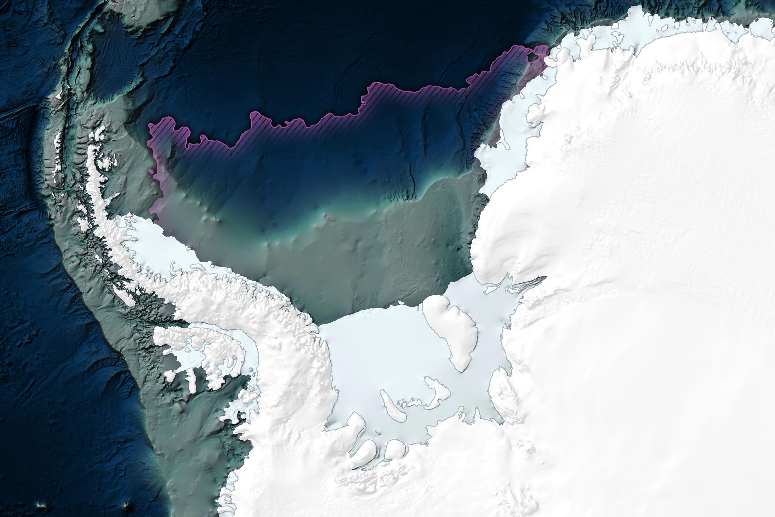
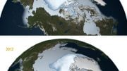
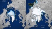
The wide view above shows sea ice extent (pink line) and the location of the icebreaker when Endurance was discovered on March 5 at a depth of 3,008 meters (9,869 feet). One week earlier, sea ice around Antarctica reached the lowest extent ever observed since the start of the satellite record in 1979. In the Weddell Sea, there was more ice than usual on the east side (toward the prime meridian) in 2022 and less ice than usual along the peninsula.
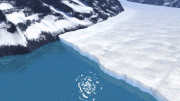
To access the search area, the Agulhas II (pictured below) had to travel deep into pack ice. While multi-year ice in the Arctic can reach 4 meters (13 feet) thick, multi-year ice around Antarctica is generally around 2 meters (7 feet). That’s a reasonable thickness for large icebreakers to handle, but less so for wooden ships like Endurance. “Because of the presence of ice through the summer and the generally thicker multi-year ice,” Meier said, “the Weddell is never a friendly place for a ship that is not ice-strengthened.”
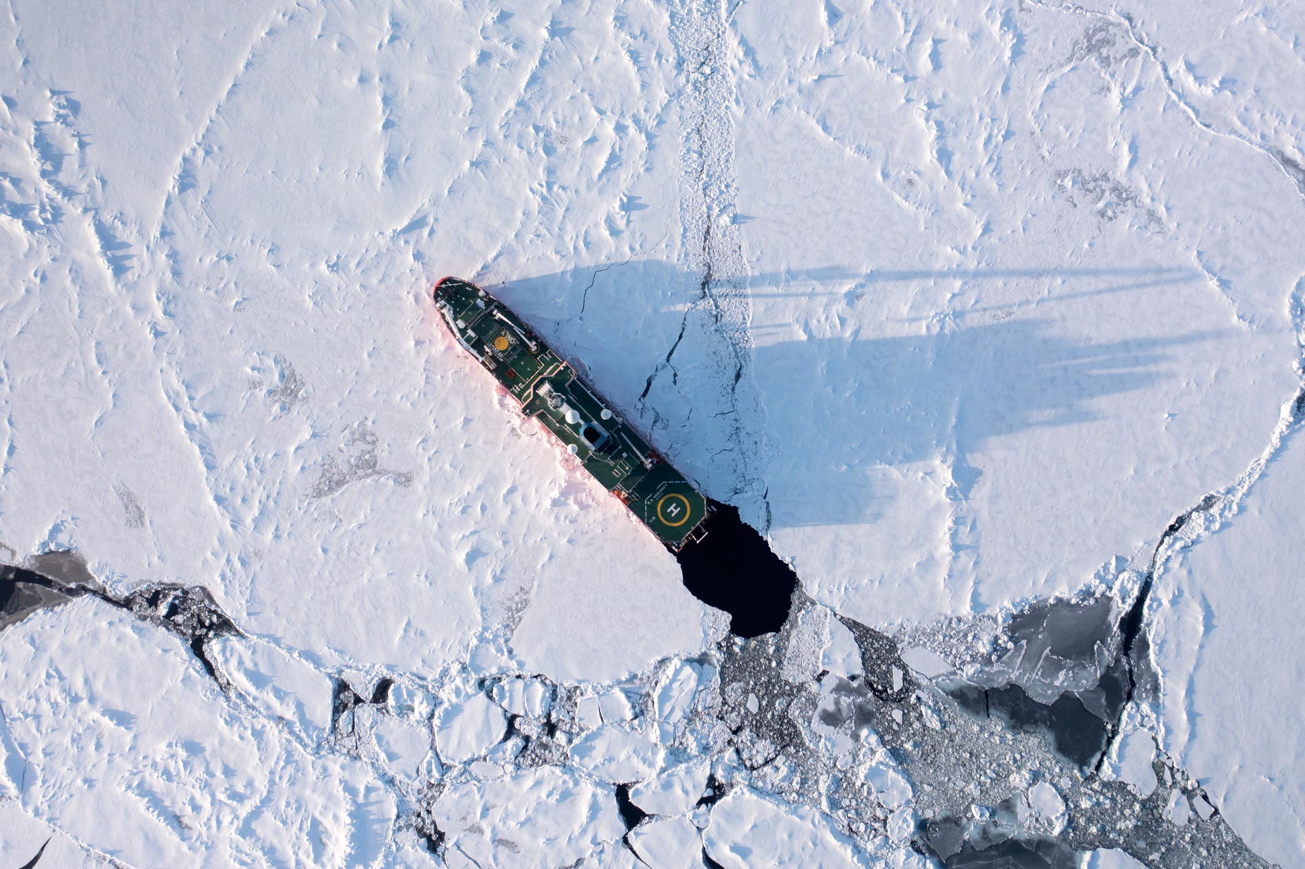
NASA Earth Observatory images by Joshua Stevens, using Landsat data from the U.S. Geological Survey with additional processing by Norman Kuring, bathymetry and topography data from the General Bathymetric Chart of the Oceans (GEBCO), and sea ice extent from Global Change Observation Mission 1st-Water (GCOM-W1) and the Japan Aerospace Exploration Agency. Photo courtesy of James Blake/Falklands Maritime Heritage Trust. The Endurance22 expedition was organized and funded by The Falklands Maritime Heritage Trust.


Very Iteresting
Very Interesting