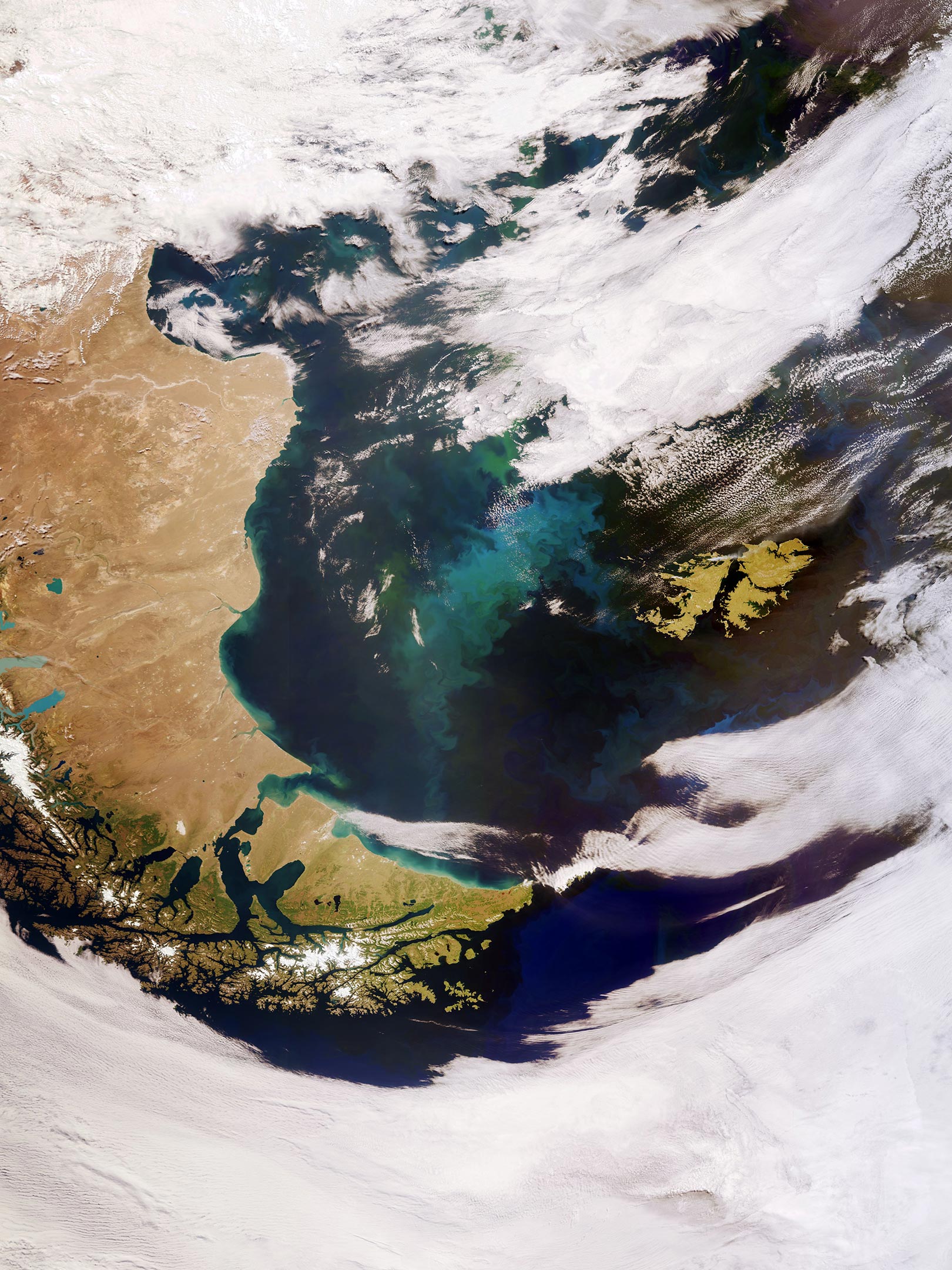
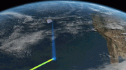
(Click image for full view.) The Copernicus Sentinel-3 mission captured this satellite view of Patagonia at the southern end of South America and the Falkland Islands (Malvinas). Credit: Contains modified Copernicus Sentinel data (2022), processed by ESA, CC BY-SA 3.0 IGO
This impressive, wide-angled view of Patagonia at the southern end of South America, as well as the Falkland Islands (Malvinas) was captured by the European Space Agency’s Copernicus Sentinel-3 mission.
Covering an area of around 673,000 sq km (260,000 sq miles), Patagonia is split by Argentina and Chile. The region comprises the southern section of the Andes Mountains, with lakes, fjords, rainforests, and glaciers in the west and deserts and tablelands to the east.
Tierra del Fuego, an island archipelago located at the southern tip of Patagonia (the southernmost tip of the image), is shared by Argentina and Chile. However, the eastern part of the main island belongs to Argentina, and the southern point of the archipelago, which forms Cape Horn, belongs to Chile. The Strait of Magellan, named after the discoverer Ferdinand Magellan, lies between Tierra del Fuego and mainland Argentina.
Part of the Alberto de Agostini National Park can be seen at the bottom of the image. The park features a highly irregular coastline, which is deeply indented by fjords. Deemed a designated UNESCO Biosphere Reserve, the park has several tidewater glaciers and comprises the islands of Gordon, Cook, and Londonderry.
The Falkland Islands can be seen in the far right of the image. The islands lie in the South Atlantic Ocean, around 600 km (370 miles) east of Patagonia. The Falklands comprise two main islands, West Falkland and East Falkland, separated by the Falkland Sound – a channel that averages around 20 km (12 miles) in width.
The swirling green and blue colored areas are densely concentrated phytoplankton blooms. These microscopic organisms thrive in the cool, nutrient-rich waters between the coast of southern Argentina and the Falkland Islands. Nutrients carried by rivers promote phytoplankton growth, which may explain the plankton hugging the South American coastline in the image, as well as dust carried from Patagonia offshore which is then diffused on the ocean surface by strong westerly winds.
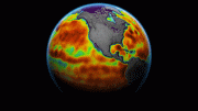
In spring and summer, populations of algae in the South Atlantic often explode into enormous blooms – which float with the meandering ocean currents. Carrying a suite of cutting-edge instruments, Copernicus Sentinel-3 measures systematically Earth’s oceans, land, ice, and atmosphere to monitor and understand large-scale global dynamics.
Sentinel-3 measures the temperature, color, and height of the sea surface as well as the thickness of sea ice, while over land maps land, provides indices of vegetation state, and measures the height of rivers and lakes.
This image is also featured on the Earth From Space video program embedded above.
Be the first to comment on "Exploring Earth From Space: Patagonia and the Falkland Islands"