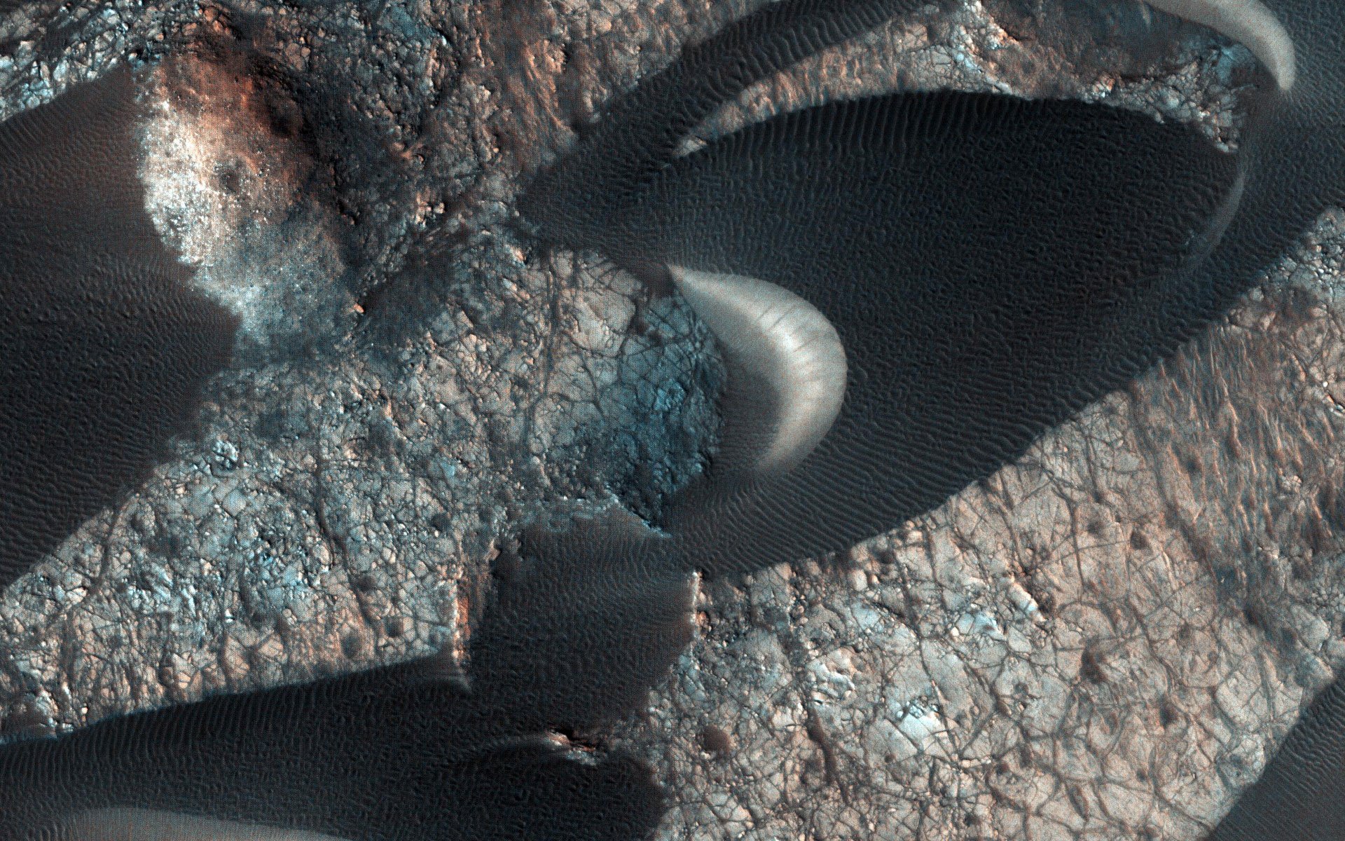
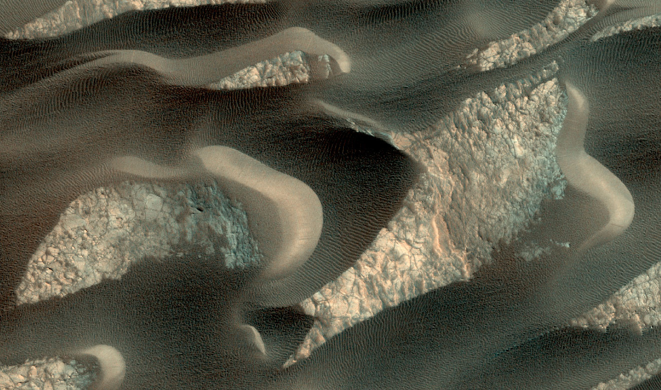
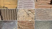
Sand Dunes Near Nili Patera on Mars. They have an elongated crescent form and are called “barchan dunes.” They are formed by the continuous action of the wind blowing in the same direction. Credit: NASA/JPL-Caltech/University of Arizona
In this image many sand dunes are visible. They have an elongated crescent form and are called “barchan dunes.” They are formed by the continuous action of the wind blowing in the same direction.
The orientation of these dunes tells us that the prevailing wind blows from right to left (east to west). The wind is continuously moving sand grains up the longer dune slope, towards the top. The small ripples on the slope are caused by this movement. When the sand grains arrive at the top, they fall down the steeper and shorter slope, which as a consequence, has no ripples. It is this gradual sand movement that causes the dunes to slowly move over time.
The map is projected here at a scale of 25 centimeters (9.8 inches) per pixel. North is up. Credit: NASA/JPL-Caltech/University of Arizona
The map is projected here at a scale of 25 centimeters (9.8 inches) per pixel. (The original image scale is 27.3 centimeters [10.7 inches] per pixel [with 1 x 1 binning] to 54.5 centimeters [21.5 inches] per pixel [with 2 x 2 binning].) North is up.
The University of Arizona, Tucson, operates HiRISE, which was built by Ball Aerospace & Technologies Corp., Boulder, Colorado. NASA’s Jet Propulsion Laboratory, a division of Caltech in Pasadena, California, manages the Mars Reconnaissance Orbiter Project for NASA’s Science Mission Directorate, Washington.


Be the first to comment on "HiRISE Spots Sand Dunes Near Nili Patera on Mars"