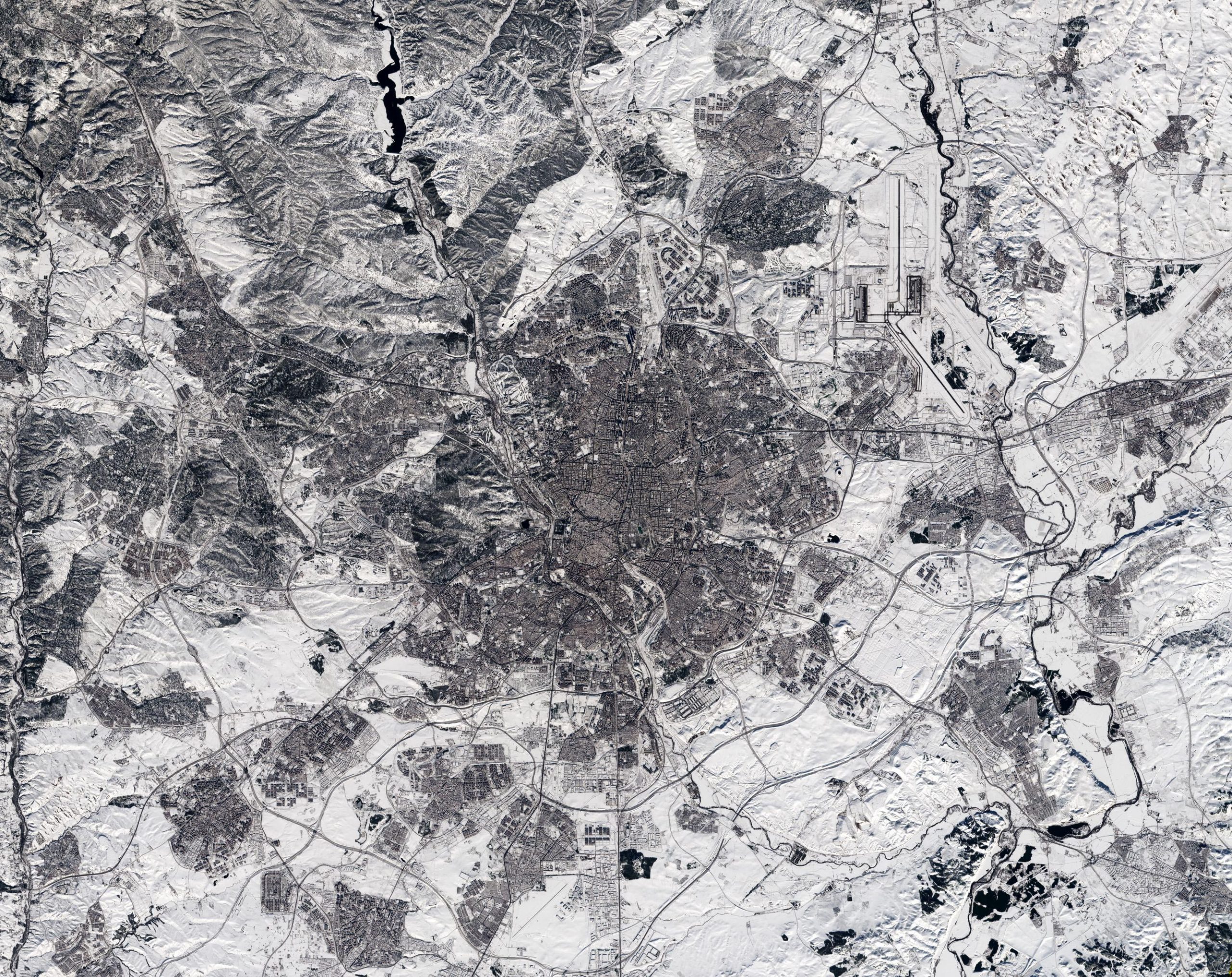
Satellite image captures Madrid’s heaviest snowfall in 50 years. Credit: Contains modified Copernicus Sentinel data (2021), processed by ESA, CC BY-SA 3.0 IGO
Captured by the Copernicus Sentinel-2 mission on January 11, 2021, at 12:14 CET, this image of Madrid in Spain appears to have been taken in black and white. In fact, it is a true-color image – but the heaviest snowfall in 50 years has blanketed the region, turning the landscape white.
Storm Filomena hit Spain over the weekend, blanketing parts of the country in thick snow and leaving half of the country on red alert. Madrid, one of the worst affected areas, was brought to a standstill with the airport having to be closed, trains canceled and roads blocked.
Although this satellite image was taken after the storm had passed, it is clear to see that much snow still remains, especially in the outskirts of the city. For example, some runways at the airport, which are visible in the top-right of the image, are still covered by snow. The unusually cold weather on the Iberian Peninsula is expected to last until later this week with temperatures forecasted to plunge to –12°C (10°F). The race is on to clear roads so that supplies of essential goods such as food supplies and COVID-19 vaccines can be delivered.
Copernicus Sentinel-2 is a two-satellite mission. Each satellite carries a high-resolution camera that images Earth’s surface in 13 spectral bands. Together they cover all Earth’s land surfaces, large islands, inland and coastal waters every five days at the equator.


Be the first to comment on "Madrid Snowbound – Stunning Satellite Image Captures Heaviest Snowfall in 50 Years"