A recent study determined the Mission Creek strand, which passes through major water and power infrastructure for the greater Los Angeles region, as the primary earthquake threat along the southern San Andreas fault.
Addressing uncertainties about where large earthquakes are most likely to occur along the southern San Andreas fault, which splits into multiple strands east of Los Angeles, a new study identifies a strand that has largely flown under the radar of public concern as the region’s greatest earthquake threat.
The study determines that the Mission Creek strand, which passes through major water and power infrastructure for the greater Los Angeles region, may account for almost the entire slip rate of this portion of the fault, suggesting it may actually be the primary Pacific-North American plate boundary fault at this latitude.
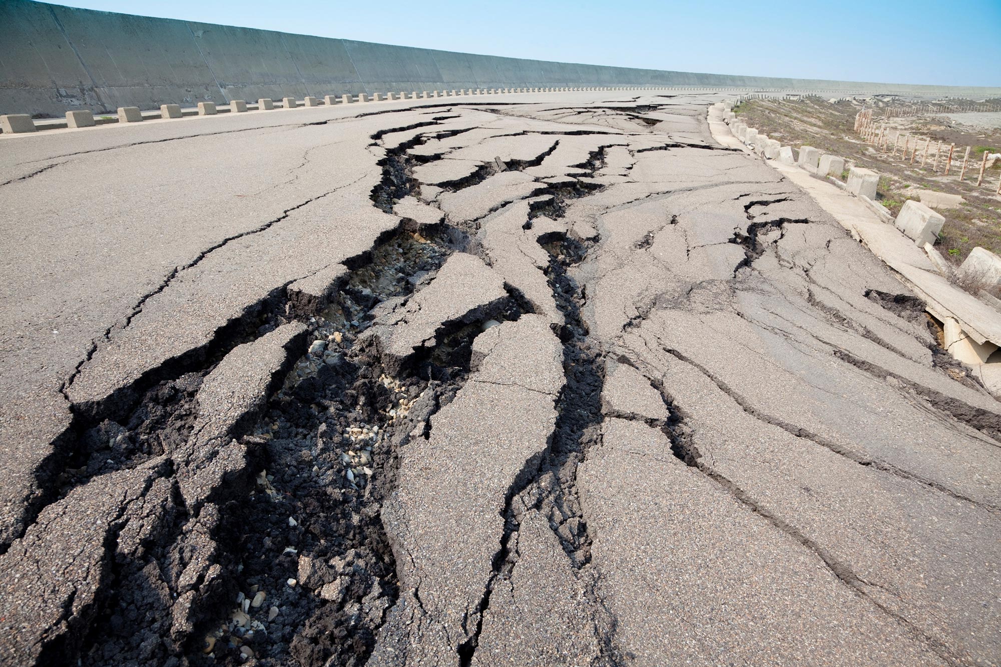
The San Andreas fault threatens large future earthquakes, since its southernmost section has not ruptured in almost 300 years and has accumulated significant strain. However, determining which of the region’s multiple fault strands carries the brunt of this strain has proven challenging due to limited resolution in slip rate models.
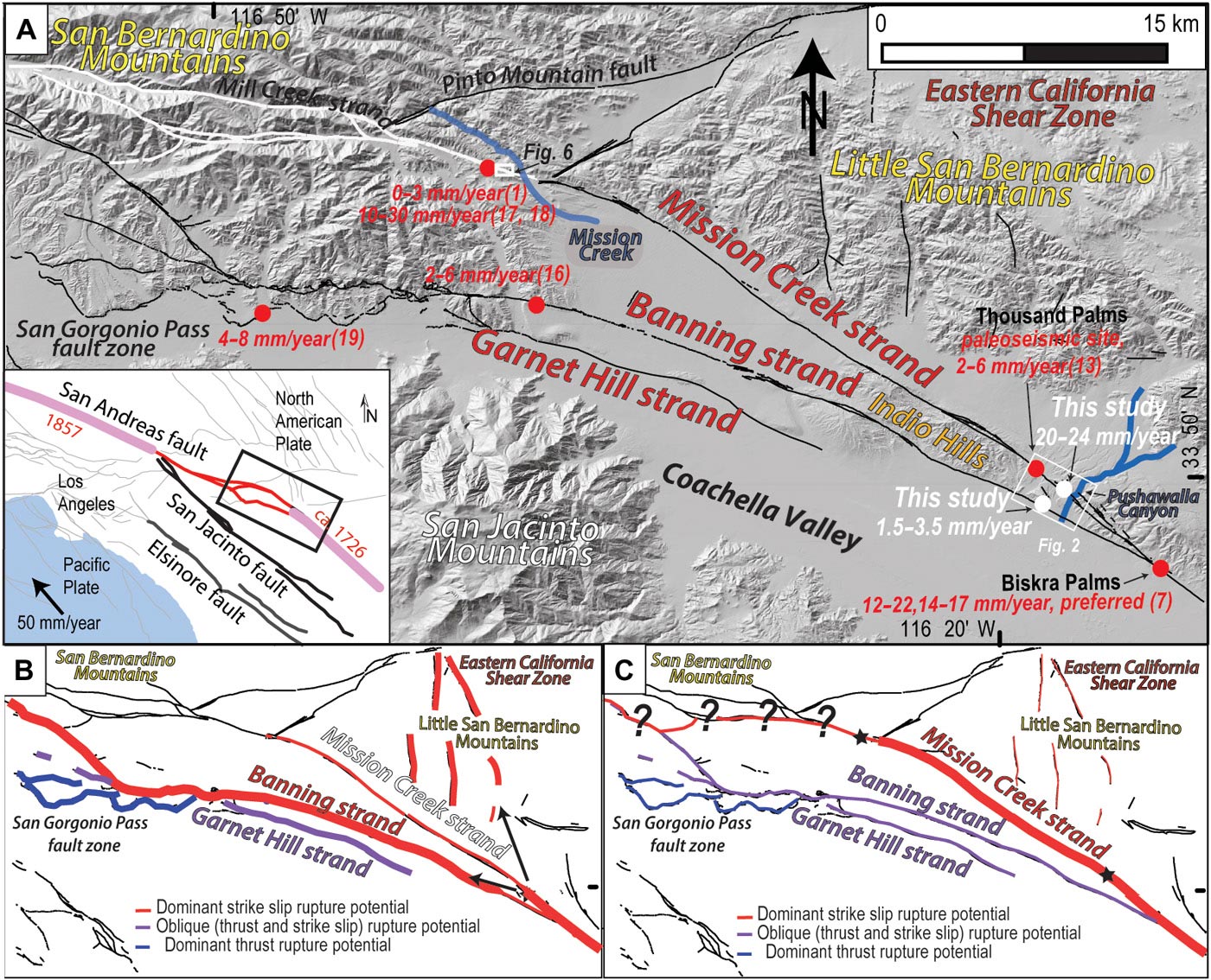
Location map of study area on the southern SAF. Credit: Blisniuk et al., Science Advances.
While existing estimates for a rupture in coming decades are higher for the Banning and Garnet Hill strands and the San Gorgonio Pass fault zone than for the Mission Creek strand, the relative risks for earthquakes along different strands has remained uncertain. To overcome the limitations of existing models, Kimberly Blisniuk and colleagues investigated the long-term deformation rates of the Mission Creek and Banning strands, calculating their fault-slip rates using cumulative records of fault motion preserved over time in nearby landforms.
Based on field mapping conducted using lidar data, the researchers chose Pushawalla Canyon as the best site to conduct their slip rate measurements. Blisniuk et al. found evidence of geologically recent slips from the faults at these latitudes, including streams carved out from late Pleistocene rock and gullies in steep-walled canyons that likely date from the Holocene.
The researchers determined that the Mission Creek strand accounts for about 21.5 millimeters per year of the San Andreas fault’s total 24.1 millimeters per year slip rate, while the Banning strand accounts for only about 2.5 millimeters per year of the slip rate. The findings indicate that the Mission Creek strand, which has received less attention for its earthquake risks than the Banning strand, Garnet Hill strand, and San Gorgonio Pass, maybe a greater hazard than previously thought.
Reference: “A revised position for the primary strand of the Pleistocene-Holocene San Andreas fault in southern California” by Kimberly Blisniuk, Katherine Scharer, Warren D. Sharp, Roland Burgmann, Colin Amos and Michael Rymer, 24 March 2021, Science Advances.
DOI: 10.1126/sciadv.aaz5691


map?
A map has been added above.
For more maps and figures, click on the DOI link at the bottom of the article to go to the study on Science Advances. There you can click the “Figures & Data” tab for more maps and photos.