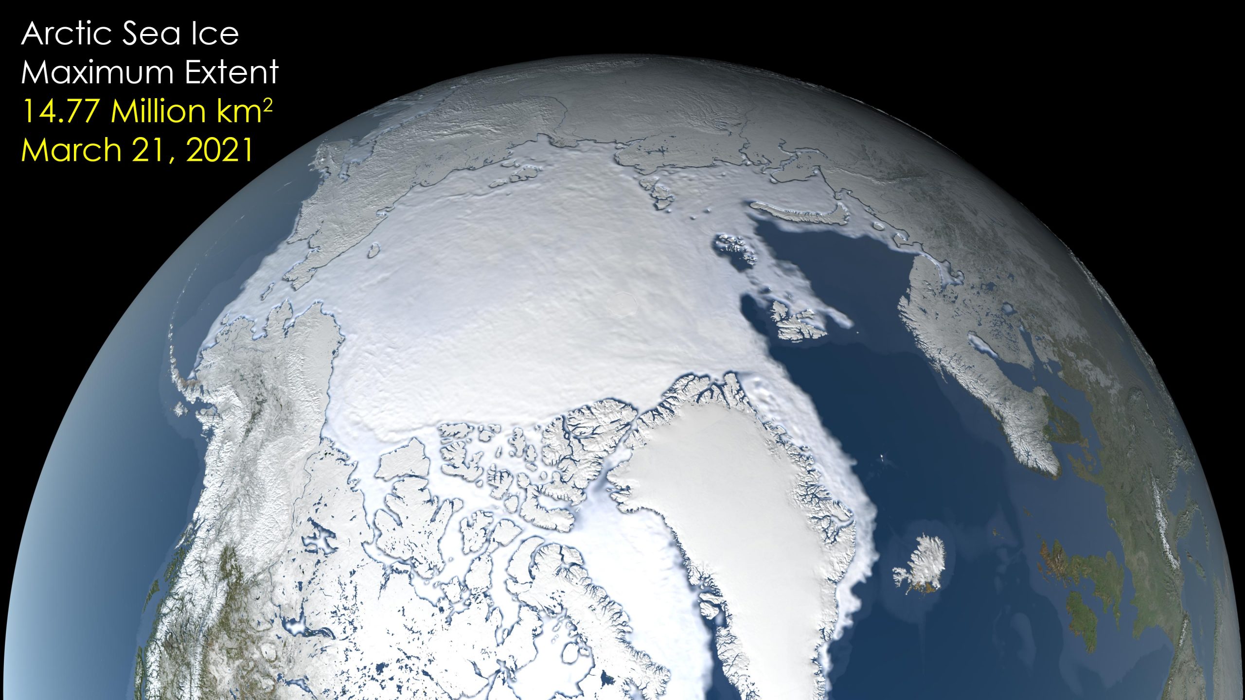
After growing through the fall and winter, sea ice in the Arctic appears to have reached its annual maximum extent. The data visualization shows the ice extent – defined as the total area in which the ice concentration is at least 15% – at its 2021 maximum, which occurred on March 21. On this day the extent of the Arctic sea ice cover peaked at 14.77 million square kilometers (5.70 million square miles), making it the seventh-lowest on record, tied with 2007. Credit: NASA’s Scientific Visualization Studio
Sea ice in the Arctic appears to have hit its annual maximum extent after growing through the fall and winter. The 2021 wintertime extent reached on March 21 ties with 2007’s as the seventh-smallest extent of winter sea ice in the satellite record, according to scientists at the NASA-supported National Snow and Ice Data Center and NASA.
This year’s maximum extent peaked at 5.70 million square miles (14.77 million square kilometers) and is 340,000 square miles (880,000 square kilometers) below the 1981 to 2010 average maximum – equivalent to missing an area of ice larger than the state of Texas and Florida combined.
This image, created at NASA’s Goddard Space Flight Center in Greenbelt, Maryland, was created using data provided by the Japan Aerospace Exploration Agency (JAXA), acquired by the Advanced Microwave Scanning Radiometer 2 (AMSR2) instrument aboard the Global Change Observation Mission 1st-Water “SHIZUKU” (GCOM-W1) satellite.
On March 21, 2021, Arctic sea ice reached its maximum extent for winter 2020-2021, tying with 2007 for the seventh-lowest maximum on record.


Be the first to comment on "NASA: 2021 Arctic Sea Ice Maximum Extent Ranks Seventh-Lowest on Record"