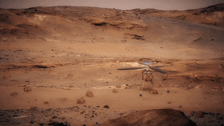
Animation illustrating NASA’s Ingenuity helicopter flying on Mars. Credit: NASA
With Flight 15, Ingenuity began the journey back towards “Wright Brothers Field” at “Octavia E. Butler Landing,” the site where Perseverance touched down with Ingenuity in February. This flight was performed with the recently-increased rotor speed of 2,700 rpm. After reviewing the data from Flight 15, the Ingenuity team is prepared to attempt our Flight 16 no earlier than Thursday, November 18.
Flight 16 will be a shorter, 109-second flight. Ingenuity will climb up to 33 feet (10 meters), glide over the “Raised Ridges” at 3 mph (1.5 meters per second), then land near the edge of “South Séítah,” covering a distance of 380 feet (116 meters). We plan to capture a series of nine color Return-to-Earth (RTE) camera images evenly spaced throughout the flight, oriented to the southwest and opposite the flight path.
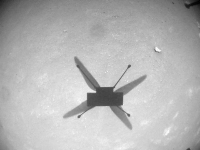
Mars Helicopter Sol 254 – Navigation Camera: NASA’s Ingenuity Mars Helicopter acquired this image using its navigation camera. This camera is mounted in the helicopter’s fuselage and pointed directly downward to track the ground during flight. This image was acquired on November 6, 2021 (Sol 254 of the Perseverance rover mission) at the local mean solar time of 12:06:00. This was the date of Ingenuity’s 15th flight. Credit: NASA/JPL-Caltech
If we could fly all the way across Séítah on Flight 9, why are we breaking the return path into multiple segments? As discussed in the Flight 9 retrospective post, the terrain of Séítah is particularly challenging for Ingenuity’s navigation algorithm. Because the navigation algorithm assumes flat terrain, any changes to the terrain height introduces heading error. On Flight 9, Ingenuity landed 154 feet (47 meters) away from the center of our 164-foot-(50-meter)-radius target airfield. The heading error on Flight 9 was less of a concern because the terrain of South Séítah was benign and allowed a large degree of uncertainty in our landed position. However, the terrain on the north side of Séítah is rockier. As a result, we have to be more precise in our landing location on the return path. Flight 16 will tackle the tricky terrain of the Raised Ridges. By doing a short flight over these ridges, we reduce accumulated heading error that can build up over longer flights.
Flight 16 will set up Ingenuity for a Séítah crossing on Flight 17, getting us closer to the current goal of Wright Brothers Field. While waiting for the Perseverance rover to catch up after Flight 17, the Ingenuity team is considering performing a flight software update to enable new navigation capabilities and better prepare Ingenuity for future flights.
Written by Joshua Anderson, Ingenuity Mars Helicopter Tactical Lead at NASA’s Jet Propulsion Laboratory.


Be the first to comment on "NASA Ingenuity Mars Helicopter Preparing To Glide Over “Raised Ridges” and Land Near Edge of “South Séítah”"