Credit: Abdullah Al Ateqi, Dimitra Atri and Dattaraj B. Dhuri
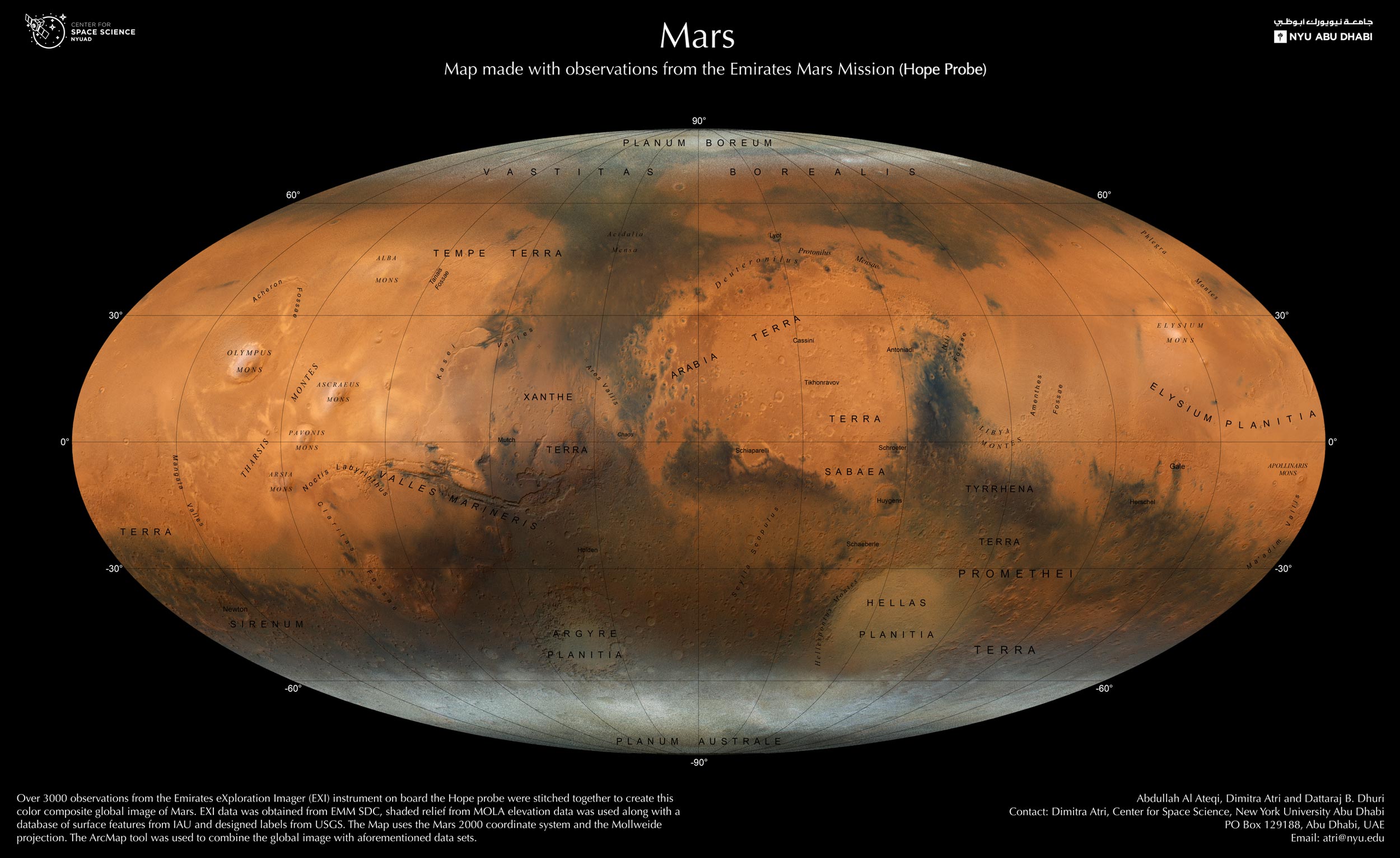
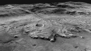
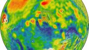
The Mars Map displays high-resolution images of the Red Planet through the lens of the UAE’s own Hope probe, and showcases the huge scientific advances made by the UAE.
NYU Abu Dhabi (NYUAD) group leader and research scientist Dimitra Atri from the Center for Space Science and his team have created a never-seen-before map of Mars, using images exclusively created from the Emirates Exploration Imager (EXI).
The EXI is a state-of-the-art imaging system on board the Emirates Mars Mission (EMM), also known as Hope or Al-Amal, which is currently orbiting Mars. The global photographic map not only showcases new images of the Red Planet from the perspective of the Hope probe, but is a testament to the UAE’s huge advancements in the field of science, and will be a valuable resource to motivate young people to pursue careers in STEM disciplines in the UAE.
The Mars Map combines more than 3,000 observations, produced by Hope’s onboard EXI instrument. Atri and his team created the color composite map by stitching together the thousands of observations from the EXI instrument over the course of one Mars year (two Earth years).
“We plan to make our map available to the entire planet, as part of the new and more advanced Atlas of Mars, which we have been working on, and will be available in both English and Arabic once published. The hope is that this accessibility will make it a great tool for researchers, and also students to learn more about Mars, and showcase the possibilities that the space sector in the UAE can offer.”
— Dimitra Atri
The Mars Map shows regions and features of the Red Planet in exceptional resolution, highlighting all its major features. For example, polar ice caps, mountains, volcanoes, remnants of ancient rivers, lakes, valleys, and impact craters are visible. Such highly detailed maps are an essential foundation upon which future scientific research on Mars can be built. The map will further allow scientists to learn about momentous shifts in climate that can fundamentally alter planets, which will provide insights that may be able to help us on Earth too.
“The complete Mars Map also brings the UAE and the Arab world another step closer to achieving EMM’s ambitious mission goal, to provide a complete global picture of the Martian climate,” Atri added. “More than 30 previous spacecraft have only managed to capture a snapshot of the Mars weather, whilst EMM will follow the seasonal changes throughout a Martian year. The Hope probe is helping researchers to create this global image of the planet due to its strategic position. Hope circles Mars in an elliptical orbit that allows it to observe from much further away than any other spacecraft. This strategic position is helping researchers to create a global image of the planet,” he said.
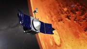
EMM is the UAE and the Arab world’s first interplanetary mission commissioned by the country’s leaders in 2014. The spacecraft was launched from Japan on July 20, 2020. Seven months later, on February 9, 2021, the Hope probe entered Mars’ orbit.


Be the first to comment on "Stunning New Photographic Mars Map With Observations Made by the Emirates Mars Mission"