First comprehensive maps of a glacier’s underside, created using an autonomous underwater vehicle, provide insights into potential future sea-level changes.
An international research team used an autonomous underwater vehicle, Ran, to create detailed maps of the underside of the Dotson Ice Shelf in Antarctica. Their findings reveal new patterns and features that challenge previous assumptions about glacier melting. This study emphasizes the importance of under-ice data for predicting future sea level rise and demonstrates significant progress in understanding the complexity of ice shelves.
An international research team used an autonomous underwater vehicle to survey a glacier in Antarctica, producing the first detailed maps of the underside of an ice shelf and uncovering indicators of potential sea level rise.
The findings are reported in the journal Science Advances.
“We have previously used satellite data and ice cores to observe how ice shelves change over time,” explains Anna Wåhlin, a professor of oceanography at the University of Gothenburg and the paper’s lead author. “By navigating the submersible into the cavity, we were able to get high-resolution maps of the ice underside. It’s a bit like seeing the back of the moon for the first time.”
“Our ability to project the future of the global coastline from rising sea levels in a warming world critically depends on data we obtain from beneath Antarctic ice shelves,” adds David Holland, a professor at New York University’s Courant Institute of Mathematical Sciences and one of the paper’s authors.
Deployment and Data Collection
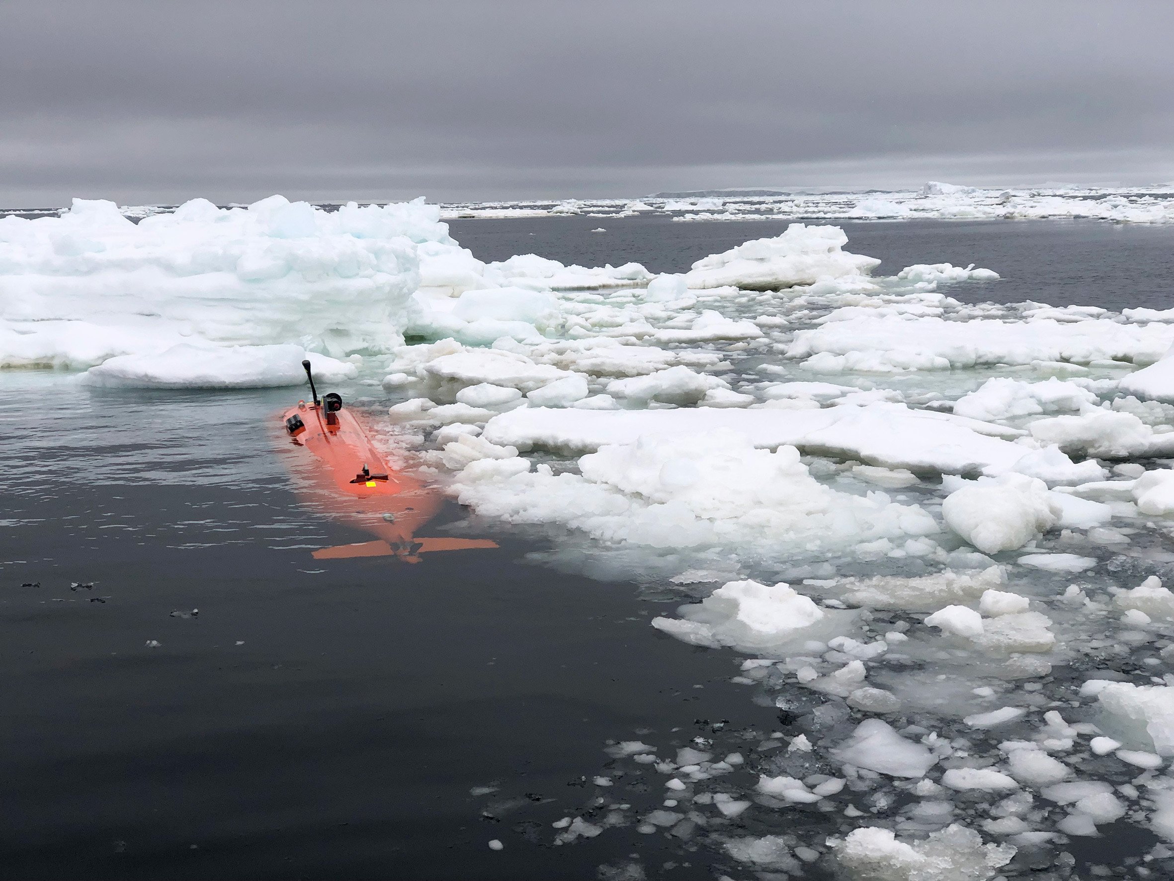
The scientists programmed Ran, an autonomous underwater vehicle, to dive into the cavity of Dotson Ice Shelf, 350 meters thick and located in West Antarctica, and scan the ice above it with an advanced sonar system. Dotson Ice Shelf is considered to have a potentially large impact on future sea level rise due to its size and location.
Over 27 days, the submarine traveled more than 1,000 kilometers (620 miles) back and forth under the glacier, reaching 17 kilometers (10.5 miles) into the cavity in order to capture the phenomena surrounding it.
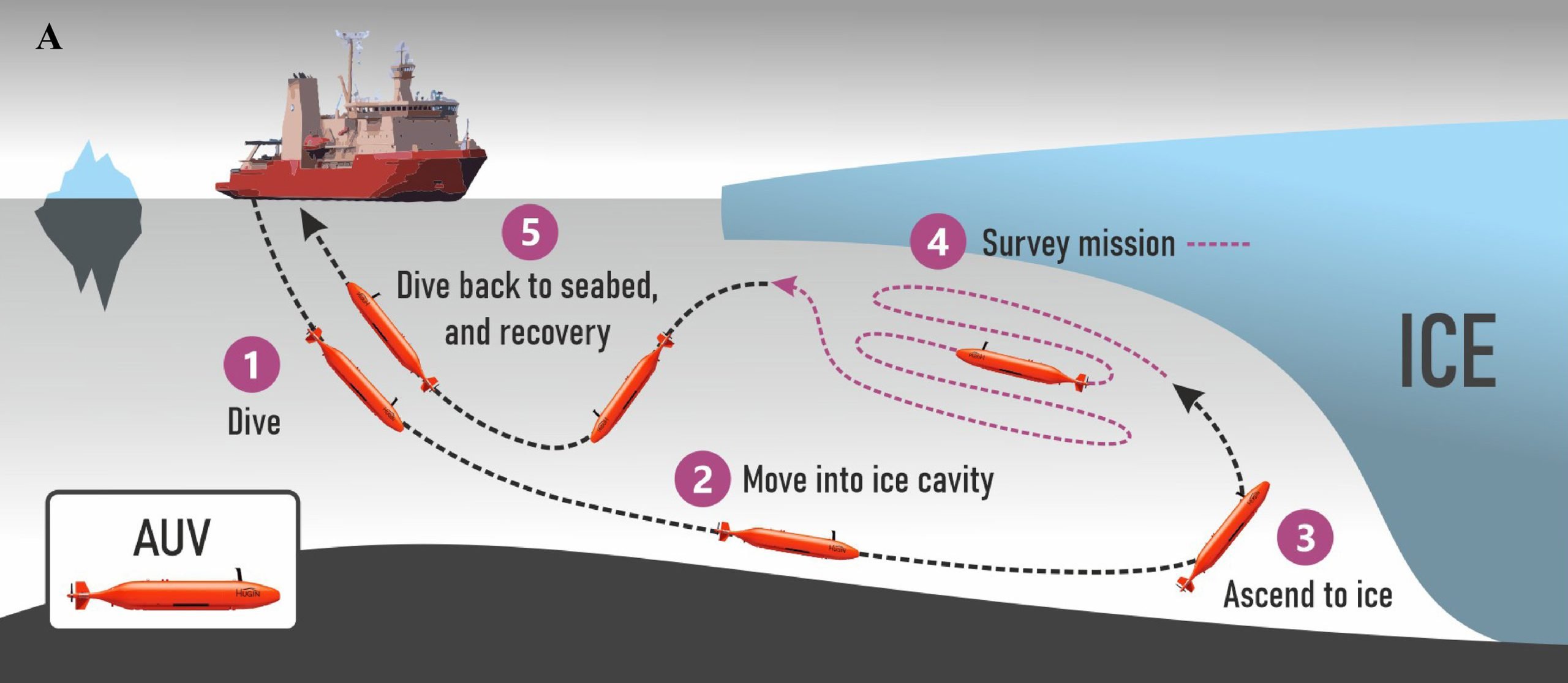
Using the data captured by Ran, the scientists were able to measure the currents below the glacier for the first time and prove why the western part of Dotson Ice Shelf melts so fast. Ran’s maps showed, not surprisingly, that the glacier melts faster where strong underwater currents erode its base and, in particular, very high melt at vertical fractures that extend through the glacier.
But the findings also showed new patterns on the glacier base that raise troubling questions. The base is not smooth, but there is a peak and valley ice-scape with plateaus and formations resembling sand dunes. The researchers suggest that these may have been formed by flowing water under the influence of Earth’s rotation.
Implications of Findings
“Earth’s rotation is critical to understanding most phenomena in the climate system, notably hurricanes and other severe-weather phenomena,” says Holland. “It seems these exotic under-ice features are also intimately controlled and shaped by the spinning of the Earth.”
“The maps that Ran produced represent a huge progress in our understanding of Antarctica’s ice shelves,” adds Karen Alley, a glaciologist from the University of Manitoba and co-author of the paper. “We’ve had hints of how complex ice-shelf bases are, but Ran uncovered a more extensive and complete picture than ever before. The imagery from the base of Dotson Ice shelf helps us interpret and calibrate what we see from the satellites.”
Much of the fieldwork for the Science Advances study was conducted in 2022, when Holland led a team to install a mooring beneath the ice shelf. This innovative engineering effort involved drilling a 1,000-foot-deep, one-foot-wide hole through the ice shelf using a hot water drill. The mooring was successfully installed before the ice froze again, allowing scientists to collect data continuously for the past two years—and to produce a time series of the changes in the melting at the bottom of the ice shelf.
“For the first time, we combined data collected from an autonomous underwater vehicle, sampling at one point in time but covering a large area under an ice shelf, with data from a mooring that we installed with a hot water drill through the ice shelf,” notes Holland. “These dual methods provided data at one point in space but spanned over time continuously,”
The scientists now realize there is a wealth of processes left to discover in future research missions under the glaciers.
“The mapping has given us new data that we need to look at more closely,” concludes Wåhlin. “It is clear that many previous assumptions about the melting of glacier undersides are falling short. Current models cannot explain the complex patterns we see. But with this method, we have a better chance of finding the answers.”
Reference: “Swirls and scoops: Ice base melt revealed by multibeam imagery of an Antarctic ice shelf” by Anna Wåhlin, Karen E. Alley, Carolyn Begeman, Øyvind Hegrenæs, Xiaohan Yuan, Alastair G. C. Graham, Kelly Hogan, Peter E. D. Davis, Tiago S. Dotto, Clare Eayrs, Robert A. Hall, David M. Holland, Tae Wan Kim, Robert D. Larter, Li Ling, Atsuhiro Muto, Erin C. Pettit, Britney E. Schmidt, Tasha Snow, Filip Stedt, Peter M. Washam, Stina Wahlgren, Christian Wild, Julia Wellner, Yixi Zheng and Karen J. Heywood, 31 July 2024, Science Advances.
DOI: 10.1126/sciadv.adn9188
The research was supported, in part, by grants from the National Science Foundation (164700, 511300, 511600, 529200, 919900).
Never miss a breakthrough: Join the SciTechDaily newsletter.
Follow us on Google and Google News.