Satellites confirm that mid-1990s climate projections of sea-level rise were largely accurate, though ice melt was underestimated.
For more than three decades, satellites have tracked global sea-level change, and a recent analysis shows that projections made in the mid-1990s were strikingly accurate. The findings, published in Earth’s Future, an open-access journal of the American Geophysical Union, come from two researchers at Tulane University.
“The ultimate test of climate projections is to compare them with what has played out since they were made, but this requires patience – it takes decades of observations,” said lead author Torbjörn Törnqvist, Vokes Geology Professor in the Department of Earth and Environmental Sciences.
“We were quite amazed how good those early projections were, especially when you think about how crude the models were back then, compared to what is available now,” Törnqvist said. “For anyone who questions the role of humans in changing our climate, here is some of the best proof that we have understood for decades what is really happening, and that we can make credible projections.”
Co-author Sönke Dangendorf, David and Jane Flowerree Associate Professor in the Department of River-Coastal Science and Engineering, added that while the accuracy of those earlier models is encouraging, the priority today is to refine global data into localized forecasts that can guide planning in vulnerable regions such as south Louisiana.
Regional Variability in Sea-Level Rise
“Sea level doesn’t rise uniformly – it varies widely. Our recent study of this regional variability and the processes behind it relies heavily on data from NASA’s satellite missions and NOAA’s ocean monitoring programs,” he said. “Continuing these efforts is more important than ever, and essential for informed decision-making to benefit the people living along the coast.”
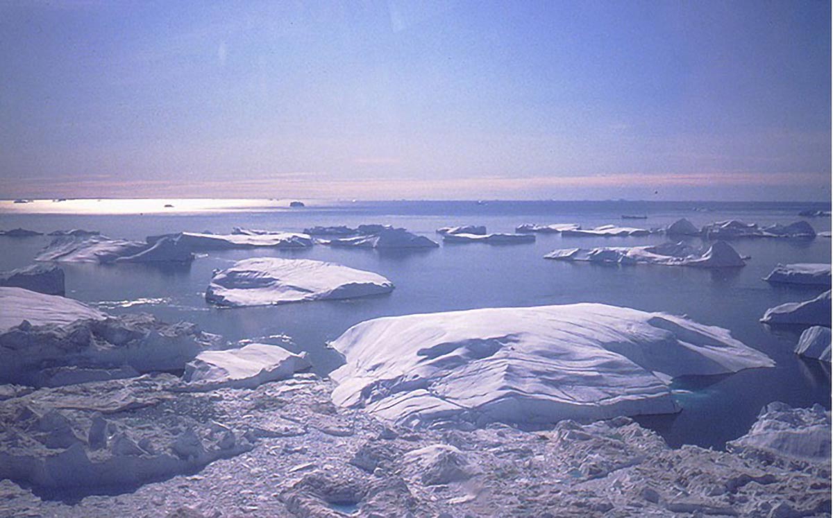
A new era of monitoring global sea-level change took off when satellites were launched in the early 1990s to measure the height of the ocean surface. This showed that the rate of global sea-level rise since that time has averaged about one eighth of an inch per year. Only more recently, it became possible to detect that the rate of global sea-level rise is accelerating.
When NASA researchers demonstrated in October 2024 that the rate has doubled during this 30-year period, the time was right to compare this finding with projections that were made during the mid-1990s, independent of the satellite measurements.
Comparing Projections and Reality
In 1996, the Intergovernmental Panel on Climate Change published an assessment report soon after the satellite-based sea-level measurements had started. It projected that the most likely amount of global sea-level rise over the next 30 years would be almost 8 cm (three inches), remarkably close to the 9 cm that has occurred. But it also underestimated the role of melting ice sheets by more than 2 cm (about one inch).
At the time, little was known about the role of warming ocean waters and how that could destabilize the marine sectors of the Antarctic Ice Sheet from below. Ice flow from the Greenland Ice Sheet into the ocean has also been faster than foreseen.
The past difficulties of predicting the behavior of ice sheets also contain a message for the future. Current projections of future sea-level rise consider the possibility, albeit uncertain and of low likelihood, of catastrophic ice-sheet collapse before the end of this century. Low-lying coastal regions in the United States would be particularly affected if such a collapse occurs in Antarctica.
Reference: “Evaluating IPCC Projections of Global Sea-Level Change From the Pre-Satellite Era” by Torbjörn E. Törnqvist, Clinton P. Conrad, Sönke Dangendorf and Benjamin D. Hamlington, 22 August 2025, Earth’s Future.
DOI: 10.1029/2025EF006533
The paper was co-authored by colleagues from the University of Oslo and NASA’s Jet Propulsion Laboratory at Caltech.
Never miss a breakthrough: Join the SciTechDaily newsletter.
Follow us on Google and Google News.
15 Comments
Be afwaid. Be vewwy afwaid.
It can’t happen Here
No matter how overwhelming the evidence, a sizable number of sleazy politicians and clueless voters will swallow the BS spewed by fossil fuel industry-funded think tanks that explain it away.
Would you be good enough to assign numerical deviations, such as the nominal percentage error (with margin of error), between predictions and what actually happened? Neither this article or the linked original publication provide them.
Also, when I asked ChatGPT about sources for the “fossil fuel industry-funded think tanks,” it was unable to provide citations for the contributors or their amounts, and when pressed, acknowledged that it was unable to find evidence for your assertion. How about providing the source(s) your claims? Without the sources, readers will be compelled to conclude it is simply “BS.”
3 1/2 inches +/- 1 inch should be a good enough error bracket to be of concern to any sane person. I don’t know the error but I doubt that it is 3 1/2 inches +/- 3 1/2 inches. Satellite-based measurements of sea-level seem sensitive enough for doing abstruse calculations involving crustal thickness and rock-type etc so that nuclear submarines can navigate unknown seamounts etc.
–
–
=
I’m not sure about your point. At first I thought that you might be weighing in on the proverbial question about whether or not size matters.
However, it seems that you are actually talking about sea level. Certainly 3 1/2 inches is more than enough accuracy and precision for a submarine to avoid hitting a seamount. But where to build a house near the coast that will survive for 50 or more years is another story! An inch or two is insignificant when waves can reach 40 feet during storms.
The authors of the article are concerned about long-term changes in coastal sea level that have an accuracy of a centimeter, and a precision of a tenth of a millimeter. For context, a grain of sand has a mid-range diameter of about 0.5 mm. I doubt that sea level can be measured meaningfully to sub-millimeter levels, when the edge of the water is varying as the sand grains move about in the waves. We have to start worrying about fractal lengths.
I have seen climatology articles, such as on the topic of energy balance, where the nominal value was small, like 0.47 watts, and the 1-sigma uncertainty was the same order of magnitude, meaning that the 95% probability of the lower-bound value could not be stated to be positive or negative.
I should point out that the person I was responding to cited NO numbers at all, which was the essence of my complaint.
MIT is a great source for climate change information. Their explanations are both simple and straightforward and also in greater depth. Here, do your own research. Like my dad use to say “if you look it up yourself, you’re more likely to remember it”.
Oh, please. I heard a clip last week from 1982 that Dan Rather reported. Back then it said only 25% of Florida would be above water by 2025. And the famous Al Gore prediction that Manhattan would go under water. Recent charts so that ice areas have increased in the Artic. This is nothing more that earth going thru its cycles and snake oil salesmen trying to make a buck off of fear mongering.
don’t forget that thise places have been improving infrastructure to mitigate sea level rise. but those strategies are not permanent solutions and some are expensive. in that time, florida is becoming increasingly vulnerable to storm surge from hurricanes. the evidence is crystal clear
None of what you say is true. That sea rise by 2025 was never stated. You’re either lying or mistaken.
Tell that to the MAGA cult.
Boy are you stupid!
Al Gore was accurate, but it takes tome to happen. Just like he said!
GW and Dale,
You have made it clear what your opinion is. Is there anything that you can cite that will support your opinion, or is it simple fact-free?
Just what did Al Gore say? Can you provide a quote?
“For more than three decades, satellites have tracked global sea-level change, and a recent analysis shows that projections made in the mid-1990s were strikingly accurate.”
The linked source article uses a slightly different description: “IPCC projections in the mid-1990s of global sea-level change over the next 30 years were remarkably robust”
Why is a science research paper using the ambiguous lawyer-words such as “strikingly accurate” and “remarkably robust” without providing their definitions of what they mean by that, or the nominal numeric error with margins of error (uncertainty)?
The lede graphic in the actual research paper shows a very wide, and increasing over time, range (~2-16 cm) in predicted sea level rise. If you cast the net wide enough, you are bound to catch everything. But does it mean that future predictions will actually be trustworthy?
For another look at the reliability of early predictions, I suggest that you look at the following:
https://wattsupwiththat.com/2018/06/30/analysis-of-james-hansens-1988-prediction-of-global-temperatures-for-the-last-30-years/