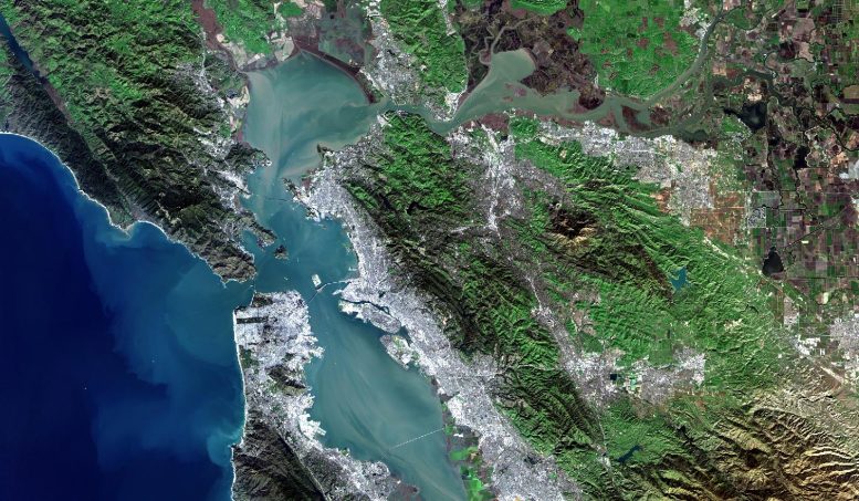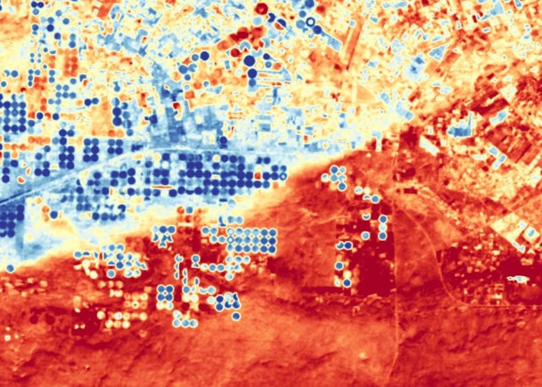
Landsat 9, a joint mission of NASA and the U.S. Geological Survey (USGS), passed its post-launch assessment review and is now in its operational phase.
Continuing the Landsat program’s nearly 50-year record of imaging Earth from orbit, USGS plans to start releasing Landsat 9 data to the public in early February.
Landsat 9 launched from Vandenberg Space Force Base in California on September 27, 2021. The mission team made contact with the spacecraft shortly after it separated from the rocket faring, and ever since then has been working to test, calibrate and commission the new satellite and its instruments.
“The imagery from Landsat 9 is fantastic,” said Del Jenstrom, Landsat 9 project manager at NASA’s Goddard Space Flight Center. “I am incredibly proud of our joint agency and contractor team for executing a very thorough and highly successful on-orbit commissioning campaign, bringing this important mission into operational status.”
One of the commissioning activities was flying Landsat 9 at an orbit below its sister satellite, Landsat 8, imaging the same swath of land at essentially the same time, which allowed the team to confirm that the radiometry and geometry of the data align as expected.

Instrument Performance and New Data Capabilities
They also calibrated the instruments through a variety of methods, including tilting Landsat 9’s spacecraft to image the full Moon – a steady source of light to ensure the instruments are detecting light consistently. That also confirmed that the Thermal Infrared Sensor 2 instrument, or TIRS-2, on the new satellite doesn’t have the stray light problems that affected the first version of the instrument on Landsat 8. This will allow researchers to take more accurate surface temperature measurements, said Jeff Masek, NASA’s Landsat 9 project scientist.
Masek said TIRS-2 and Landsat 9’s other instrument, the Operational Land Imager 2, or OLI-2, are both performing as hoped. That means, with both Landsat 9 and Landsat 8 in orbit, there will be high-quality, medium-resolution images every eight days. He said he’s looking forward to seeing what people do with the new data of Earth’s landscapes and coastal regions.
“The Landsat user base is eager to get another observatory that will double the frequency with which they can get this high-quality data,” Masek said. “This is really going to benefit research in areas like snow cover, crop monitoring and water quality.”
Transition to USGS and Long-Term Impact
NASA led the commissioning campaign and will soon transfer operational control of the two Landsat 9 instruments to the USGS, which will distribute and archive the data. Command of the spacecraft itself and mission will be handed over to USGS in May, after the team finishes a software update that will resolve a radiation susceptibility issue that the team identified during checkout of the data recorders. Mitigation measures proved successful, and the software update will ensure those measures continue in automated fashion.
“Landsat 9 is distinctive among Earth observation missions because it carries the honor to extend the 50-year Landsat observational record into the next 50 years,” said Dr. Chris Crawford, USGS Landsat 9 Project Scientist. “Landsat 9 enhances the spatial resolution, spectral continuity, and coincidental acquisition of reflected and emitted thermal infrared image data of Landsats 1-8. Landsat 9 ensures continued 8-day global land and near-shore revisit coverage partnered with Landsat 8 in orbit.”
The Landsat 9 launch was managed by NASA’s Launch Services Program, based at Kennedy Space Center in Florida. In July, the Landsat program will mark 50 years since the launch of the first Landsat satellite. Since then, the program has provided continuous coverage of Earth’s land surfaces, allowing scientists and resource managers to track land cover, land use and the impacts of climate change and monitor natural resources.
Never miss a breakthrough: Join the SciTechDaily newsletter.
1 Comment
Worked with remote sensing for 18 years. SLAR was our all-weather mapper – night/day/clouds. Does the new Landsat 9 provide those options?