NASA Transfers Landsat 9 to USGS Control
On August 11, NASA transferred ownership and operational control of the Landsat 9 satellite to the U.S. Geological Survey (USGS) in a ceremony in Sioux Falls, South Dakota.
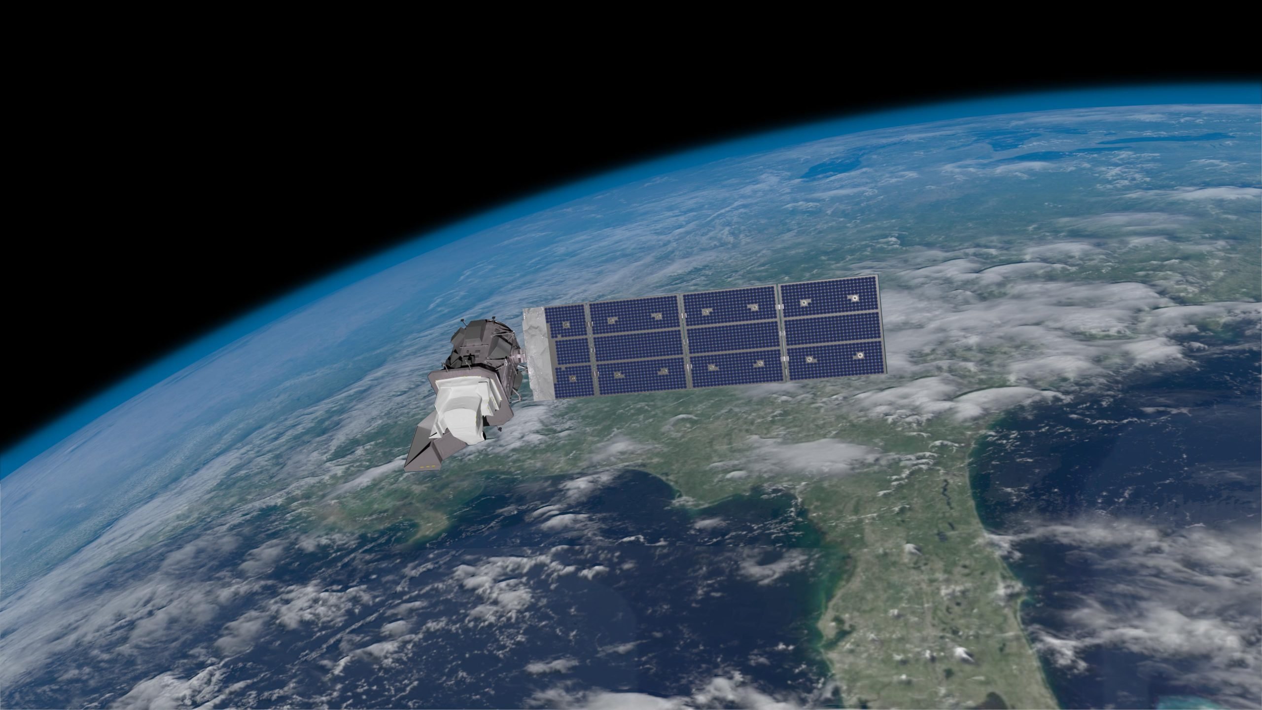
Landsat 9 is the newest in the Landsat series of remote-sensing satellites, which provide global coverage of landscape changes on Earth. The Landsat program – a joint effort between NASA and USGS – is a long-running project that recently marked 50 years of continuous service on July 23.
“For more than fifty years now, Landsat satellites have helped us learn more about how Earth systems work, how human activities affect those systems, and how we can make better decisions for the future,” said NASA Administrator Bill Nelson. “Landsat 9, the latest joint effort by NASA and USGS, proudly carries on that remarkable record.”
NASA launched Landsat 9 from Vandenberg Space Force Base in California on September 27, 2021. Since then, NASA mission engineers and scientists, with USGS collaboration, have been putting the satellite through its paces. This included steering it into its orbit, calibrating the detectors, and collecting test images. Now fully mission-certified, the satellite is under USGS operational control for the remainder of its mission life.
A count down of 9 things about the Landsat mission, the science, the technology, and the people who continue its legacy. Credit: NASA’s Goddard Space Flight Center
“Our partnership with NASA over many years has been good for science and good for the American people,” said Assistant Secretary for Water and Science Tanya Trujillo. “A half-century archive of Landsat’s Earth observations is a magnificent achievement in the history of science. This fifty-year record gives scientists a consistent baseline that can be used to track climate change and enables them to see changes to the land that might not otherwise be noticed.”
Landsat 9 Joins Landsat 8 for Comprehensive Earth Coverage
Landsat 9 joined Landsat 8, which has been orbiting since 2013. Together, the two satellites collect images of Earth’s full surface every eight days. An average of 740 Landsat 9 scenes are collected by USGS specialists every day from around the world to be processed and archived at the USGS Earth Resources Observation and Science Center in Sioux Falls.
Video showing Landsat 8 and Landsat 9 constellation and paths used for Earth imaging. Credit: NASA
Remote-sensing satellites such as Landsat help scientists observe the world using ranges of light beyond the power of human sight. This allows for monitoring land changes that may have natural or human causes. Landsat is unique because it consistently captures a comprehensive view of Earth at a moderate resolution of approximately 30 meters (98 feet), the area of a baseball infield. This global view of changes on the land through decades provides an unparalleled perspective for a broad range of data applications in fields such as agriculture, water management, forestry, disaster response, and – crucially – climate change science.
Economic Value and Public Access to Landsat Data
Landsat provides billions of dollars in value to the U.S. economy each year, according to estimates. Landsat images and data became available to the public at no charge starting in 2008. This policy has served to expand applications of Landsat data that enable greater efficiencies for government agencies while creating profitable commercial opportunities for information service industries.
With a data user community that keeps growing, engineers and scientists are already looking forward to the next mission. NASA and USGS are developing options for the next iteration of Landsat, currently called Landsat Next.
The Landsat program has provided continuous global coverage of landscape change since 1972. Landsat’s unmatched long-term data record provides the basis for a critical understanding of environmental and climate changes occurring in the United States and around the world.
Never miss a breakthrough: Join the SciTechDaily newsletter.
Follow us on Google and Google News.