
A new satellite-based framework allows scientists to measure the changing rhythms of cities in near real time.
Cities are often described as living systems, but until now that idea has mostly been a metaphor. Roads, buildings, parks, and neighborhoods change constantly, yet much of that activity is hard to see as it happens. By the time a pattern becomes obvious from the ground, a neighborhood may already be booming, declining, or spreading into nearby green space.
Researchers now say satellites can reveal those changes much earlier. In a study published in the Proceedings of the National Academy of Sciences (PNAS), scientists introduced a framework called the “Urban Pulse,” which uses frequent satellite observations to track how cities physically change over time.
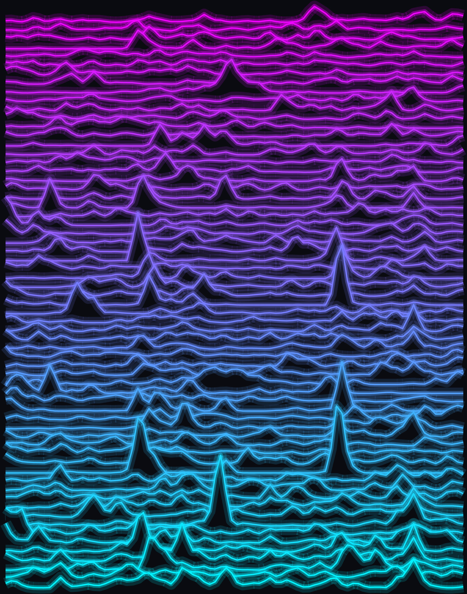
The idea is similar to an electrocardiogram (EKG), which helps doctors detect hidden signals from the heart. Instead of measuring electrical activity in the body, Urban Pulse monitors the visible signs of construction, demolition, repairs, infrastructure upgrades, and expansion across urban landscapes.
Zhe Zhu, director of the Global Environmental Remote Sensing (GERS) Laboratory and associate professor of natural resources and the environment in the College of Agriculture, Health and Natural Resources (CAHNR), was the study’s first author. He worked with senior author Karen C. Seto, the Frederick C. Hixon Professor of Geography and Urbanization Science at the Yale School of the Environment, along with Michail Fragkias of Boise State University and a multi-institutional research team.
“For decades, we had just been capturing the outcome of urbanization – a house that’s been built, or a road expansion,” Zhu says. “But you don’t really see the dynamics within an urban area.”
Measuring a City’s Heartbeat
Urban growth is usually studied after the fact. Planners may count new buildings, review zoning changes, analyze census data, or compare older satellite images with newer ones. Those methods can be useful, but they often miss the timing and rhythm of change.
Urban Pulse is designed to capture that rhythm. It analyzes decades of dense time series data from NASA’s Harmonized Landsat and Sentinel-2 (HLS) datasets, which combine observations from major Earth observing satellite missions. This allows researchers to examine repeated views of the same places and identify when physical changes occur.
The framework uses CAPES, a deep learning and time series analysis method developed by former UConn postdoctoral researcher Ji Won Suh. Suh is now a tenure-track assistant professor at the University of Victoria in Canada. With this approach, the team can detect neighborhood-level transformations such as new construction, demolition, and infrastructure improvements.
Three Vital Signs of a City
To develop and test the framework, Zhu’s team examined many cities and several types of satellite inputs. The study highlights six cities: Seattle, Shenzhen, Lagos, Mumbai, Dubai, and Mexico City. They differ sharply in geography, wealth, governance, climate, and development history, yet they shared three major patterns.
The first pattern is that urbanization is spiky. Cities do not grow at a smooth, constant rate. Construction often arrives in bursts, with intense periods of activity followed by quieter intervals.
The second pattern is that urbanization is cyclical. Neighborhoods can move through boom and rest phases, but those cycles do not necessarily follow seasons or predictable annual schedules.
The third pattern is that urbanization is asynchronous. A city does not develop all at once. One district may surge while another slows down, creating an uneven pattern across the urban landscape. The researchers suggest this lack of synchronization may help keep infrastructure systems and labor markets from overheating.
What COVID Revealed About Cities
The framework also captured how cities responded to the COVID-19 pandemic. According to the researchers, the data showed a widespread, synchronized slowdown in urban development, a pattern they describe as a global “cardiac arrest” in construction activity.
But the recovery was not the same everywhere. Shenzhen showed coordinated declines followed by rapid, policy-driven rebounds. Mumbai and Mexico City had more muted responses, suggesting that the pandemic’s urban effects varied widely depending on local conditions, policies, economies, and development systems.
“It’s like in human beings,” Zhu notes. “When you get a disease, it’s not going to show up exactly the same in different people.”
A Possible Early Warning System
The researchers say Urban Pulse could eventually help governments detect problems before they become entrenched. If a neighborhood’s activity drops sharply or if development begins pushing rapidly into green space, planners may have a chance to respond sooner.
Public access to this kind of data could also affect everyday decisions. A person considering a move, or a business owner choosing where to open a new location, could use a neighborhood’s pulse as one signal of local activity and economic vitality.
“This is going to be a very impactful tool influencing not only top-down policy decisions from governments but also bottom-up decisions from everyday people navigating their cities,” Zhu says.
Reference: “The Urban Pulse: Diagnosing the urbanization process as spiky, cyclical, and asynchronous” by Zhe Zhu, Michail Fragkias, Ji Won Suh, Ella McCoshan, Lelin Chen, Kexin Song, Juwon Kong, Tian Li and Karen C. Seto, 8 June 2026, Proceedings of the National Academy of Sciences.
DOI: 10.1073/pnas.2537770123
Zhu completed this work while on sabbatical at Yale University alongside his collaborator Karen Seto.
Never miss a breakthrough: Join the SciTechDaily newsletter.
Follow us on Google and Google News.