
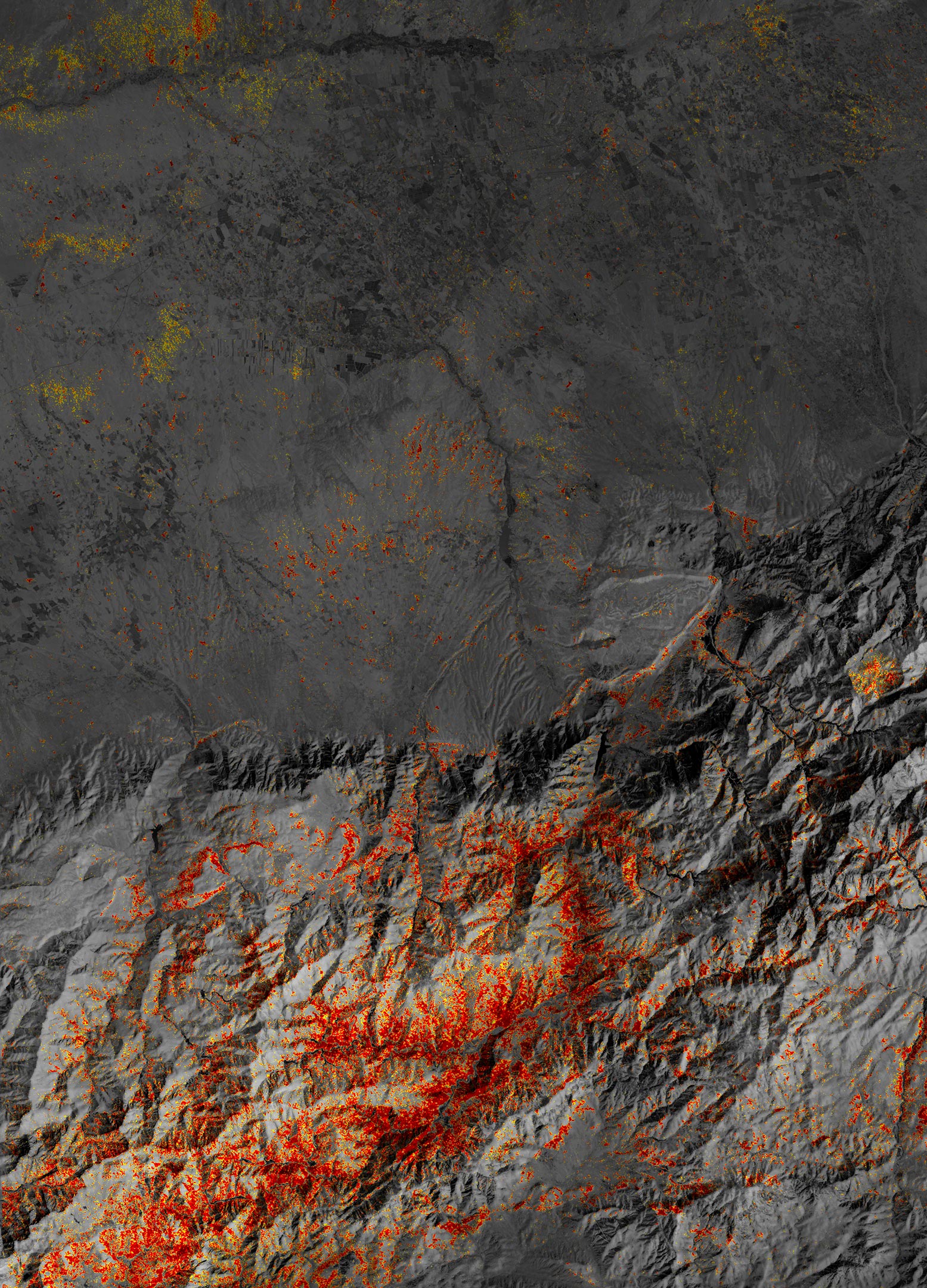
Communities in the High Atlas Mountains were among the hardest hit after a magnitude 6.8 earthquake caused widespread damage.
A powerful earthquake has devasted communities in western Morocco. The magnitude 6.8 quake struck on September 8, 2023, roughly 40 miles (70 kilometers) southwest of Marrakesh, at a depth of 16 miles (26 kilometers), shaking homes and causing thousands of deaths and widespread damage.
The Role of Satellite Imaging in Assessing Damage
The damage proxy map shown above is a NASA Earth Observatory version of a map created by the Earth Observatory of Singapore — Remote Sensing Lab (EOS-RS). The map uses modified Copernicus Sentinel-1 satellite data processed by the European Space Agency (ESA) and with software originally developed at NASA’s Jet Propulsion Laboratory and Caltech and modified at EOS-RS. It is derived from synthetic aperture radar images captured before (May 26, 2023, through August 30, 2023) and after (September 11, 2023) the earthquake.
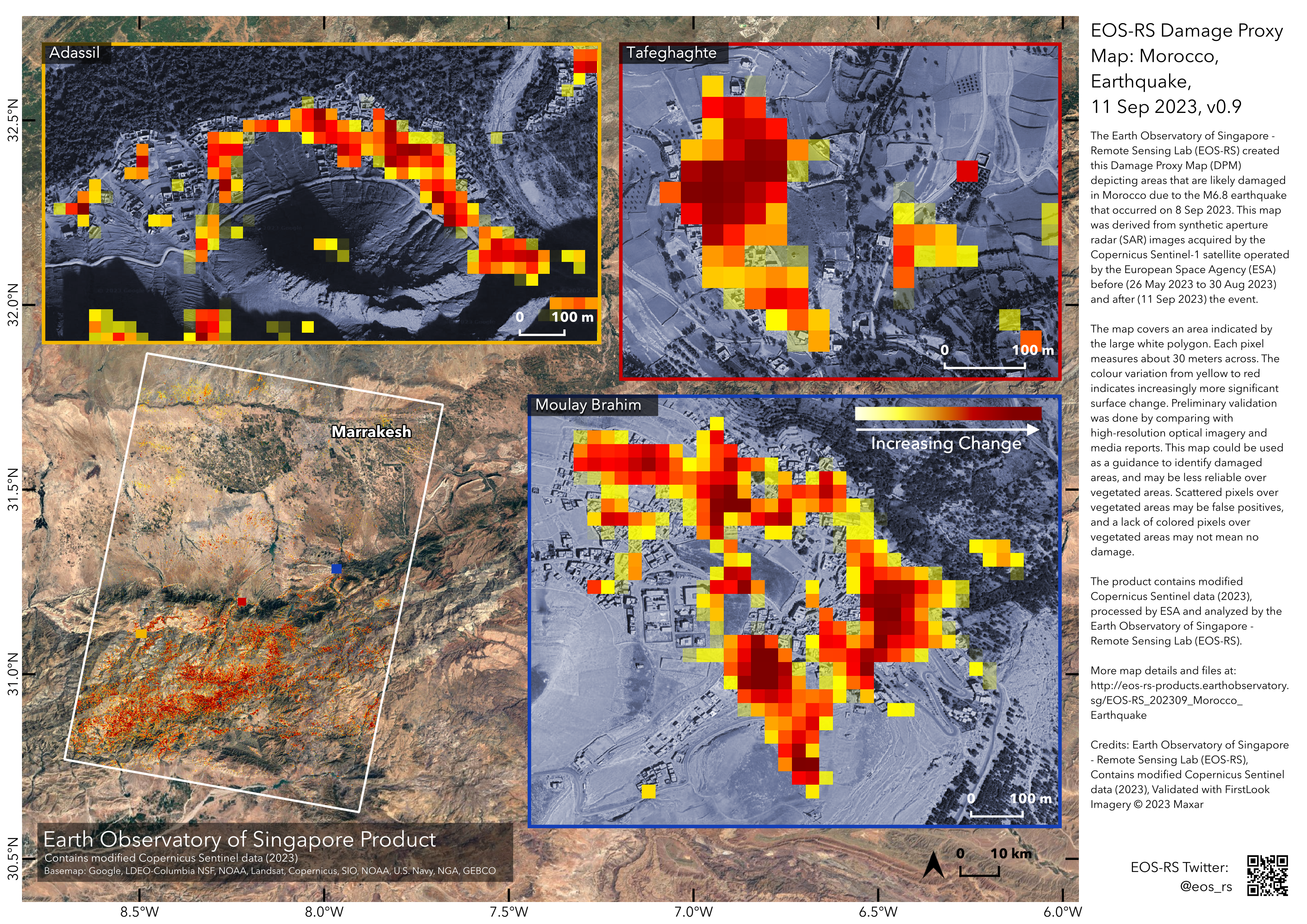
To map the landscape, including buildings, Sentinel-1’s radar sends pulses of microwaves toward the Earth’s surface and “listens” for reflected echoes of those waves. In the map above, the damage proxy data from EOS-RS was laid over a Landsat 9 image and combined with a digital elevation model based on data collected by the Shuttle Radar Topography Mission.
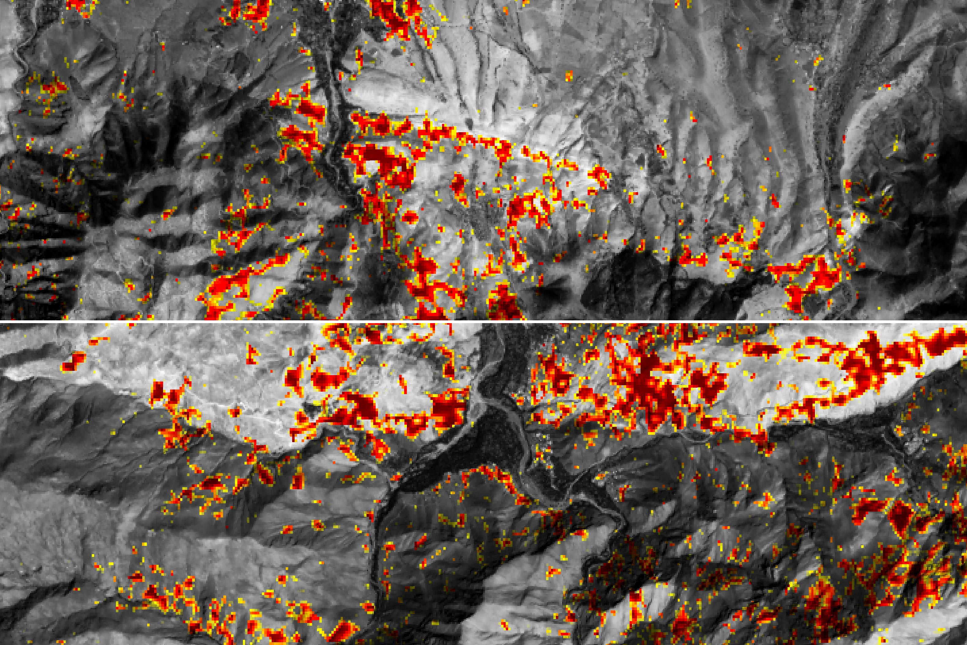
The detailed views of the damage proxy map below show damage in Adassil and Tafeghaghte, towns near the quake’s epicenter. Dark red pixels represent areas likely to have severe damage to buildings, homes, and infrastructure or changes to the landscape. Orange and yellow areas are moderately or partially damaged. Each pixel measures about 30 meters across (about the size of a baseball infield).
Impact on Local Communities
While urban areas in Marrakesh experienced strong, damaging shaking, the most severe destruction occurred in small communities in rural, mountainous areas in the High Atlas Mountains. Adassil, a village less than 10 kilometers from the epicenter, had widespread damage after experiencing some of the quake’s most intense shaking. Much of Tafeghaghte has been reduced to rubble, and half of the village’s residents are dead or missing, the BBC reported.
Preliminary validation of the damage proxy map was done by comparing it with high-resolution optical imagery and media reports, according to the Earth Observatory of Singapore — Remote Sensing Lab. Though the map can be used as guidance to identify damaged areas, it is less reliable over vegetated areas, the lab cautioned.
Historical Perspective
Though rare, large earthquakes have occurred in western Morocco before. In 1960, a damaging 5.9 magnitude quake struck coastal Morocco near Agadir and caused as many as 15,000 casualties. Historical data from the U.S. Geological Survey (USGS) show that until 2023, no other earthquakes magnitude 6 or larger have been recorded within 500 kilometers of the Agadir event since 1900. Quakes of that intensity are more common in the northern part of Morocco near the Mediterranean Sea, where a magnitude 6.4 earthquake struck in February 2004 and a magnitude 6.3 in January 2016, the USGS noted in a release.
NASA’s Involvement
NASA’s Earth Applied Sciences Disasters program area has been activated in support of the earthquake in Morocco. As new information becomes available, the team will be posting maps and data products on its open-access mapping portal.
NASA Earth Observatory image by Michala Garrison, using modified Copernicus Sentinel data (2020) processed by ESA and analyzed by the Earth Observatory of Singapore — Remote Sensing Lab (EOS-RS) with software originally developed at NASA’s Jet Propulsion Laboratory and Caltech and modified at EOS-RS. The Earth Observatory version of the map was laid over Landsat data from the U.S. Geological Survey and combined with a digital elevation model from the Shuttle Radar Topography Mission.
Never miss a breakthrough: Join the SciTechDaily newsletter.
Follow us on Google and Google News.