Landsat 9 completed its own pass last week in time for the big game.
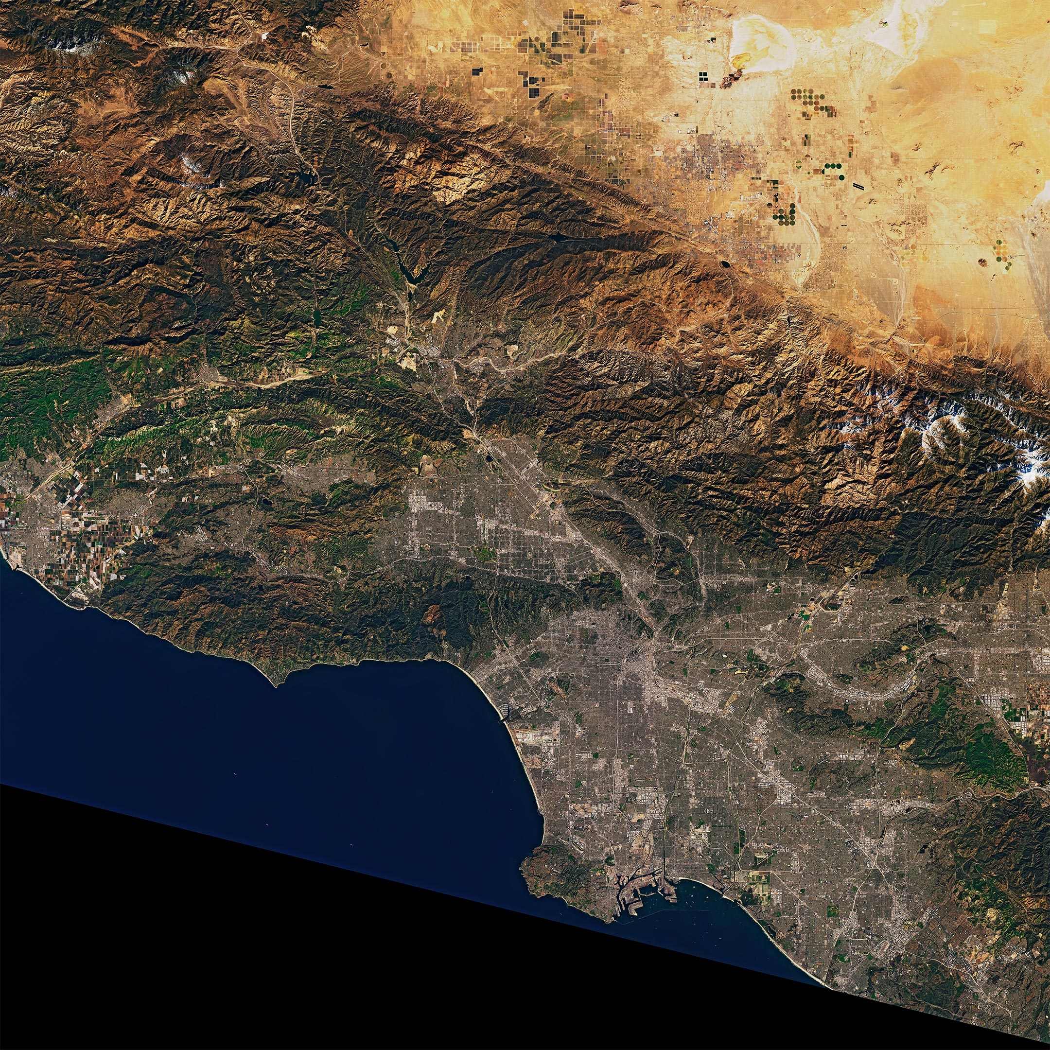
Passes will be flying today in Los Angeles at the Super Bowl, one of the most-watched sporting events each year in the United States. Earlier this week, one of the science community’s newest satellites also flew over LA, continuing 50 years of watching the city—and the planet—from above.
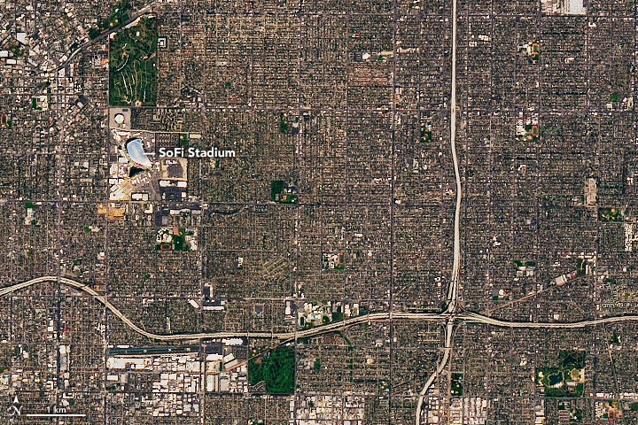
On February 7, 2022, the Operational Land Imager-2 (OLI-2) on Landsat 9 acquired these natural-color views of the Los Angeles area. The Super Bowl, the championship of American football, will be played in SoFi Stadium in Inglewood, California. It will be the eighth time the Los Angeles area has hosted the Super Bowl, but the first since 1993.
NASA launched Landsat 9 in September 2021 from the Vandenberg Space Force Base, about 150 miles (240 kilometers) up the road from Los Angeles. The satellite took its “first light” images on October 31, and mission operators have since been testing the satellite’s systems and subsystems and calibrating its instruments. In late January 2022, NASA transferred operation of Landsat 9 to the U.S. Geological Survey (USGS).
On February 10, USGS announced that Landsat 9 data is now available for free download from EarthExplorer, Machine to Machine (M2M), and LandsatLook. Since October 31, 2021, Landsat 9 has collected more than 57,000 images of Earth. The images will be processed, archived, and distributed from the USGS Earth Resources Observation and Science Center.
Landsat 9 carries two main instruments: OLI-2, which detects visible, near-infrared, and shortwave-infrared light in nine wavelengths, and the Thermal Infrared Sensor 2 (TIRS-2), which detects thermal radiation in two wavelengths used to measure Earth’s surface temperatures. The new satellite and instruments are quite similar in design to Landsat 8, which was launched in 2013 and remains in orbit. Together the satellites will collect approximately 1,500 images of Earth’s surface every day, observing the entire planet every eight days.
Landsat 9 features several improvements, including higher radiometric resolution, allowing OLI-2 to detect more subtle differences in surface features, especially over darker areas like water or dense forests. With 14-bit radiometric resolution, Landsat 9 can differentiate more than 16,000 shades of a given wavelength; Landsat 8 provides 12-bit data and 4,096 shades. Landsat 7, the satellite being replaced, detects only 256 shades with its 8-bit resolution.
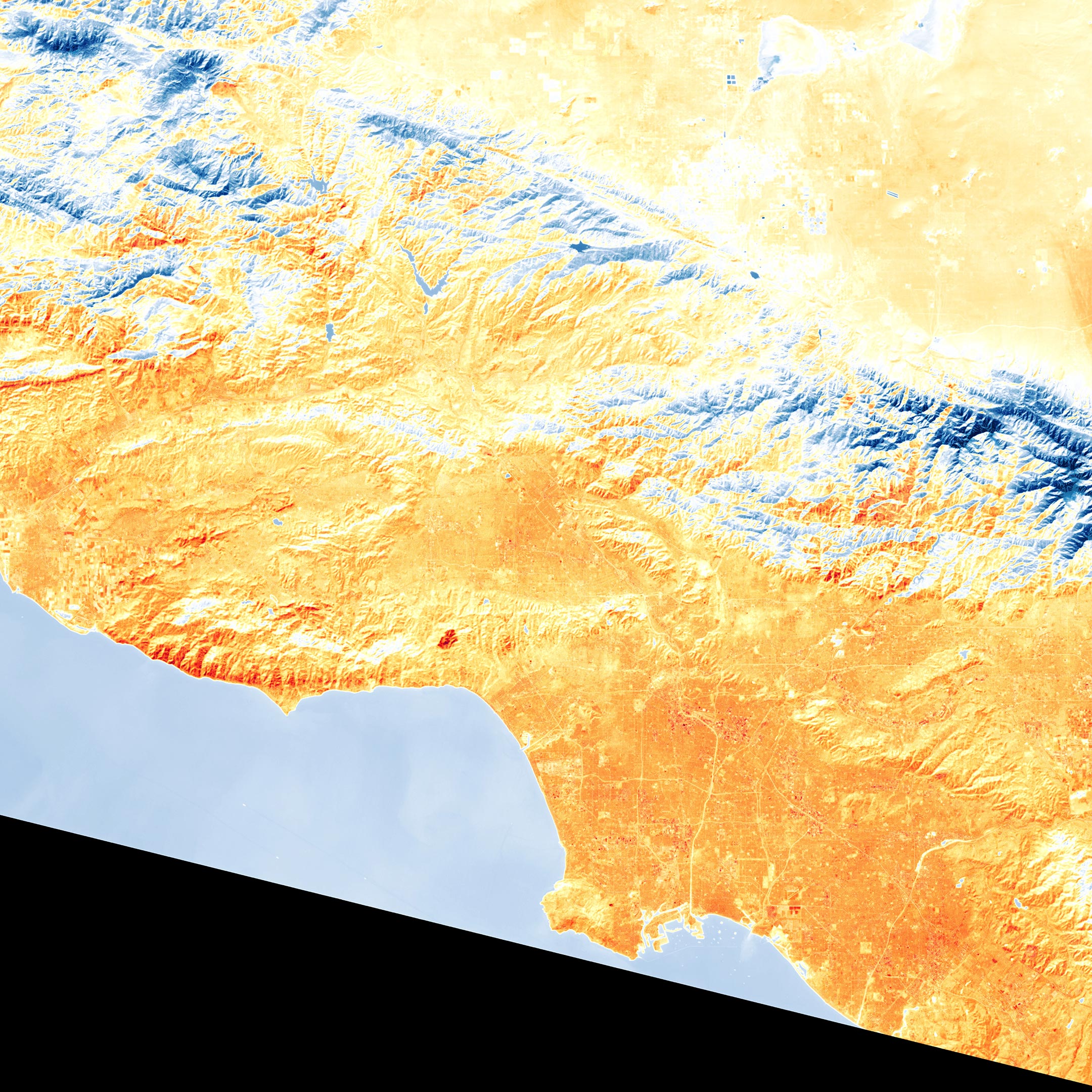
The third image was acquired on February 7 with the TIRS-2 instrument on Landsat 9. It shows land surface temperatures just before a winter heat wave hit Southern California. Temperatures have been 15 to 20 degrees Fahrenheit (8° to 11° Celsius) above normal this week in many parts of California, and several towns and cities (including Burbank) set new daily temperature records in February. The National Weather Service declared a heat advisory for February 9–13. Some forecasters are suggesting this Super Bowl could see some of the warmest game-time temperatures on record.
NASA Earth Observatory images by Joshua Stevens, using Landsat data from the U.S. Geological Survey.
Never miss a breakthrough: Join the SciTechDaily newsletter.
Follow us on Google and Google News.
1 Comment
They need to plant trees