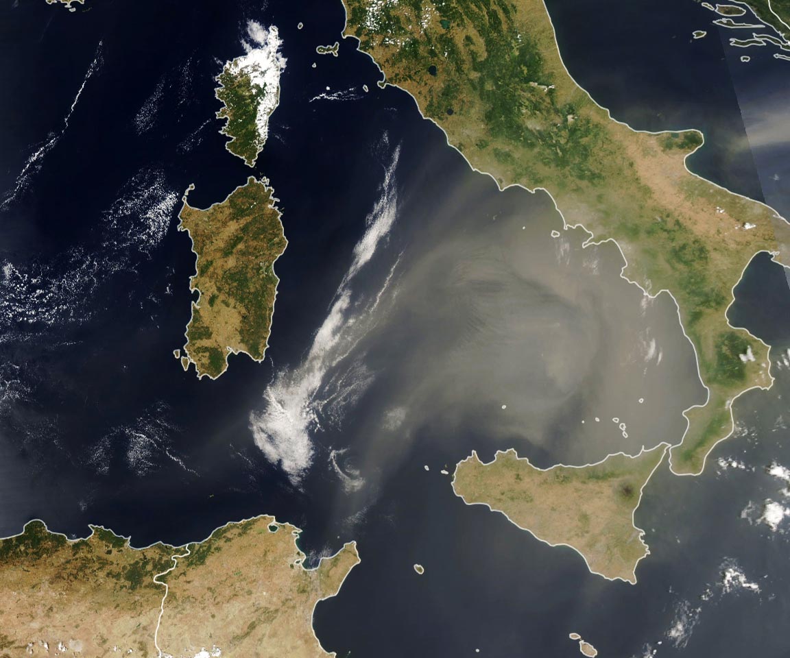
The dust storm traveled from Algeria to Italy, spanning roughly 1,000 kilometers (620 miles).
On June 22, 2021, the Moderate Resolution imaging Spectroradiometer (MODIS) on NASA’s Aqua satellite captured this image of dust blowing from North Africa toward Italy. As this time-lapse animation shows, the dust appears to have traveled from Algeria and Mali, blowing across more than 1,000 kilometers (600 miles) due to a large mesoscale convective weather system. The dust is expected to continue traveling farther north into Europe this week, according to forecasts by the Copernicus Atmosphere Monitoring Service.
Tens of millions of tons of dust blow out each year from northern and western Africa, lofted from the Sahara Desert by strong seasonal winds. Dust storms can degrade air quality, but they also play an important role in absorbing and reflecting solar energy to regulate Earth’s climate. Dust also fertilizes ocean and land ecosystems with iron and various minerals that help plants and phytoplankton grow.
NASA Earth Observatory image by Lauren Dauphin, using MODIS data from NASA EOSDIS LANCE and GIBS/Worldview.
Never miss a breakthrough: Join the SciTechDaily newsletter.
Follow us on Google and Google News.
2 Comments
“The dust is expected to continue traveling further north into Europe this week,…”
https://www.dictionary.com/e/farther-vs-further/
Thanks for the note! The spelling has been corrected.