Researchers are using Cold War spy satellite images to explore changes in the environment, including deforestation in Romania, marmot decline in Kazakhstan and ecological damage from bombs in Vietnam.
Ecologists have harnessed new advances in image processing to improve analysis of declassified US military intelligence photographs and detect previously unseen changes in the environment. Dr. Catalina Munteanu, of Humboldt University, and Dr. Mihai Daniel Nita, Transilvania University of Brașov, present new findings from the US Geological Survey declassified satellite imagery.
The main data source for the analyses are Cold War Spy satellite images, which were collected by the US since 1960, initially to monitor the Sino-Soviet bloc. Eight satellites took pictures on film roll, which were then parachuted back into the atmosphere, where a perfectly timed US military plane snatched it mid-air before it could be intercepted.
The researchers obtained the photos through the U.S. Geological Survey’s Earth Resources Observation and Science (EROS) Centre, after being declassified in 1995 under an executive order by President Bill Clinton.
This type of film data has been given an upgrade, by employing drone image processing software, using a rectification technique known as structure from motion.
Mihai, a co-author, a pioneer of this method commented “The mathematic procedure behind the drone image processing software is structure from motion. This approach allows us to process historical aerial or satellite images faster and more precise than the traditional approach.” This essentially creates a historical Google-Earth style of map, for satellite imagery taken as far back as the Cold War.
Previously, the same research group had utilized the CORONA dataset to analyze photos of agricultural landscapes in Kazakhstan between 1960’s and 1970’s. These photos were used to identify population declines in steppe marmots due to a reduction in burrow number. On marmots, Catalina Munteanu says, “Marmot population declined over the past 50 years in Kazakhstan– and this is a decline that we might have missed, if only looking at short time periods of 10-15 years for which modern data is available.
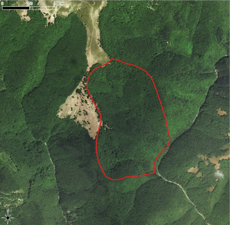
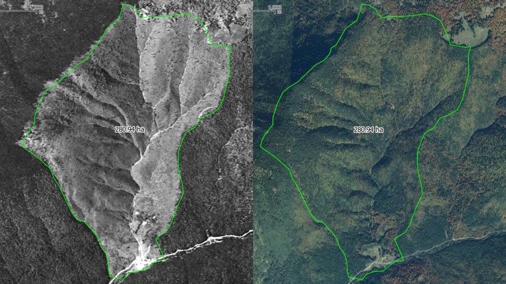
The authors present several new findings, in addition to the published research on marmots in Kazakhstan. One use included revealing the extent of large-scale deforestation in the aftermath of the Second World War in Romania.
“The extent and location of these historical clear-cuts were previously unknown – this data revealed where most of these harvests were located. Many of the forest harvested then were old forest, of high ecological value, and some areas were planted with spruce monocultures that are ecologically much less resilient and diverse,” says lead researcher Catalina Munteanu.
Pictures from the 1960’s revealed the watershed was completely clear cut by Soviet-Romanian companies as a reparation to the war. In 2015, a Google Earth image of the same area, showed the secondary forest regrowth after 60 years.
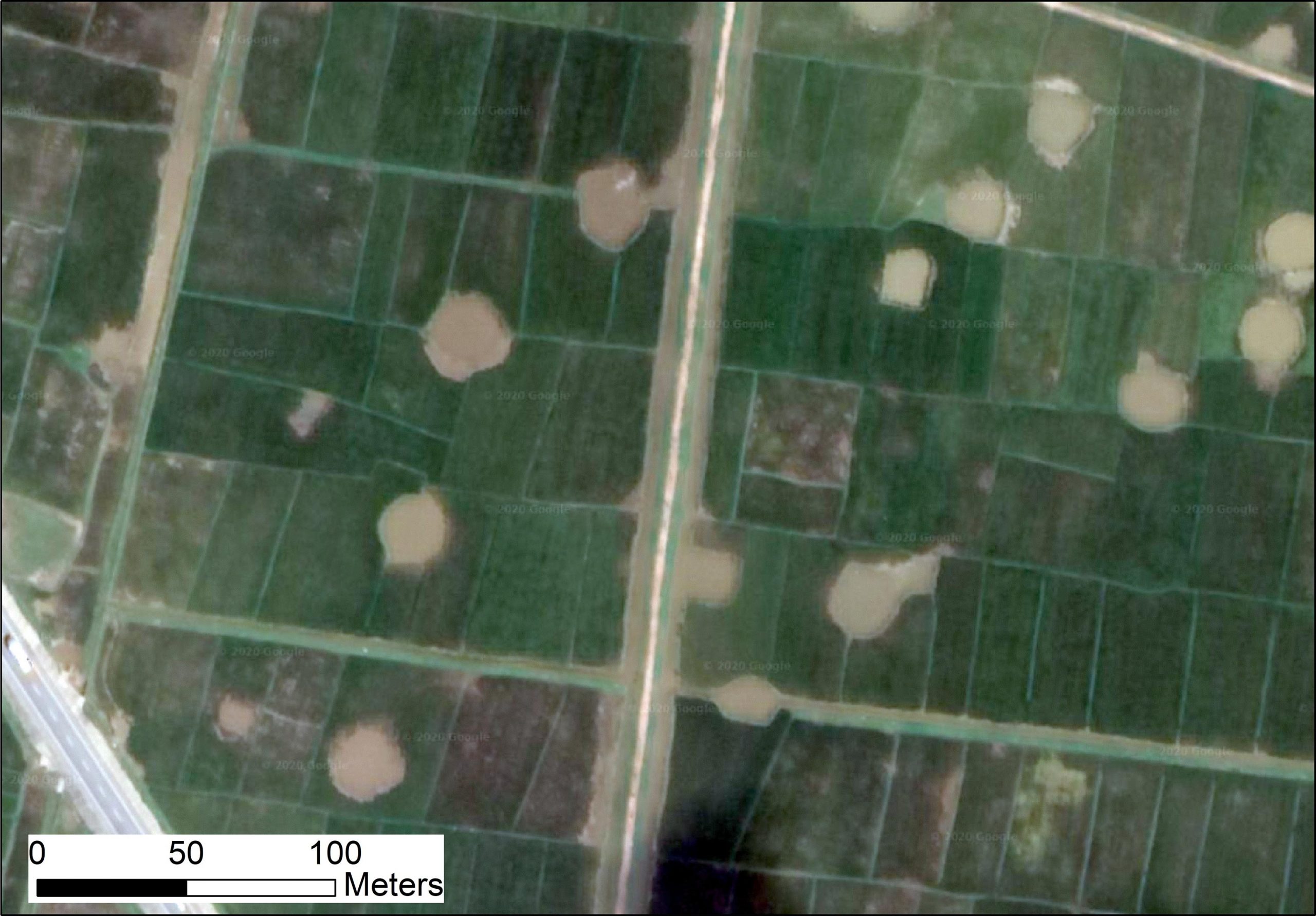
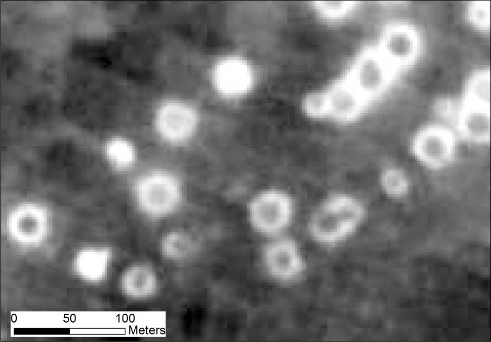
Interestingly, new examination of photos from the Vietnam War has revealed the extensive ecological damage caused by explosions. Mihai Daniel Nita, in a separate piece of work, has assessed the expansion of agricultural land in previously ravaged forests, as well as craters from the impact of bomb explosions, which have been transformed into fish farming ponds.
Spy satellite imagery can be used to map warfare-induced deforestation and changing agricultural practices in Vietnam.
“With this data we can not only map the extent of this damage with help of these images, but also explore how landscapes have changed later in response to the war. For example, some of the bomb craters are now filled with water and are used as fish ponds,” said Mihai.
This work demonstrates that often our choice of baselines is dictated by data availability, and that by using different data sources, we may shift the baselines against which we quantify change. The interpretation of environmental change will depend heavily on the reference points we choose.
Catalina and the co-authors caution that “this is a reminder to be very careful in our interpretations of environmental change. All data sources have their limitations and maybe also integrate these data. A good idea is to consider integrating across multiple data sources whenever possible.”
There may be many more applications of the data, such as mapping the development of cities and built infrastructure.
Catalina commented, “photos of this nature can also be a direct source of information (e.g., a penguin colony detected on an ice shelf) or be an indication of species or their habitat (e.g., previous work on the burrows of marmots in Kazakhstan).”
It is expected that large scale applications of historical satellite imagery data, as seen here, can set an example for the expansion of the use of these data into other disciplines relating to human environment interactions.
Future work could involve investigated ecological shock events such as war, and how this modified landscape has influenced the land use change itself.
Never miss a breakthrough: Join the SciTechDaily newsletter.
Follow us on Google and Google News.