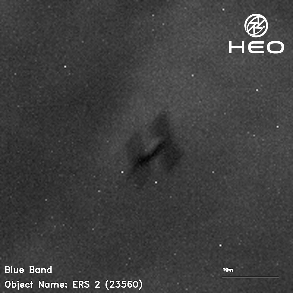
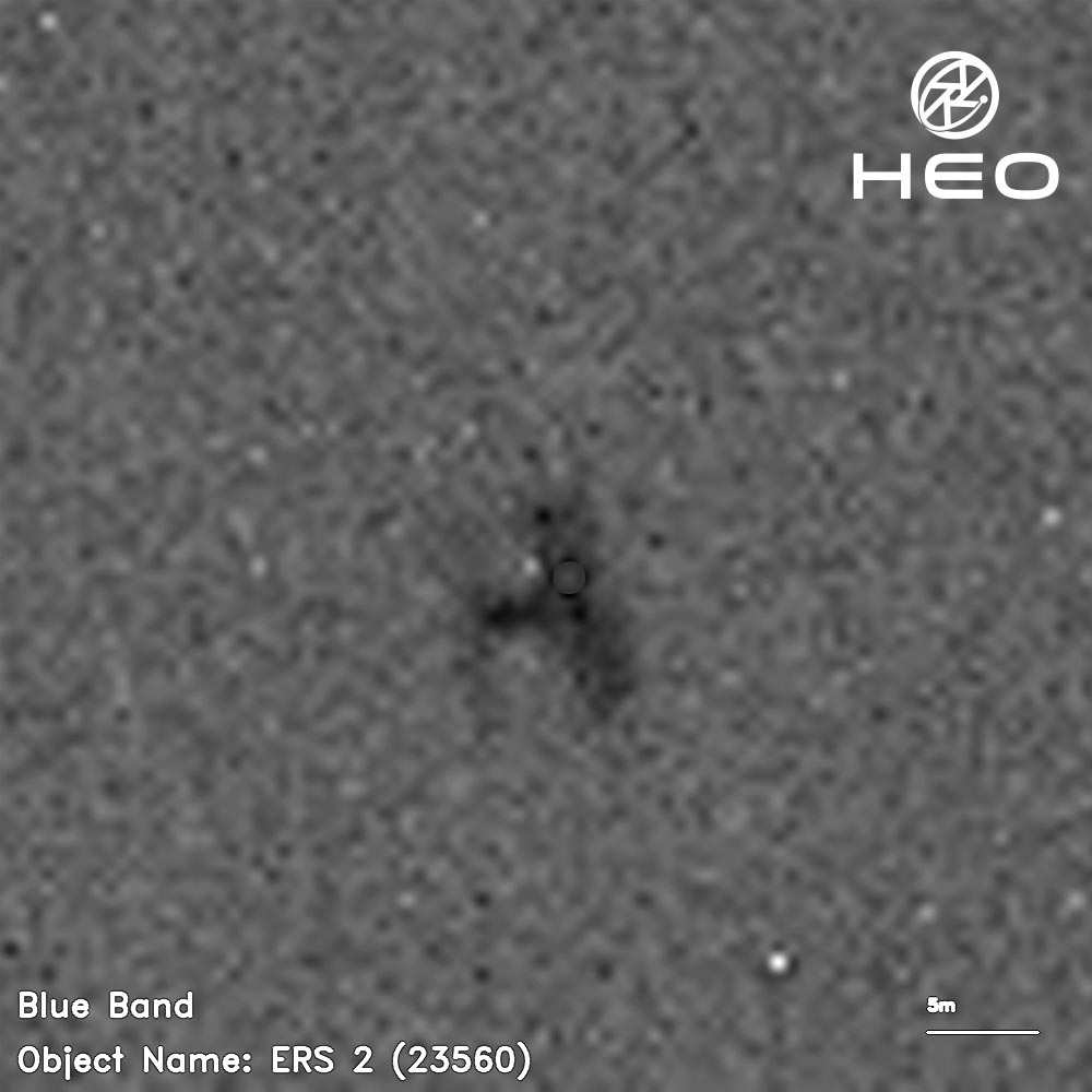
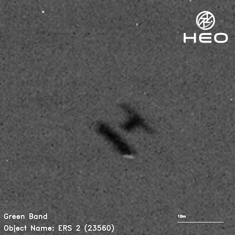
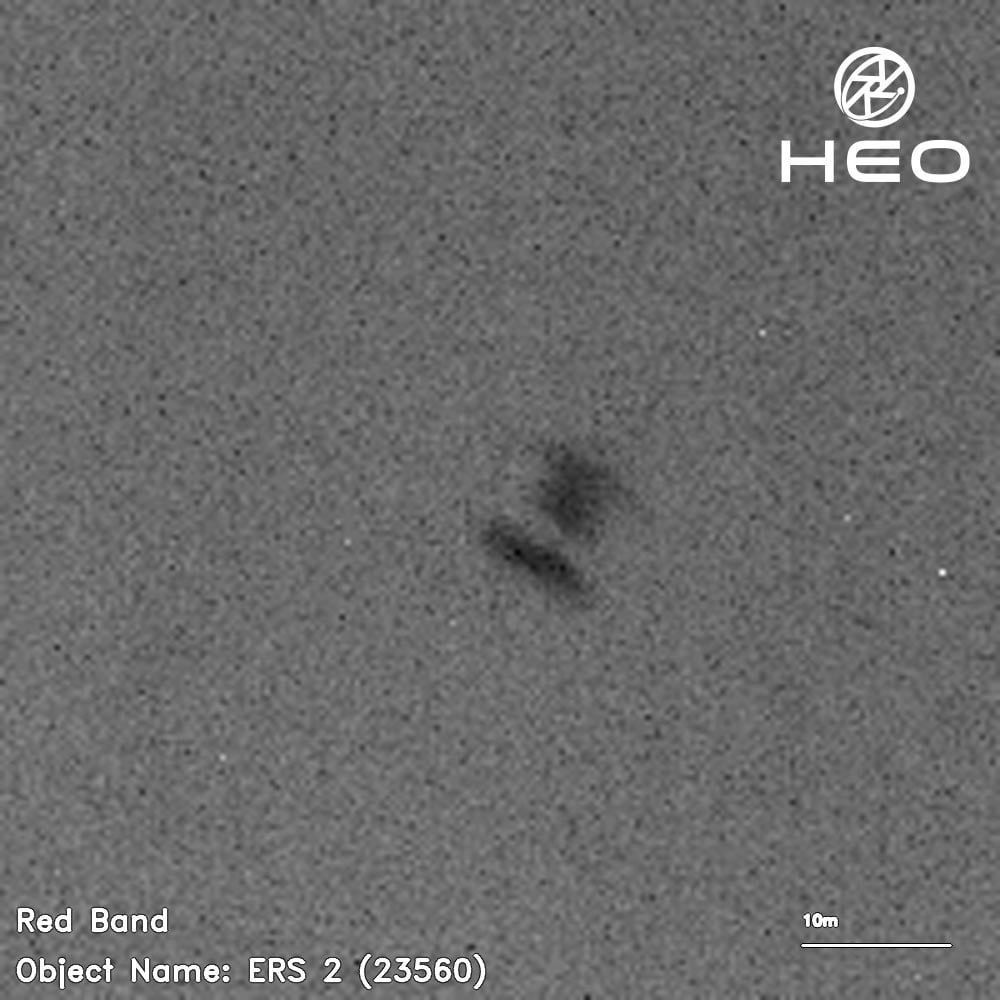
ERS-2 is expected to undergo atmospheric reentry and begin to break up today.
Throughout its 16-year working life, the second European Remote Sensing satellite, ERS-2, returned a wealth of information that revolutionized our perspective of our planet and understanding of climate change. As well as leaving a remarkable legacy of data that still continue to advance science, this outstanding mission set the stage for many of today’s satellites and ESA’s position at the forefront of Earth observation.
The End of an Era: Decommissioning ERS-2
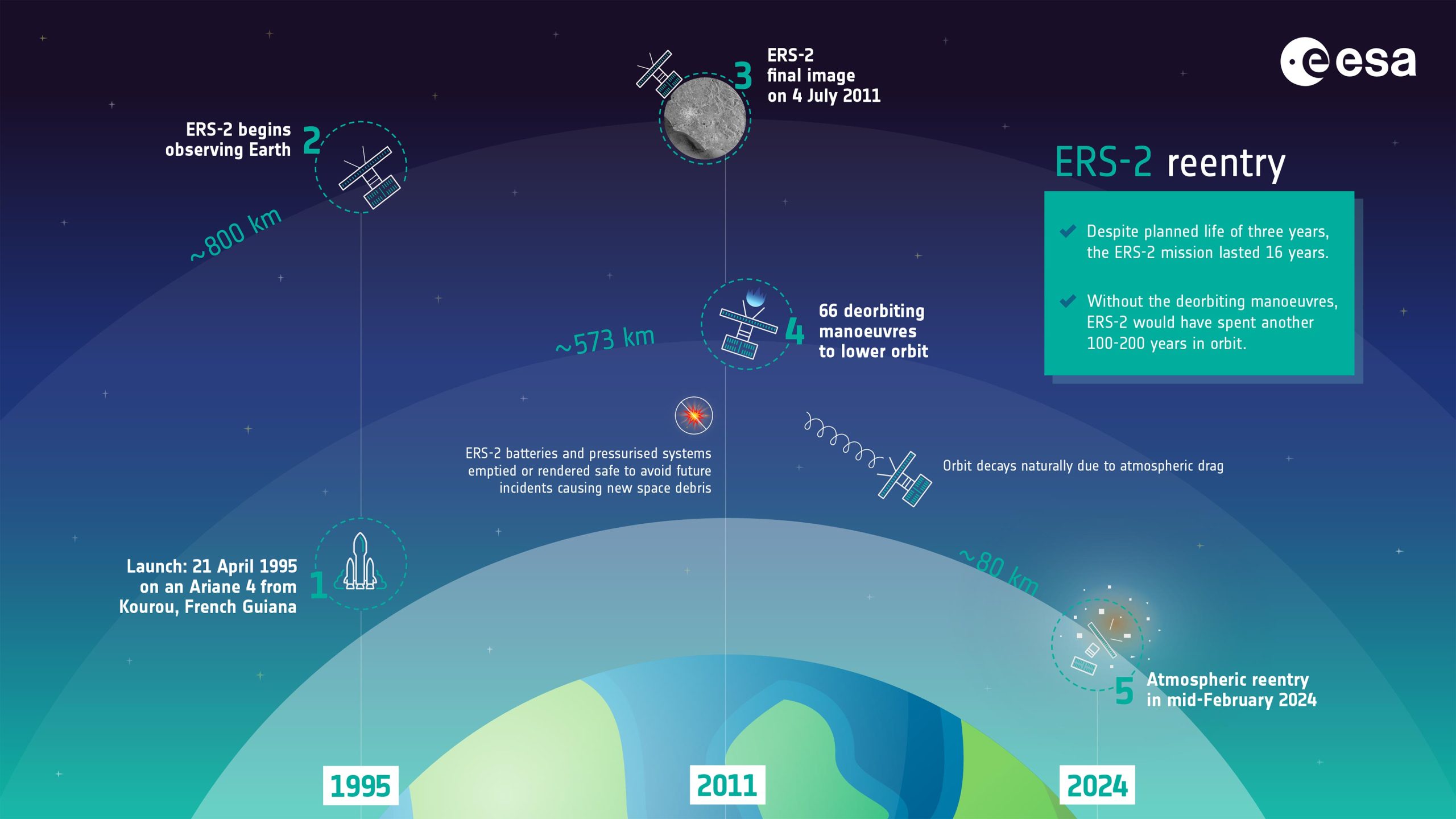
In 2011, ESA retired ERS-2 and began the process of deorbiting – and now it’s time for this pioneering satellite to reenter the atmosphere naturally and start to burn up.
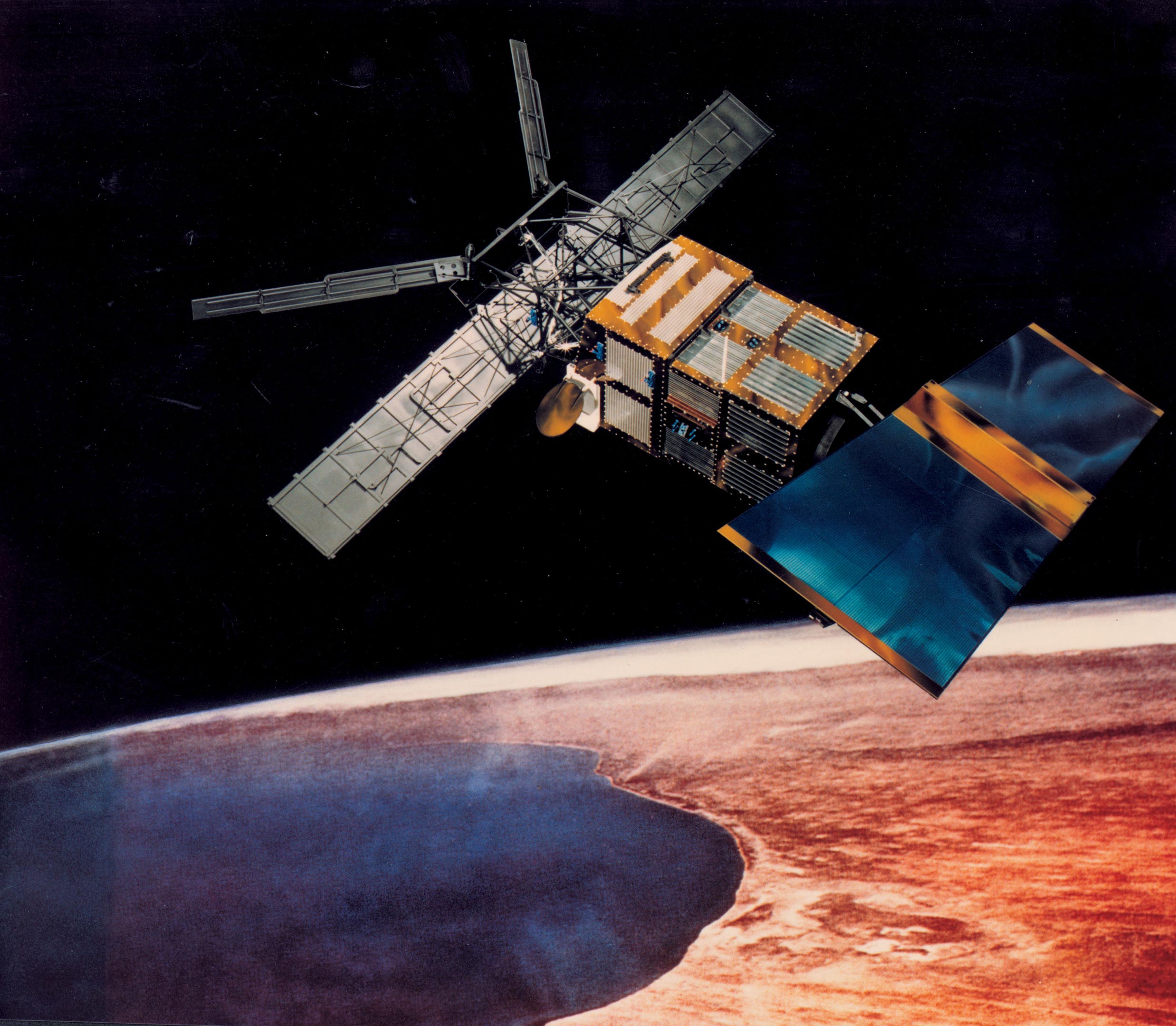
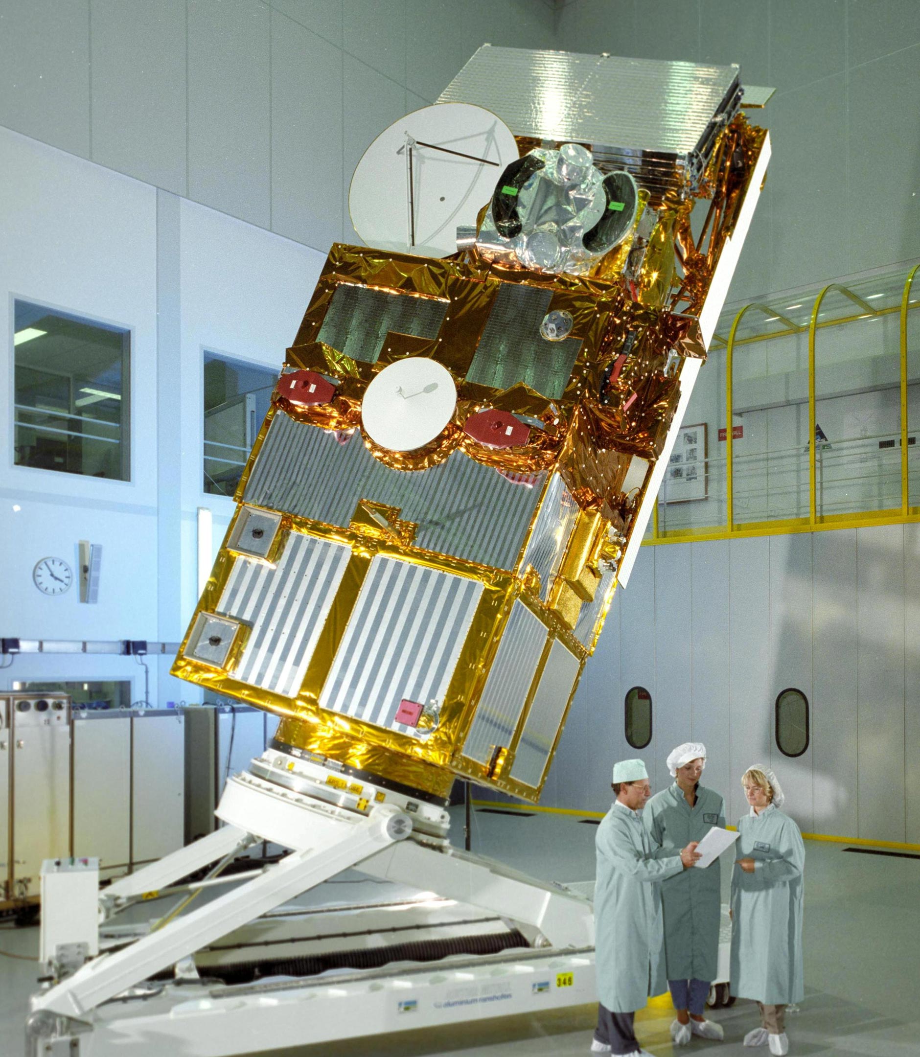
ERS-2 was launched in 1995 following on from its sister satellite, ERS-1, which had been launched four years earlier. At launch, ERS-2 weighed 2,516 kg (5,547 pounds). After depleting its fuel, it is estimated that it currently weighs 2,294 kg or (5,057 pounds).
At their time of launch, the two ERS satellites were the most sophisticated Earth observation satellites ever developed.
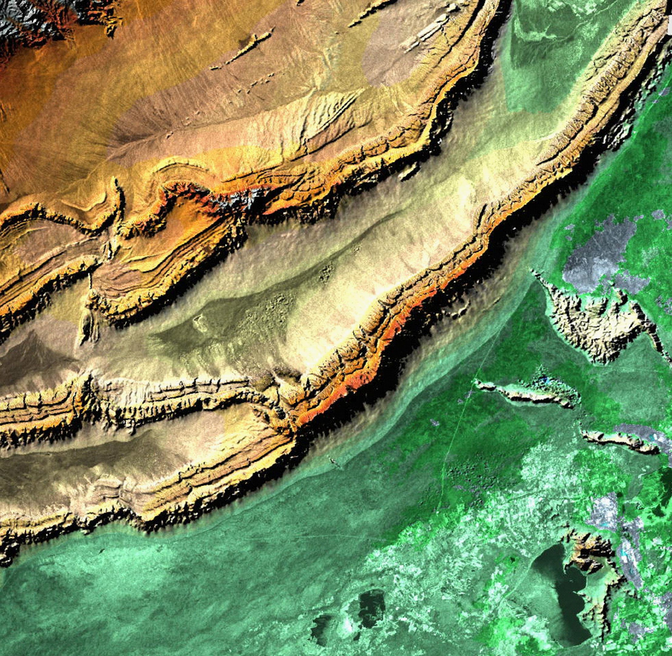
Both satellites carried an impressive package of instruments including an imaging synthetic aperture radar, a radar altimeter, and other powerful sensors to measure ocean-surface temperature and winds at sea. ERS-2 had an additional sensor to measure atmospheric ozone.
Groundbreaking Contributions to Environmental Science
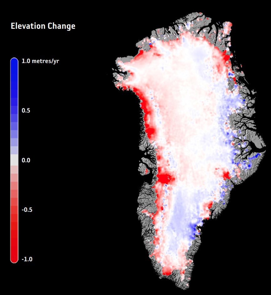
These ground-breaking ESA satellites collected a bounty of data on Earth’s diminishing polar ice, changing land surfaces, sea-level rise, warming oceans, and atmospheric chemistry. In addition, were called upon to monitor natural disasters such as severe floods and earthquakes in remote parts of the world.
The various technologies pioneered on ERS set the stage for successor missions such as the hugely successful Envisat mission, the MetOp weather satellites, today’s family of Earth Explorer scientific research missions, and the Copernicus Sentinels as well as many other national satellite missions, paving the way for the routine observations that we take for granted today.
For example, the ERS radar was the forerunner of the radar on today’s Copernicus Sentinel-1 mission, its radar altimeter provided heritage for the sensor on the CryoSat Earth Explorer mission to map changes in ice thickness and the ERS radiometer lives on in the version carried on Copernicus Sentinel-3.
ERS-2’s Global Ozone Monitoring Experiment (GOME) was the forerunner of Sciamachy on Envisat and GOME-2 on MetOp.
Back when ERS-2 was launched the notion of climate change was far less appreciated and understood than it is today – but the ERS missions gave scientists the data that helped us to begin to understand the impact that humans are having on the planet.
A Legacy That Lives On
Thousands of scientific papers have been published based on ERS data, and thanks to ESA’s Heritage Space Programme, which ensures that data from now-inactive satellites continue to be improved and used, more findings on our changing world and the risks we face will still emerge.
ERS-2 was still functioning when ESA declared the mission complete in 2011 and subsequently embarked upon lowering its altitude from about 785 km to 573 km to minimize the risk of collision with other satellites, and fully passivated the satellite.
ERS-2’s disposal was conducted considering ESA’s space debris mitigation requirements at that time to new projects, demonstrating the Agency’s strong commitment to reducing space debris.
After 13 years of orbital decay, mainly driven by solar activity, the satellite will now naturally reenter Earth’s atmosphere. ERS-2 is now expected to undergo atmospheric reentry and begin to break up on February 21, 2024.
Never miss a breakthrough: Join the SciTechDaily newsletter.
Follow us on Google and Google News.