
Close Menu
    Facebook X (Twitter) Instagram
    SciTechDaily
    • Biology
    • Chemistry
    • Earth
    • Health
    • Physics
    • Science
    • Space
    • Technology
    Facebook X (Twitter) Pinterest YouTube RSS
    SciTechDaily
    Home»Earth»Satellite Imagery Key to Powering Google Earth Timelapse
    Earth

    Satellite Imagery Key to Powering Google Earth Timelapse

    By European Space Agency (ESA)April 19, 2021No Comments4 Mins Read
    Facebook Twitter Pinterest Telegram LinkedIn WhatsApp Email Reddit
    Share
    Facebook Twitter LinkedIn Pinterest Telegram Email Reddit
    Sermersooq Greenland
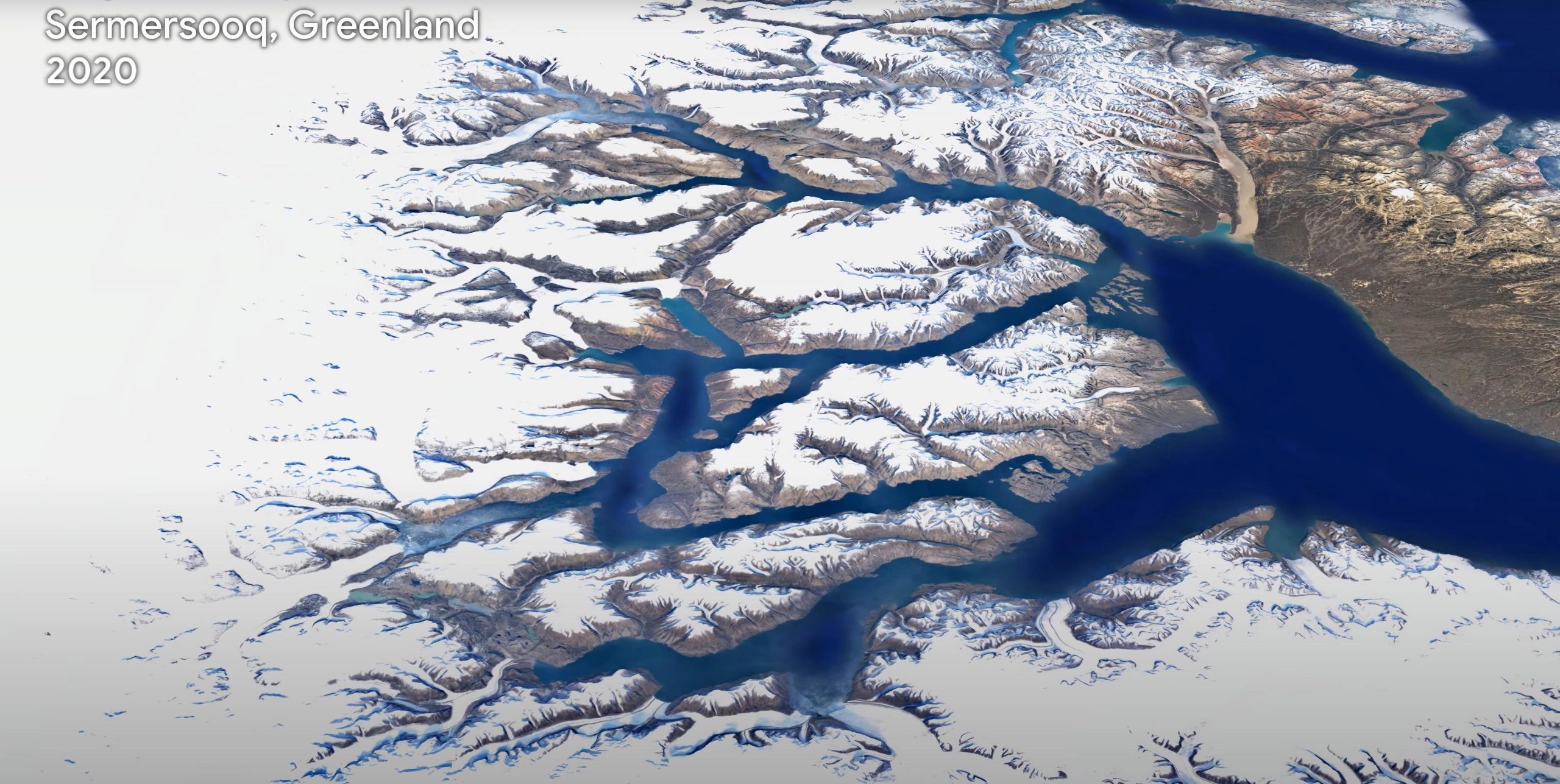
    One of the most comprehensive pictures of our changing planet is now available to the public. Thanks to the close collaboration between Google Earth, ESA, the European Commission, NASA, and the US Geological Survey, 24 million satellite photos from the past 37 years have been embedded into a new layer of Google Earth – creating a new, explorable view of time on our planet. Credit: Google Earth Timelapse (Google, Landsat, Copernicus)

    Timelapse in Google Earth turns 37 years of satellite images into a powerful visual story of Earth’s transformation.

    One of the most comprehensive pictures of our changing planet is now available to the public. Thanks to the close collaboration between Google Earth, ESA, the European Commission, NASA, and the US Geological Survey, 24 million satellite photos from the past 37 years have been embedded into a new layer of Google Earth – creating a new, explorable view of time on our planet.

    In the biggest update to Google Earth since 2017, users can now discover our planet in an entirely new dimension – time. With a new feature called Timelapse in Google Earth, users can witness nearly four decades of change across the entire planet. The update will show the visual evidence of the drastic changes taking place in our world including the effects of climate change and human behavior.

    Users can now take a journey across the world, explore the ever-changing shapes of coastlines, follow the growth of megacities, track deforestation, and much more. For each topic, Google Earth will take you on a guided tour to better understand the planet’s changes and how people experience them.

    Rebecca Moore, Director of Google Earth, said, “This update was made possible thanks to open data provided by the European Union’s Copernicus program, and its Sentinel satellites, as well as NASA and the US Geological Survey’s Landsat program. The Copernicus Sentinel-2 high-resolution imaging mission was integral in the development of Google Earth’s new Timelapse feature and the unique global view we are now bringing to people everywhere.”

    Maurice Borgeaud, Head of the Science, Applications & Climate Department at ESA Earth Observation Programmes, commented, “The use of Copernicus Sentinel data makes it possible for millions of people to explore changes on Earth. But what the operational fleet of European satellites allows us to do goes much further! We are analyzing all aspects of changes on our planet – no matter whether natural or manmade – and their impact on the climate.”

    The Sentinels are a fleet of dedicated EU-owned satellites, designed to deliver the wealth of data and imagery that are central to the European Union’s Copernicus environmental program. The Copernicus Sentinel-2 high-resolution imaging mission, used predominantly for land monitoring, was key to improving Timelapse and its functionality.
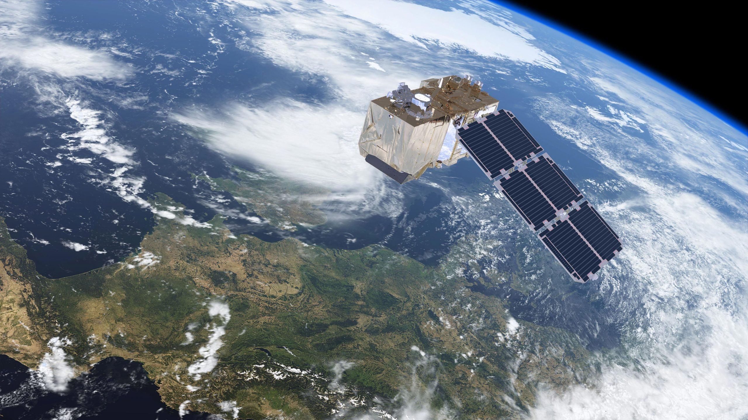
    Copernicus Sentinel 2
    Sentinel-2 carries a high-resolution multispectral optical imager to monitor changes in vegetation for Europe’s environmental monitoring Copernicus program. Credit: ESA/ATG medialab

    Copernicus Sentinel-2 is a polar-orbiting mission based on a constellation of two identical satellites in the same orbit, 180° apart for optimal coverage and data delivery. The combination of high resolution, novel spectral capabilities, a swath width of 290 km and frequent revisit times provides unprecedented views of Earth, every five days at 10 m spatial resolution.

    This new timelapse capability required a significant amount of time and involved ‘pixel crunching’ in Earth Engine, Google’s platform for geospatial analysis. In order to add the animated Timelapse imagery to Google Earth, more than 20 million satellite images from 1984 to 2020 were gathered. In total, it took more than 2 million processing hours across thousands of machines in Google Cloud to weave 20 petabytes of satellite imagery into a single 4.4 terapixel-sized video mosaic.

    In order to explore Timelapse, users can use the search bar to choose any place on the planet where they want to see time in motion. Google Earth will be updated with Timelapse imagery annually throughout the next decade as more satellite images become available.

    To explore this new layer in Google Earth, go to Timelapse.


    Never miss a breakthrough: Join the SciTechDaily newsletter.
    Follow us on Google and Google News.

    European Space Agency Google NASA
    Share. Facebook Twitter Pinterest LinkedIn Email Reddit

    Related Articles

    NASA ICON Finds Effects of Massive Tonga Volcanic Eruption Reached Space

    Reaching for the Stars From Kourou – Europe’s Spaceport in French Guiana

    ESA and NASA Join Forces To Tackle Global Challenge of Climate Change

    Advanced New Spacecraft Will Monitor Sea Level Rise and Atmospheric Temperature With Extreme Precision

    Ground Displacement From Puerto Rico Earthquake Mapped by NASA

    Search for Extra-Terrestrial Life Takes Mars Scientists on Expedition to Australia

    NASA Satellite Image Shows La Niña Peaking in Intensity

    ESA’s Hershel Space Telescope Captures Incredible Views of Eagle Nebula

    Hubble Reaches New Milestone: 10,000th Scientific Paper Published

    Leave A Reply Cancel Reply

    • Facebook
    • Twitter
    • Pinterest
    • YouTube

    Don't Miss a Discovery

    Subscribe for the Latest in Science & Tech!

    Trending News

    Bees Have a Hidden Nutritional Superpower, Oxford Study Reveals

    A Century-Old Belief About Diamond Has Just Been Overturned

    The Universe Can Expand Faster Than Light Without Breaking Physics

    The Exercise Paradox: Why Workouts Don’t Guarantee Weight Loss

    This Ancient Sea Animal Fights Viruses in the Opposite Way Humans Do

    39 Sweeteners Put to the Test Produced Surprising Gut Changes

    This Experimental Drug Repaired the Gut and Reversed Severe Fatty Liver Disease

    Physicists Just Turned a Black Hole Energy Theory Into Reality

    Follow SciTechDaily
    • Facebook
    • Twitter
    • YouTube
    • Pinterest
    • Newsletter
    • RSS
    SciTech News
    • Biology News
    • Chemistry News
    • Earth News
    • Health News
    • Physics News
    • Science News
    • Space News
    • Technology News
    Recent Posts
    • 3.1-Billion-Year-Old Rocks Rewrite the History of Earth’s Early Tectonics
    • Ancient DNA Reveals a Medieval Burial Mystery: They Weren’t Family
    • The Truth About Vikings Is More Complicated Than Museums Admit
    • Chromosome Chaos Reveals 81 New Cancer-Causing Genes
    • Rare Autism-Linked Syndrome Is Far More Common Than Scientists Thought
    Copyright © 1998 - 2026 SciTechDaily. All Rights Reserved.
    • Science News
    • About
    • Contact
    • Editorial Board
    • Privacy Policy
    • Terms of Use

    Type above and press Enter to search. Press Esc to cancel.