
The year 2020 will be remembered for being a very trying year and western wildfires have just added to the year’s woes. So far in 2020, California has experienced 7,606 fires and those fires have consumed 2.3 million acres. Washington and Oregon have also been hard hit by wildfires. Over 300,000 acres are reported to be burning. Four towns in Oregon have been mostly destroyed by the wildfire devastation. The town of Malden in Washington was also destroyed. And a wildfire meteorologist with the National Interagency Fire Center, Nick Nausler, tweeted that the U.S. has not seen this level of wildfire activity since the “Big Blowup” of 1910.
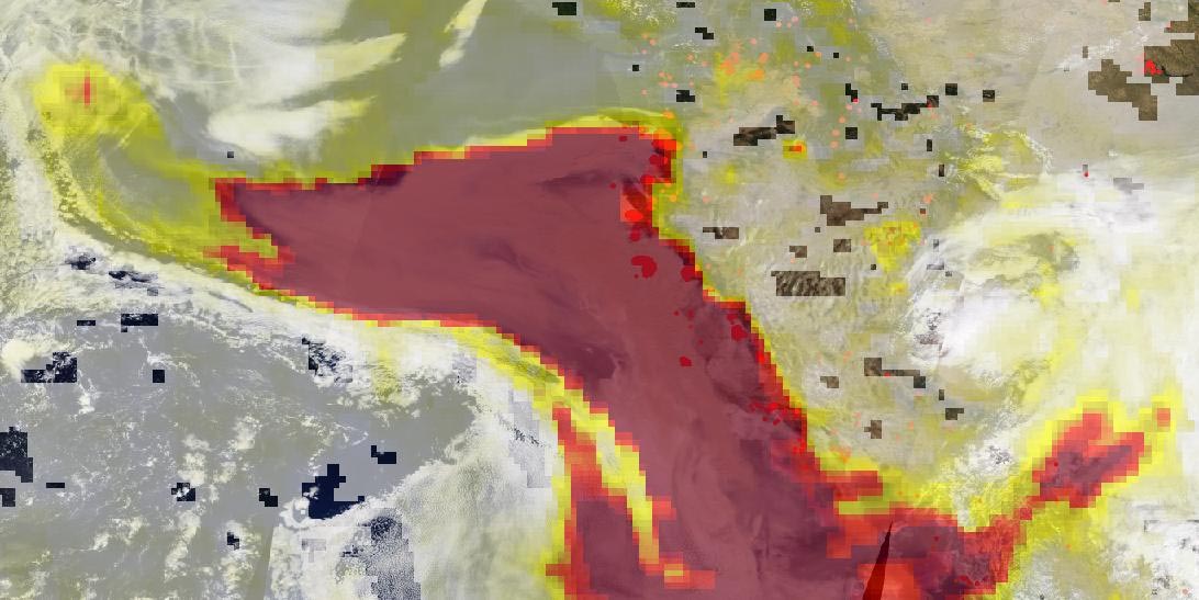
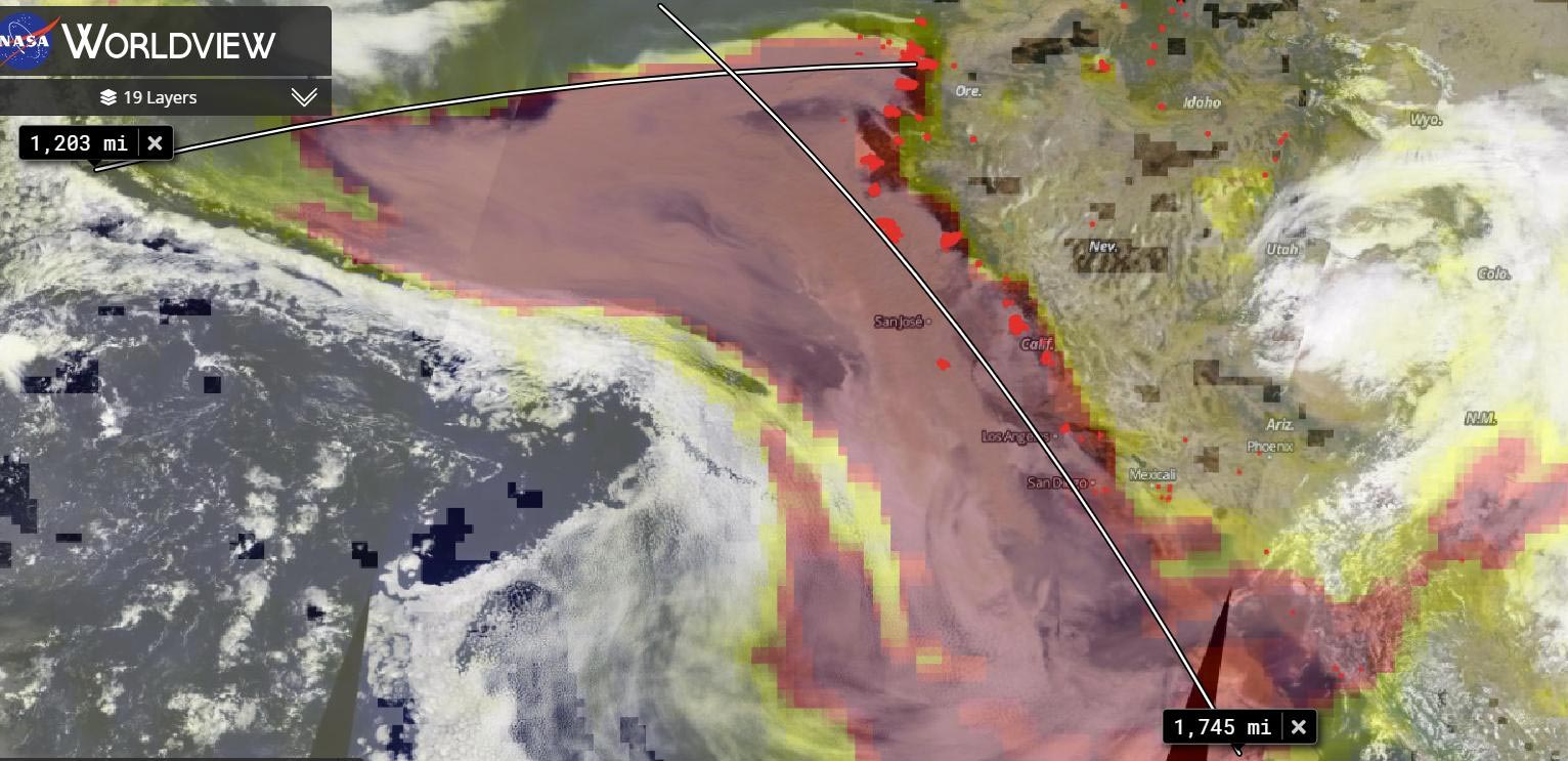
In the images above, the top image shows the areas (marked in red) where the wildfires are currently burning in the West. Copious amounts of smoke spill off the coast and into the Pacific Ocean. Thee second image, however, shows the real story of the danger that smoke poses. Using the OMPS (Ozone Mapping Profiler Suite) instrument aerosols are detected and measured in terms of thickness and height of the atmospheric aerosol layer. For most atmospheric events involving aerosols, the AI ranges from 0.0 (colorless through light yellow, yellow, orange, and red) to 5.0 (deep red), with 5.0 indicating heavy concentrations of aerosols that could reduce visibilities or impact health. High aerosol concentrations not only can affect climate and reduce visibility, they also can impact breathing, reproduction, the cardiovascular system, and the central nervous system, according to the US EPA. Since aerosols are able to remain suspended in the atmosphere and be carried in prevailing high-altitude wind streams, they can travel great distances away from their source and their effects can linger as evidenced in the image found below.
The smoke released by any type of fire (forest, brush, crop, structure, tires, waste or wood burning) is a mixture of particles and chemicals produced by incomplete burning of carbon-containing materials. All smoke contains carbon monoxide, carbon dioxide, and particulate matter (PM or soot). Smoke can contain many different chemicals, including aldehydes, acid gases, sulfur dioxide, nitrogen oxides, polycyclic aromatic hydrocarbons (PAHs), benzene, toluene, styrene, metals, and dioxins. The type and amount of particles and chemicals in smoke varies depending on what is burning, how much oxygen is available, and the burn temperature.
Credit: NASA Worldview
Exposure to high levels of smoke as evidenced in these wildfires should be avoided. Individuals are advised to limit their physical exertion if exposure to high levels of smoke cannot be avoided. Individuals with cardiovascular or respiratory conditions (e.g., asthma), fetuses, infants, young children, and the elderly may be more vulnerable to the health effects of smoke exposure.
Residents of these areas are on notice that sunsets will be much redder and more orange for a while. The reason? The size of the smoke particles is just right for filtering out other colors meaning that red, pink and orange colors can be seen more vividly in the sky. More orange and red sunsets are likely as long as the smoke lingers.
NASA’s Earth Observing System Data and Information System (EOSDIS) Worldview application provides the capability to interactively browse over 700 global, full-resolution satellite imagery layers and then download the underlying data. Many of the available imagery layers are updated within three hours of observation, essentially showing the entire Earth as it looks “right now.” Actively burning fires, detected by thermal bands, are shown as red points. Image Courtesy: NASA Worldview, Earth Observing System Data and Information System (EOSDIS).
Never miss a breakthrough: Join the SciTechDaily newsletter.
Follow us on Google and Google News.