TROPOS involvement throughout the Aeolus mission and preparations for the upcoming EarthCARE mission.
After completing a very successful mission, ESA’s Aeolus satellite descended from an altitude of 320 km back to Earth’s atmosphere. While the satellite would usually fall down slowly due to the Earth’s gravity, ESA orchestrated its first-ever controlled satellite reentry.
Related:
- Fiery Finale: Final Images of the Doomed Aeolus Spacecraft
- ESA’s Aeolus: A Historic End to a Trailblazing Mission
- Mission Possible: Steering Aeolus Through Earth’s Fiery Welcome
- Aeolus’ Epic Fall: The Wind Satellite Making Space History
This is a brief review of scientific experiments that happened shortly before the end of Aeolus’ mission life in which the Leibniz Institute for Tropospheric Research (TROPOS) was involved:
TROPOS Involvement Throughout the Whole Mission
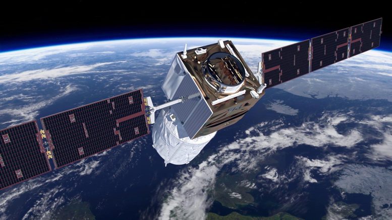
Launched on August 22, 2018, the Aeolus satellite was orbiting the Earth for almost five years while providing vertical profiles of the horizontal wind speed and backscatter information on clouds and aerosols. TROPOS strongly contributed to the great success of the mission while providing continuous reference measurements all over the world for validation of the wind and aerosol/cloud products from the beginning until the end of the mission. Also beyond the mission, TROPOS will be involved in the Aeolus Data, Innovation and Science Cluster (DISC) project to improve the data products and enhance the scientific impact of the mission. TROPOS took part in the Level-2A aerosol optical properties product development, monitoring the data quality and supporting external validation with the science team from European partners.
End-of-Life Tests
Before the satellite’s historic end, the Aeolus team successfully conducted a series of end-of-life experiments. The scientists hope that the results of these experiments will help improve future lidar missions in space. The radiometric performance of the instrument and the impact on both aerosol and wind products were assessed in collaboration with the Aeolus DISC for each test.
Vertical Winds
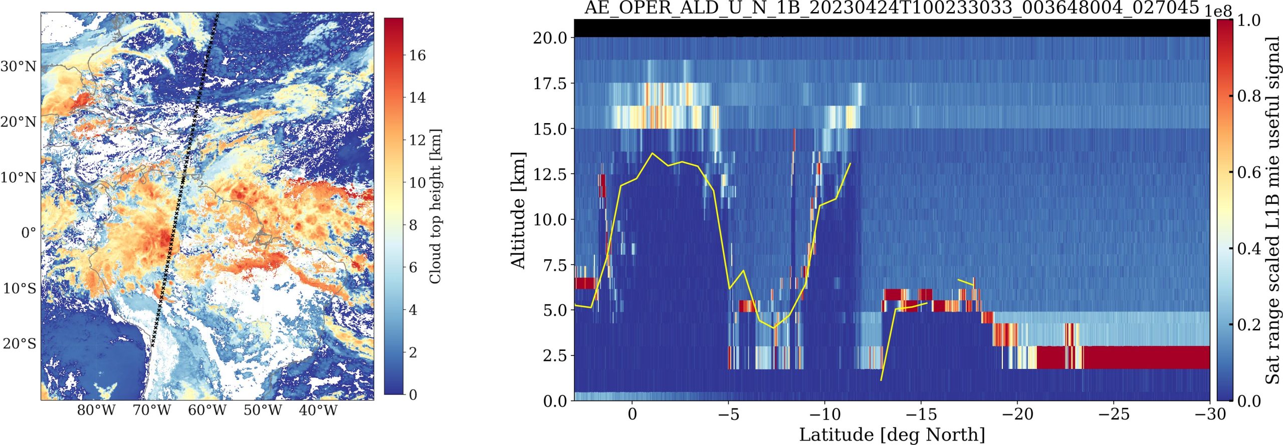
TROPOS was involved in one experiment where the laser was tilted from its nominal 35-degree diagonal view to a nadir view (point on the Earth’s surface directly beneath the satellite) to measure vertical winds over deep convective cloud systems. While vertical air motions are negligible on average over large horizontal scales, this assumption is not valid in situations with strong convection (e.g., tropical storms). “While we are still analyzing the promising data collected during this test, we hope that we can quantify the impact of vertical air motions on the assumptions that are used,” says Dr. Sebastian Bley of TROPOS.
ATLID Test
TROPOS was also involved in an ATLID test, where the Aeolus laser ALADIN was configured in a way to mimic the ATLID lidar, which will fly on EarthCARE. This test is intended to prepare for the upcoming EarthCARE satellite which will carry a lidar instrument very similar to that flying on Aeolus. “Lessons learned from Aeolus helped us a lot in preparing for the EarthCARE mission. With its four instruments on one platform for measuring aerosols, clouds, and radiation, it is even more challenging than Aeolus,” says Dr. Ulla Wandinger of TROPOS. The launch window for the EarthCARE mission is currently scheduled for April-June 2024. While performing the ATLID test, Aeolus was flying over Leipzig and Mindelo at Cape Verde Islands, both stations with ground-based lidar instruments operated by TROPOS.
Final statement by TROPOS
We followed the Aeolus reentry with mixed feelings. On one hand, we are sad about the fact that this wonderful satellite burned up in Earth’s atmosphere, while on the other hand, we are pleased and proud that we could contribute to the success of this exciting mission.
But there is also reason to look into a bright future. Our work will continue also after Aeolus illuminated the sky like a falling star for the last time. Our colleagues at TROPOS will continue working on the Aeolus data from the last five years within the Aeolus DISC project, notably validating the reprocessed aerosol products and highlighting novel applications for the atmospheric science community.
Furthermore, we are heavily involved in the preparation for the upcoming EarthCARE mission, which will be launched in the summer of next year. TROPOS has a leading role in the development of the processors for the ATLID lidar and the cloud products for the Multi-Spectral Imager (MSI) within the frame of the ESA-CARDINAL project. Furthermore, TROPOS is preparing for the validation of the EarthCARE measurements with our ground-based measurements sites of the whole globe.
Reference: “HETEAC – the Hybrid End-To-End Aerosol Classification model for EarthCARE” by Ulla Wandinger, Athena Augusta Floutsi, Holger Baars, Moritz Haarig, Albert Ansmann, Anja Hünerbein, Nicole Docter, David Donovan, Gerd-Jan van Zadelhoff, Shannon Mason and Jason Cole, 25 May 2023, Atmospheric Measurement Techniques.
DOI: 10.5194/amt-16-2485-2023
Never miss a breakthrough: Join the SciTechDaily newsletter.
Follow us on Google and Google News.