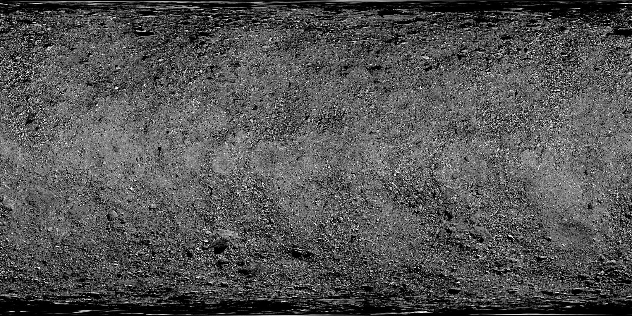
This global map of asteroid Bennu’s surface is a mosaic of images collected by NASA’s OSIRIS-REx spacecraft between March 7 and April 19, 2019. A total of 2,155 PolyCam images were stitched together and corrected to produce the mosaic. At 2 inches (5 cm) per pixel, this is the highest resolution at which a planetary body has been globally mapped. The spacecraft collected these images at distances ranging from 1.9 to 3.1 miles (3.1 to 5 km) above the asteroid’s surface. This detailed view of Bennu was used by the mission team during their selection of the primary and backup sample collection sites – Nightingale and Osprey.
Full-sized versions of the mosaic are available for download here (mosaic only) and here (mosaic with coordinate system).
Never miss a breakthrough: Join the SciTechDaily newsletter.
Follow us on Google and Google News.