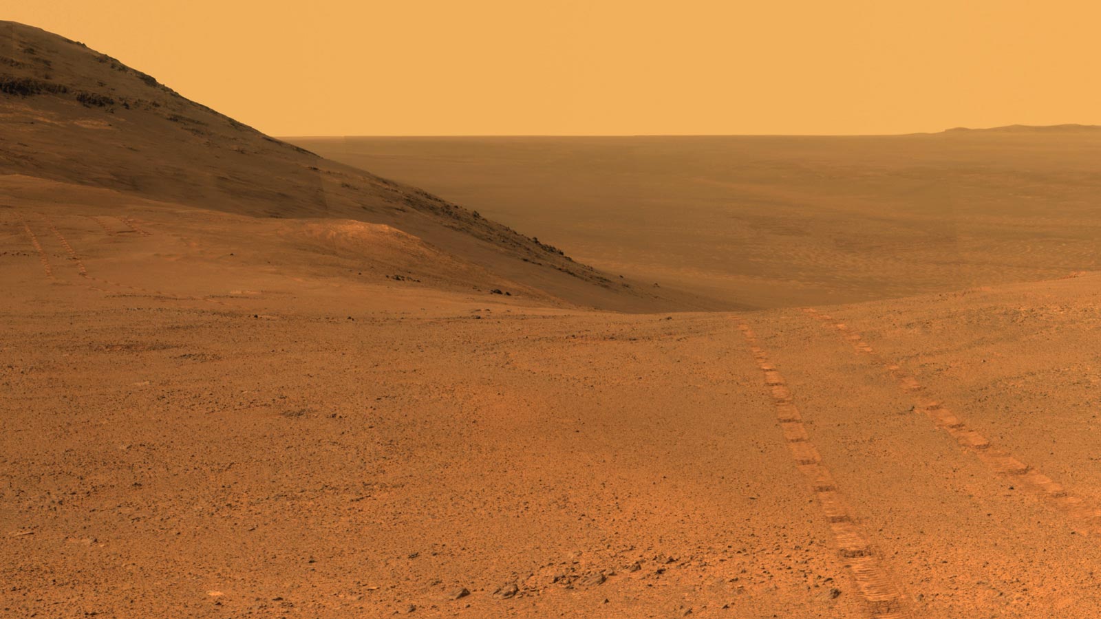
This new panoramic view was captured by NASA’s Mars Exploration Rover Opportunity before entering the upper end of a fluid-carved valley that descends the inner slope of a large crater’s rim.
The scene includes a broad notch in the crest of the crater’s rim, which may have been a spillway where water or ice or wind flowed over the rim and into the crater. Wheel tracks visible in the area of the notch were left by Opportunity as the rover studied the ground there and took images into the valley below for use in planning its route.
Opportunity’s panoramic camera (Pancam) took the component images for this view from a position outside the crater during the span of June 7 to June 19, 2017, sols 4753 to 4765 of the rover’s work on Mars.
This scene includes features that may have been ancient channels from water, ice or wind moving toward the notch in the rim, which might have been a spillway. Perseverance Valley, just on the other side, was likely carved by action of some fluid, such as water, water-lubricated debris, or wind. The mission is investigating to learn more about that process from evidence in place.
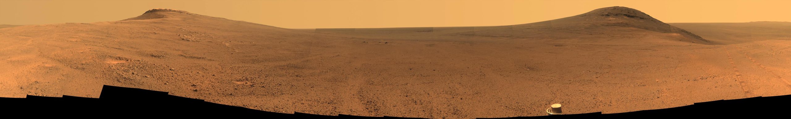
The panorama spans about three-fourths of a full-circle view, from southeastward on the left, through westward in the middle, to northeastward on the right. High points visible on the rim of Endeavour Crater include “Winnemucca” on the left and “Cape Tribulation” on the right. Winnemucca is part of the “Cape Byron” portion of the crater rim. The horizon at far right extends across the floor of Endeavour Crater, which is about 14 miles (22 kilometers) in diameter. Opportunity has been investigating sites on and near the western rim of Endeavour since 2011, following seven years of exploring smaller craters after its 2004 landing. Images showing more of the crater’s rim, for context, are at PIA21496, PIA21490 and PIA17758.
This view merges exposures taken through three of the Pancam’s color filters, centered on wavelengths of 753 nanometers (near-infrared), 535 nanometers (green) and 432 nanometers (violet). Color is enhanced in this version to make differences in surface materials more easily visible.
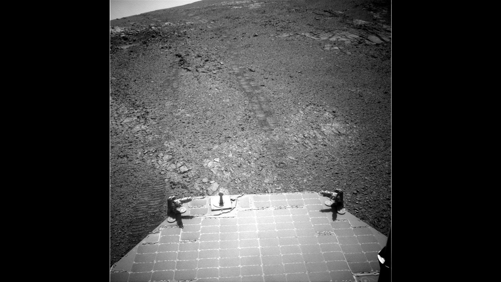
The rover team calls this the “Sprained Ankle” panorama because the images were collected during a driving moratorium while engineers diagnosed a temporary steering stall with one front wheel pointed outward more than 30 degrees. The team was able to straighten the wheel to point straight ahead, and then resumed driving.
Credit: NASA/JPL-Caltech/Cornell/Arizona State Univ.
“It is a tantalizing scene,” said Opportunity Deputy Principal Investigator Ray Arvidson of Washington University in St. Louis. “You can see what appear to be channels lined by boulders, and the putative spillway at the top of Perseverance Valley. We have not ruled out any of the possibilities of water, ice, or wind being responsible.”
Opportunity’s panoramic camera (Pancam) took the component images of the scene during a two-week driving moratorium in June 2017 while rover engineers diagnosed a temporary stall in the left-front wheel’s steering actuator. The wheel was pointed outward more than 30 degrees, prompting the team to call the resulting vista Pancam’s “Sprained Ankle” panorama. Both ends of the scene show portions of Endeavour Crater’s western rim, extending north and south, and the center of the scene shows terrain just outside the crater.
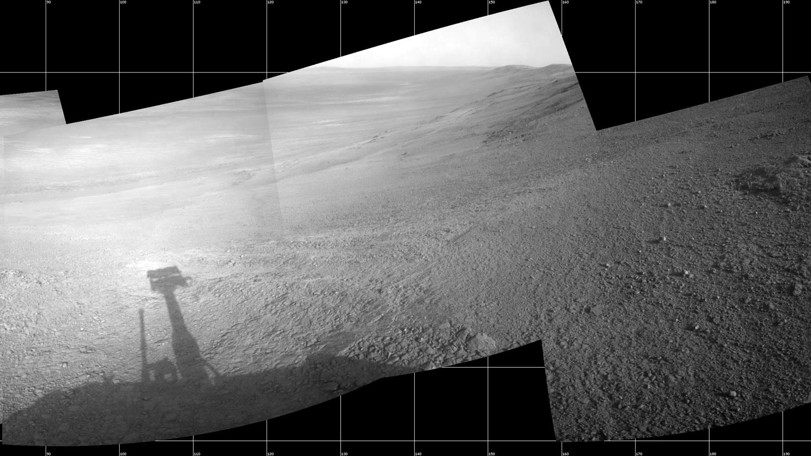
The team was able to straighten the wheel to point straight ahead, and now uses the steering capability of only the two rear wheels. The right-front wheel’s steering actuator has been disabled since 2006. Opportunity has driven 27.95 miles (44.97 kilometers) since landing on Mars in 2004.
On July 7, 2017, Opportunity drove to the site within upper Perseverance Valley where it will spend about three weeks without driving while Mars passes nearly behind the sun from Earth’s perspective, affecting radio communications. The rover’s current location is just out of sight in the Sprained Ankle panorama, below the possible spillway. Opportunity is using Pancam to record another grand view from this location.
After full communications resume in early August, the team plans to drive Opportunity farther down Perseverance Valley, seeking to learn more about the process that carved it.
Never miss a breakthrough: Join the SciTechDaily newsletter.
Follow us on Google and Google News.