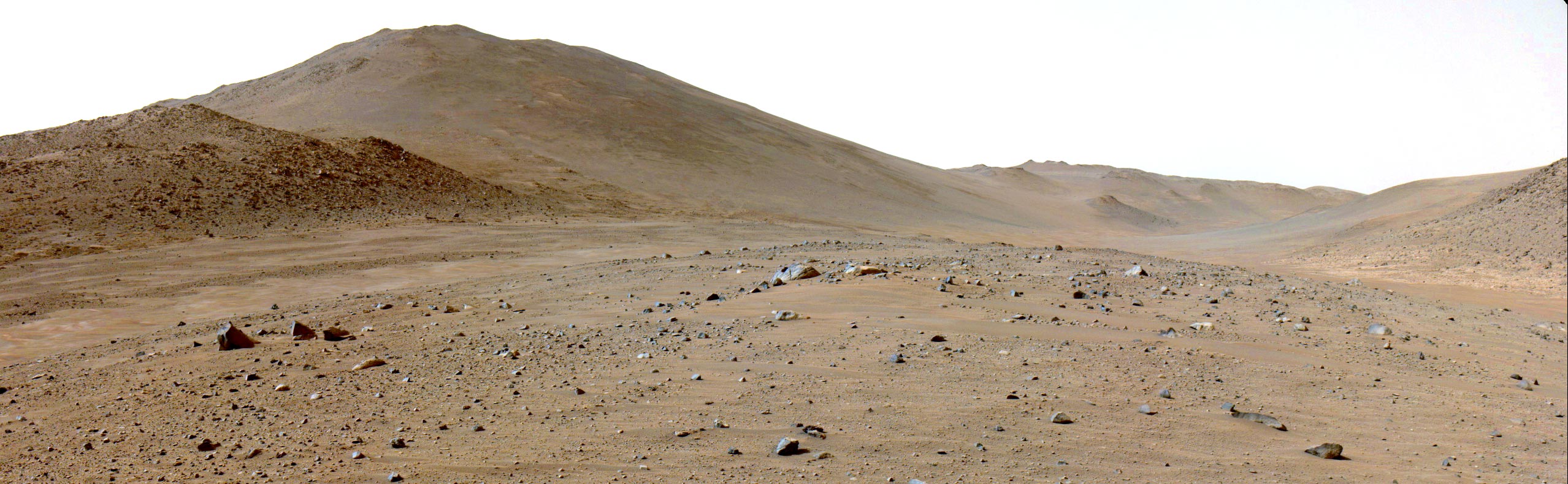
Perseverance rover reached the “Bright Angel” site on Mars by navigating through a dune field, bypassing large boulders. The rover is now investigating this area’s unique geological features to understand Mars’s past environmental conditions and support future human exploration. Credit: NASA/JPL-Caltech
Originally thought of as little more than a route clear of rover-slowing boulders, Neretva Vallis has provided a bounty of geologic options for the science team.
After detouring through a dune field to avoid wheel-rattling boulders, NASA’s Perseverance Mars rover reached its latest area of scientific interest on June 9. The route change not only shortened the estimated drive time to reach that area — nicknamed “Bright Angel” — by several weeks, but also gave the science team an opportunity to find exciting geologic features in an ancient river channel.
Perseverance is in the later stages of its fourth science campaign, looking for evidence of carbonate and olivine deposits in the “Margin Unit,” an area along the inside of Jezero Crater’s rim. Located at the base of the northern channel wall, Bright Angel features rocky light-toned outcrops that may represent either ancient rock exposed by river erosion or sediments that filled the channel. The team hopes to find rocks different from those in the carbonate-and-olivine-rich Margin Unit and gather more clues about Jezero’s history.
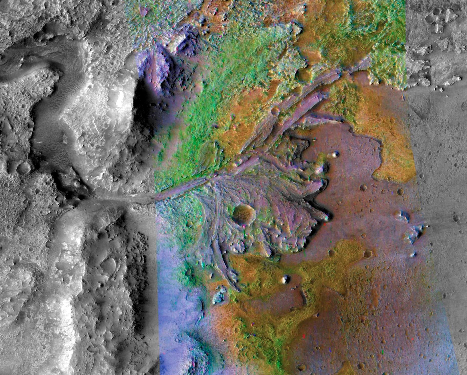
This image of Mars’ Jezero Crater is overlaid with mineral data detected from orbit. The green color represents carbonates – minerals that form in watery environments with conditions that might be favorable for preserving signs of ancient life. NASA’s Perseverance is currently exploring the green area above Jezero’s fan (center). Credit: NASA/JPL-Caltech/MSSS/JHU-APL
To get to Bright Angel, the rover drove on a ridge along the Neretva Vallis river channel, which billions of years ago carried a large amount of the water that flowed into Jezero Crater. “We started paralleling the channel in late January and were making pretty good progress, but then the boulders became bigger and more numerous,” said Evan Graser, Perseverance’s deputy strategic route planner lead at NASA’s Jet Propulsion Laboratory in Southern California. “What had been drives averaging over a hundred meters per Martian day went down to only tens of meters. It was frustrating.”
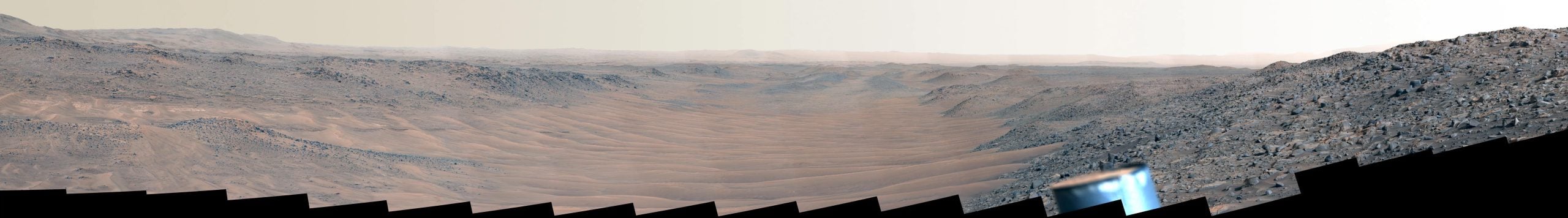
Perseverance captured this mosaic looking downstream of the dune-filled Neretva Vallis river channel on May 17. The channel fed Jezero Crater with fresh water billions of years ago. Credit: NASA/JPL-Caltech/ASU/MSSS
Channel Surfing
In rough terrain, Evan and his team use rover imagery to plan drives of about 100 feet (30 meters) at a time. To go farther on any given Martian day, or sol, planners rely on Perseverance’s auto-navigation, or AutoNav, system to take over. But as the rocks became more plentiful, AutoNav would, more times than not, determine the going was not to its liking and stop, dimming the prospects of a timely arrival at Bright Angel. The team held out hope, however, knowing they might find success cutting across a quarter-mile (400-meter) dune field in the river channel.
“We had been eyeing the river channel just to the north as we went, hoping to find a section where the dunes were small and far enough apart for a rover to pass between — because dunes have been known to eat Mars rovers,” said Graser. “Perseverance also needed an entrance ramp we could safely travel down. When the imagery showed both, we made a beeline for it.”
The Perseverance science team was also eager to travel through the ancient river channel because they wanted to investigate ancient Martian river processes.
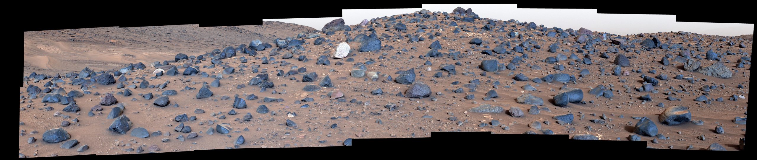
Stitched together from 18 images taken by NASA’s Perseverance rover, this mosaic shows a boulder field on “Mount Washburn” on May 27. Intrigued by the diversity of textures and chemical composition in the light-toned boulder at center, the rover’s science team nicknamed the rock “Atoko Point.” Credit: NASA/JPL-Caltech/ASU/MSSS
Rock Star
With AutoNav helping guide the way on the channel floor, Perseverance covered the 656 feet (200 meters) to the first science stop in one sol. The target: “Mount Washburn,” a hill covered with intriguing boulders, some of a type never observed before on Mars.
“The diversity of textures and compositions at Mount Washburn was an exciting discovery for the team, as these rocks represent a grab bag of geologic gifts brought down from the crater rim and potentially beyond,” said Brad Garczynski of Western Washington University in Bellingham, the co-lead of the current science campaign.“But among all these different rocks, there was one that really caught our attention.” They nicknamed it “Atoko Point.”
NASA’s Perseverance rover was traveling in the ancient Neretva Vallis river channel when it captured this view of an area of scientific interest named “Bright Angel” — the light-toned area in the distance at right — with one of its navigation cameras on June 6. Credit: NASA/JPL-Caltech
Some 18 inches (45 centimeters) wide and 14 inches (35 centimeters) tall, the speckled, light-toned boulder stands out in a field of darker ones. Analysis by Perseverance’s SuperCam and Mastcam-Z instruments indicates that the rock is composed of the minerals pyroxene and feldspar. In terms of the size, shape, and arrangement of its mineral grains and crystals — and potentially its chemical composition — Atoko Point it is in a league of its own.
Some Perseverance scientists speculate the minerals that make up Atoko Point were produced in a subsurface body of magma that is possibly exposed now on the crater rim. Others on the team wonder if the boulder had been created far beyond the walls of Jezero and transported there by the swift Martian waters eons ago. Either way, the team believes that while Atoko is the first of its kind they’ve seen, it won’t be the last.
After leaving Mount Washburn, the rover headed 433 feet (132 meters) north to investigate the geology of “Tuff Cliff” before making the four-sol, 1,985-foot (605-meter) journey to Bright Angel. Perseverance is currently analyzing a rocky outcrop to assess whether a rock core sample should be collected.
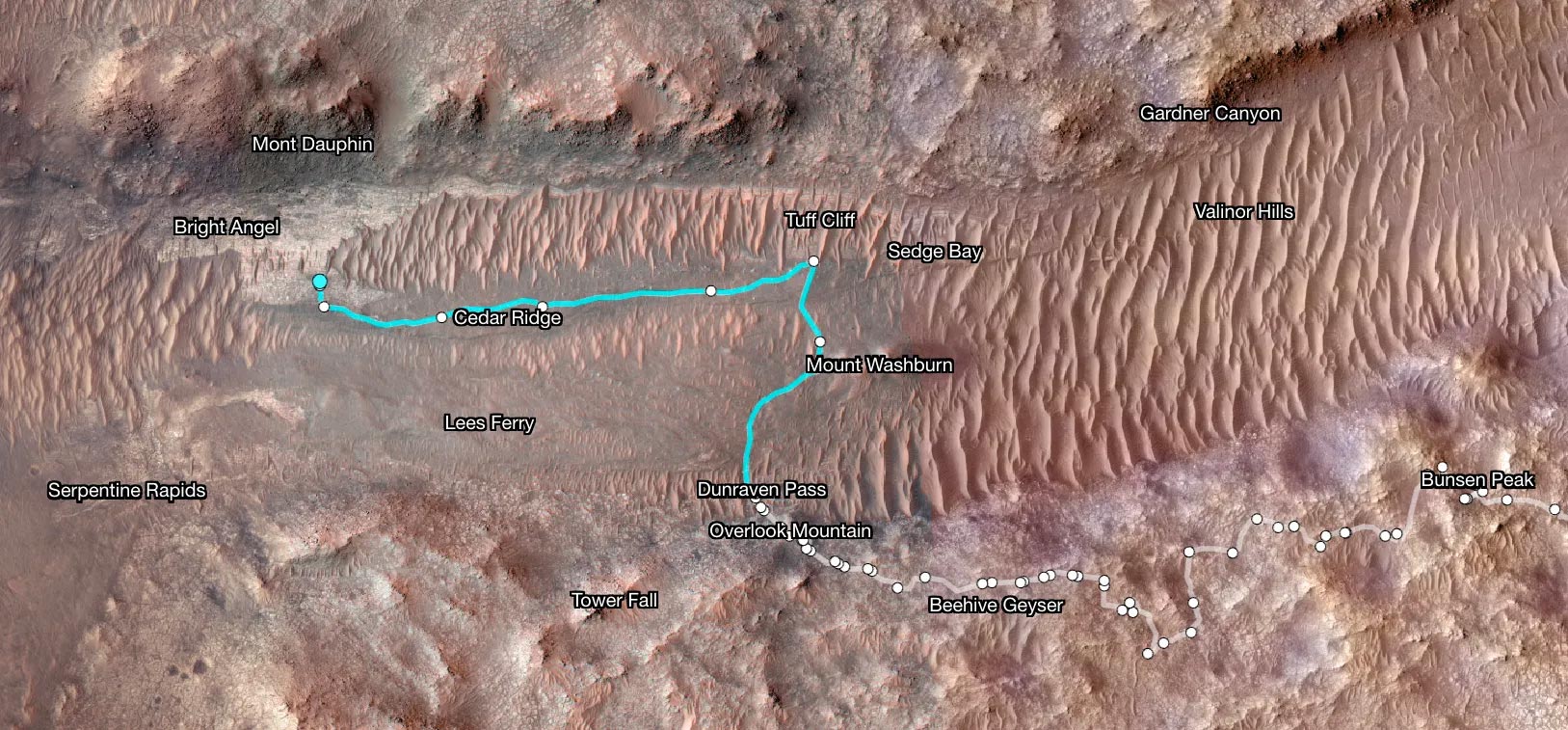
Superimposed on an image from NASA’s Mars Odyssey orbiter, this map shows Perseverance’s path between Jan. 21 and June 11. White dots indicate where the rover stopped after completing a traverse beside Neretva Vallis river channel. The pale blue line indicates the rover’s route inside the channel. Credit: NASA/JPL-Caltech/University of Arizona
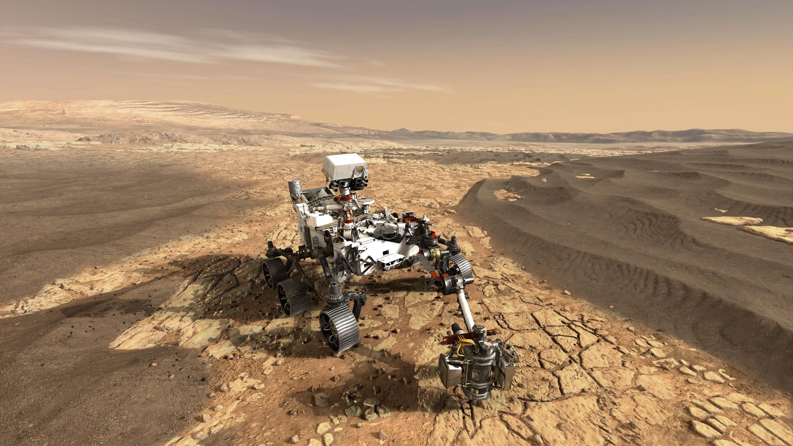
NASA’s Perseverance Mars rover
The Perseverance mission, part of NASA’s Mars 2020 program, aims to explore the surface of Mars to seek signs of ancient life, collect samples, and study Mars’ climate and geology. Launched in July 2020 and landing on Mars in February 2021 in the Jezero Crater—a site believed to have once been flooded with water—Perseverance is equipped to drill and collect soil and rock samples for possible future return to Earth.
The rover is also testing new technology that might benefit future robotic and human missions to the Red Planet. This includes the MOXIE experiment, which is designed to produce oxygen from Martian atmospheric carbon dioxide, and the Ingenuity helicopter drone, which tests powered flight in the thin Martian atmosphere.
Perseverance’s advanced suite of scientific instruments enables it to carry out its primary mission of assessing the geological framework of its landing site, determining the habitability of the environment, searching for signs of ancient microbial life, and characterizing the planet’s climate and geology. Through its explorations, the rover aims to pave the way for human exploration of Mars, contributing to NASA’s long-term goal of establishing a sustainable presence on Mars.


Be the first to comment on "NASA’s Perseverance Rover Crosses Ancient Martian River To Reach New Scientific Frontiers"