Intensified global warming has transformed Canadian High Arctic river networks over 60 years, influenced by freeze-thaw cycles and flooding patterns. New research underscores the urgent need for predictive models to forecast future Arctic environmental shifts.
New research co-led by Simon Fraser University and the University of British Columbia shows that amplified global warming in the Canadian High Arctic drove a profound shift in the structure of a river network carved into a permafrost landscape in only 60 years. Documenting a powerful interplay among climate change, the freeze-thaw dynamics of polygonal ground, and the delivery of surface water by floods as well as snow and ice melting, the team developed a new view of the physical controls governing the speed and pattern of river channel development in these fragile landscapes.
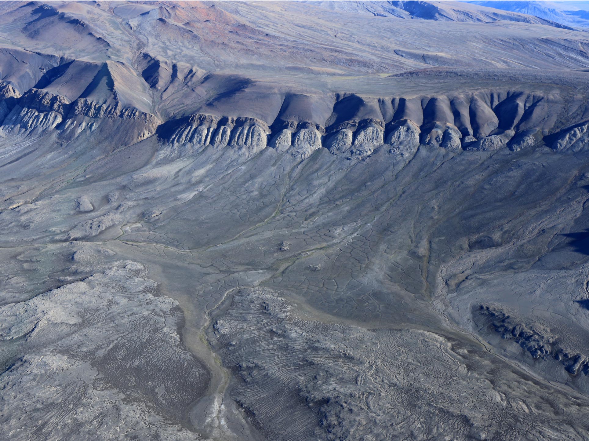
Polygonal Ground and Water Flow
“One of the key processes we identified in the evolution of stream networks is that their development is influenced by the way water flows through fields of roughly 10 meter-wide polygons, created through the freezing and thawing of the soil in Arctic regions,” says Shawn Chartrand, assistant professor in the School of Environmental Science at Simon Fraser University, and lead author of the research published today (September 12) in the journal Nature Communications.
“This influence is also affected by the timing, magnitude, and duration of flood events, as well as whether the underlying sediment particle substrates are frozen, or partially frozen.”
Research Methodology and Landscape Evolution
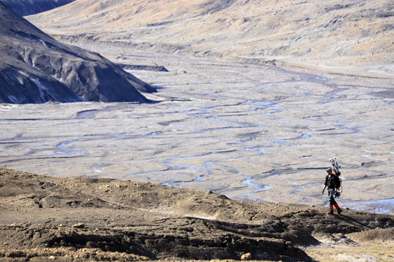
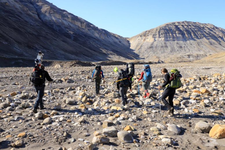
Chartrand is part of an international research team that arrived at the uninhabited island of Axel Heiberg at the start of one of the most intense summer warming events ever recorded. Their field research focused on the island’s Muskox Valley, east of the Muller Ice Cap. Researchers combined air photographs from 1959 with field observations and state-of-the-art Light Detection and Ranging (LiDAR) data they collected in 2019 to understand how the Axel Heiberg Island landscape has evolved over a 60-year period.
The Ripple Effects of Warming
“Interconnected physical processes can deepen river channels and expand river networks, creating more surface area for heat exchange, which can increase local rates of permafrost thaw,” says study co-author Mark Jellinek, professor of Earth, Ocean and Atmospheric Sciences at the University of British Columbia. “These cascading effects can enhance the release of greenhouse gases in the Arctic as organic soil carbon thaws and the permafrost retreats.”
Using the LiDAR data, the team produced a Digital Elevation Model (DEM) of a 400-meter section of the valley. “Through modeling of how water moves through the landscape, we found that flood waters routed through interconnected polygon troughs enhances the likelihood of erosion and channel development,” says Chartrand.
Influence of Temperature on Flooding
Flooding from the valley lake, and seasonal melt of the snowpack and ground ice contributes water which coalesces down valley, setting the conditions for coarse sediment transport and the development of channel networks along the valley floor. However, the timing of flooding during peak thaw can influence how much erosion occurs. “Warming air temperatures play a role here,” he explains. “We predict that erosion and sediment transport is sensitive to whether floods occur before or after a period of elevated air temperatures, because this influences the depth to which sediment particle substrates are thawed, and thus effects whether the particles are transported by flood waters.”
Looking Ahead: Predicting Future Changes
Researchers say the challenge going forward will be to apply this data to produce predictive physical models that help to understand how Arctic river networks will evolve over future decades marked by both warming and intensifying climate variability. They point to added urgency as expanding river networks will carry greater sediment loads as well as nutrients and metals into fragile watersheds and fisheries with potentially significant consequences for coastal wildlife, waters, and populations.
Reference: “High Arctic channel incision modulated by climate change and the emergence of polygonal ground” by Shawn M. Chartrand, A. Mark Jellinek, Antero Kukko, Anna Grau Galofre, Gordon R. Osinski and Shannon Hibbard, 12 September 2023, Nature Communications.
DOI: 10.1038/s41467-023-40795-9
The research team also included scientists from the Finnish Geospatial Research Institute, Laboratoire de Planétologie et Géosciences (UMR CNRS 6112), University of Western Ontario, and the Jet Propulsion Laboratory.
Never miss a breakthrough: Join the SciTechDaily newsletter.
Follow us on Google and Google News.