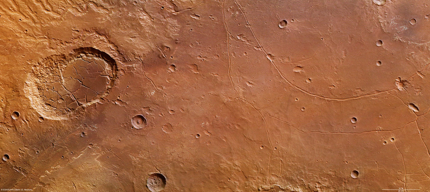
High-Resolution Stereo Camera (HRSC) nadir and color channel data taken during revolution 10602 on April 27, 2012, by ESA’s Mars Express have been combined to form a natural-color view of the Ladon Valles region. Centered at around 18°S and 329°E, this image has a ground resolution of about 20 m per pixel. The image shows the interconnected craters Sigli and Shambe, believed to have formed when a large meteorite fragmented into two pieces just before impact. Extensive fracturing can be seen within the craters. Above the craters (west), creek-like flow channels can be seen leading into the wider impact basin region to the right (north). Credit: ESA/DLR/FU Berlin (G. Neukum)
New images from the high-resolution stereo camera on ESA’s Mars Express reveal a variety of features of several impact craters and their surrounding areas on Mars.
ESA’s Mars Express has observed the southern part of a partially buried approximately 440 km (270 mi) wide crater, informally named Ladon basin.
The images, near to where Ladon Valles enters this large impact region reveal a variety of features, most notably the double interconnected impact craters Sigli and Shambe, the basins of which are crisscrossed by extensive fracturing.
This region, imaged on April 27 by the high-resolution stereo camera on Mars Express is of great interest to scientists since it shows significant signs of ancient lakes and rivers.
Both Holden and Eberswalde Craters were on the final shortlist of four candidate landing sites for NASA’s Mars Science Laboratory, which is due now to land in Gale Crater on August 6.
Large-scale overview maps show clear evidence that vast volumes of water once flowed from the southern highlands. This water carved Ladon Valles, eventually flowing into Ladon basin, an ancient large impact region.
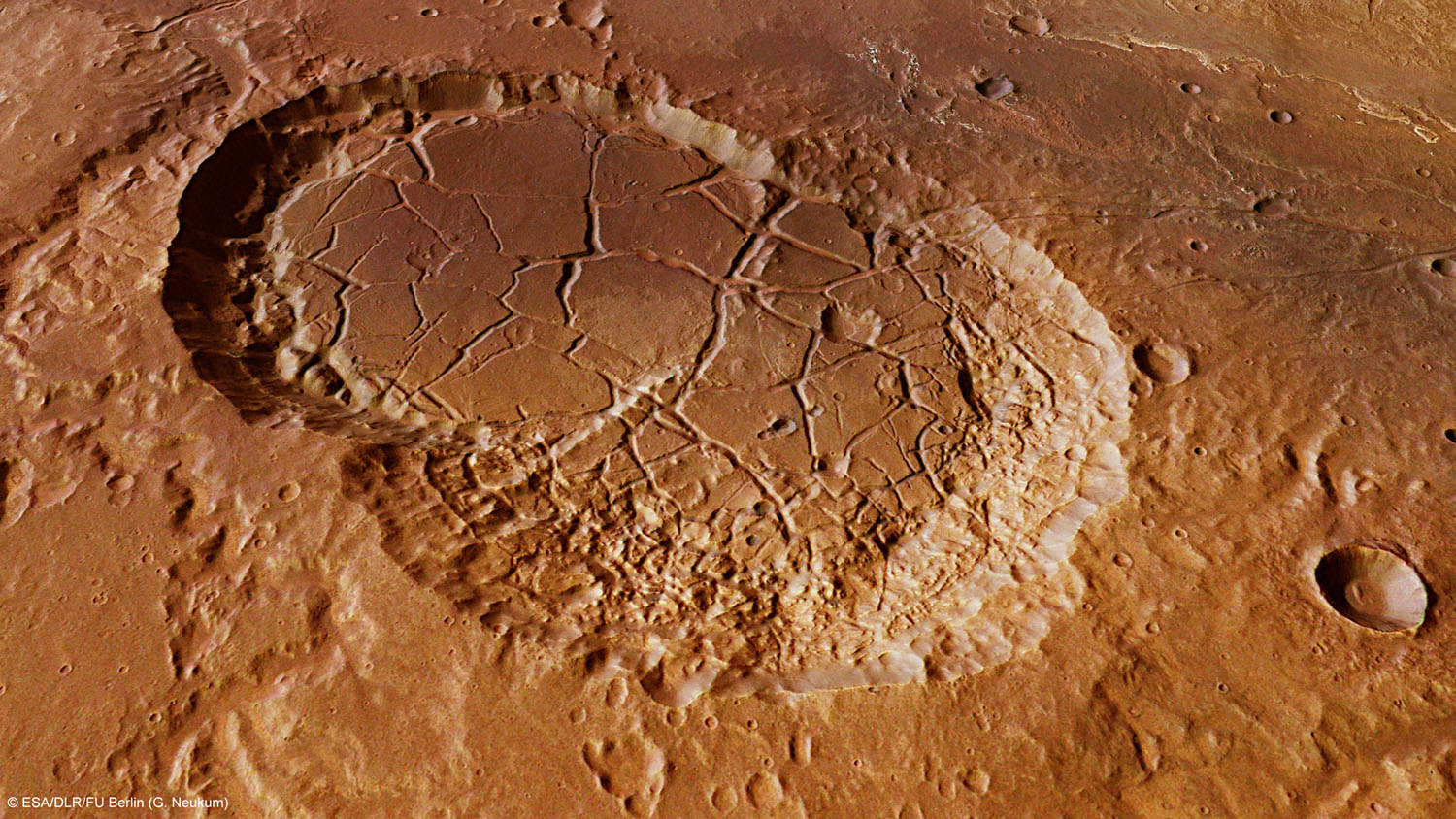
This computer-generated perspective view was created using data obtained from the High-Resolution Stereo Camera (HRSC) on ESA’s Mars Express. Centered at around 18°S and 329°E, this image has a ground resolution of about 20 m per pixel. Sigli and Shambe dominate this image, which highlights the deep fracturing within the crater walls. The shape of the craters leads scientists to believe they were formed from the same impactor, which fragmented into two pieces just before hitting Mars. Credit: ESA/DLR/FU Berlin (G. Neukum)
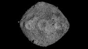
Elliptical craters like this 16 km-wide (10 mi-wide) example are formed when asteroids or comets strike the surface of the planet at a shallow angle.
Scientists have suggested that a fluidized ejecta pattern indicates the presence of subsurface ice that melted during the impact. Subsequent impacts have created a number of smaller craters in the ejecta blanket.
The interconnected craters Sigli and Shambe are thought to have formed later when an incoming projectile split into two pieces just before impact. The joined craters were then partly filled with sediments at some later epoch.
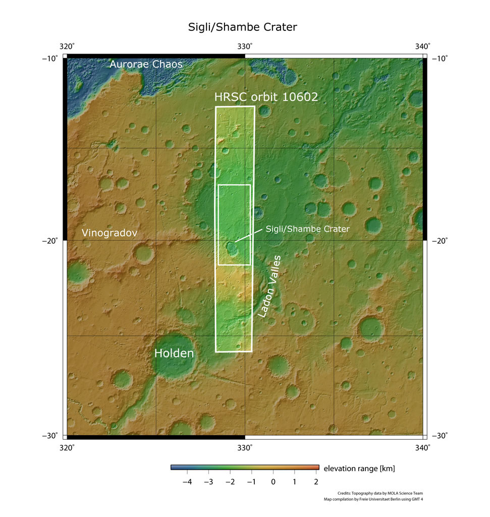
Ladon basin is seen here in a broader context. The smaller rectangle shows the region covered in this ESA Mars Express HRSC image release. Ladon Valles, which flows into Ladon basin, is north of the well-known craters Holden and Eberswalde, which were potential landing-site candidates for NASA’s Mars Science Laboratory. Credit: NASA MGS MOLA Science Team
Deep fractures can be seen within the craters whilst in the central and right part of the image, smaller craters and more subtle curved fractures appear. These fractures on the basin floor extend beyond the image borders and form concentric patterns. The fractures are believed to have evolved by compaction of the huge sediment loads deposited within the impact basin.
The outflow of Ladon Valles into Ladon basin is located towards the east of Sigli and Shambe Craters, towards the bottom of this image. Here, and in several other parts of the image, lighter-toned layered deposits can be seen. Researchers have detected clay minerals within these deposits, suggesting a relatively long-lasting presence of liquid water in the region’s past.
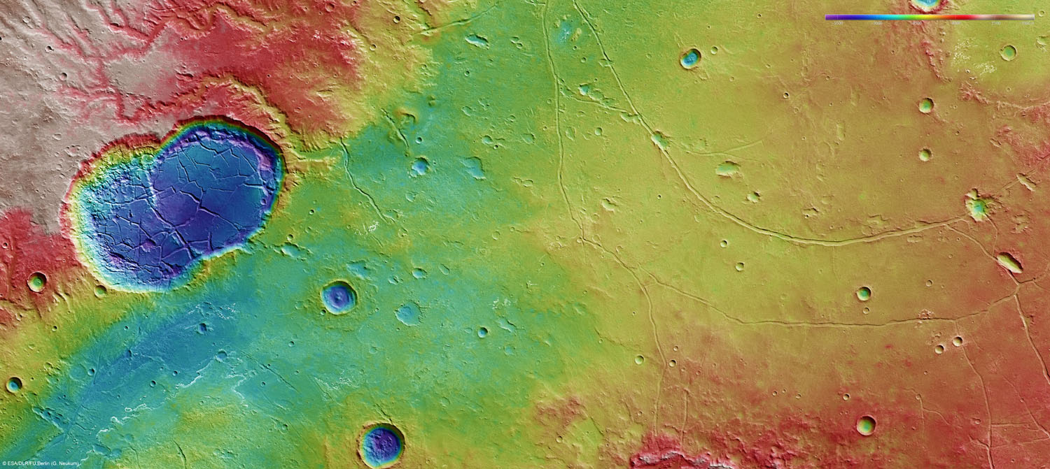
This color-coded plan view is based on a digital terrain model of the region, from which the topography of the landscape can be derived. The color coding brings into stark relief the fracturing inside Sigli and Shambe and the winding flow channels above (west) of the craters leading into the relatively flat impact basin. Centered at around 18°S and 329°E, the image has a ground resolution of about 20 m per pixel. Credit: ESA/DLR/FU Berlin (G. Neukum)
In addition, winding, valley-like dendritic structures running into the larger basin can be seen above Sigli and Shambe Craters, running into the larger impact basin, again indicating flowing water at some distant epoch.


Be the first to comment on "Images From ESA’s Mars Express Reveals the Features of Ladon Basin"