
Close Menu
    Facebook X (Twitter) Instagram
    SciTechDaily
    • Biology
    • Chemistry
    • Earth
    • Health
    • Physics
    • Science
    • Space
    • Technology
    Facebook X (Twitter) Pinterest YouTube RSS
    SciTechDaily
    Home»Earth»NASA’s SWOT Satellite Reveals the Depths of California’s Weather Woes
    Earth

    NASA’s SWOT Satellite Reveals the Depths of California’s Weather Woes

    By Jane Lee, NASA Jet Propulsion LaboratoryMarch 8, 2024No Comments3 Mins Read
    Facebook Twitter Pinterest Telegram LinkedIn WhatsApp Email Reddit
    Share
    Facebook Twitter LinkedIn Pinterest Telegram Email Reddit
    SWOT Observes Coastal California Flooding February 2024
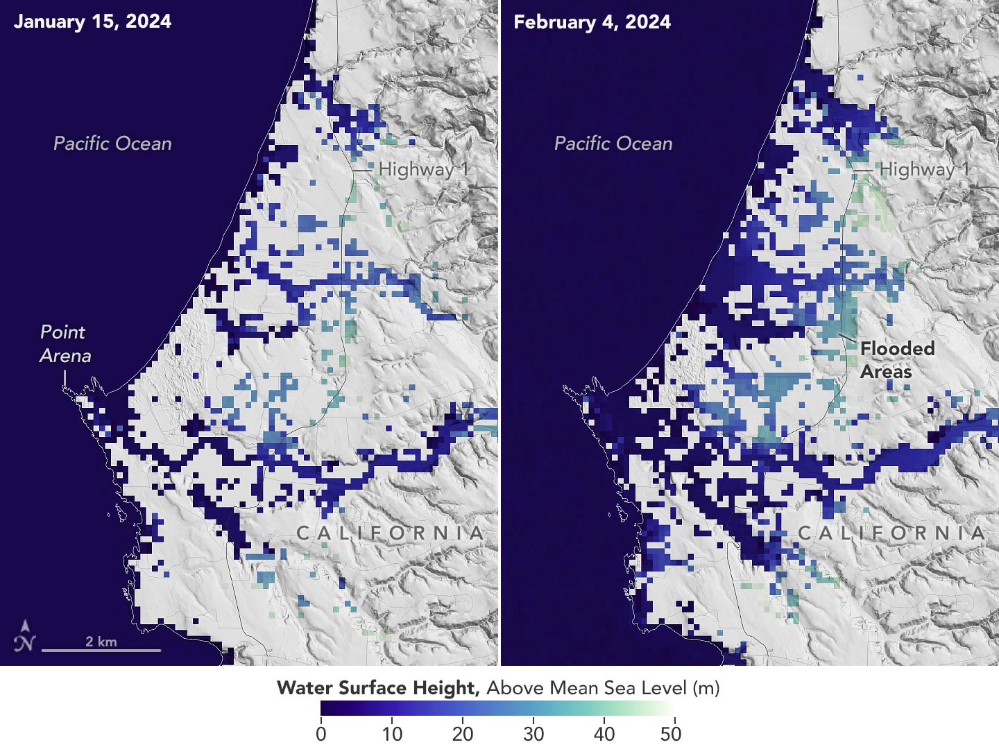
    This image shows SWOT satellite data for water surface height in part of Mendocino County, Northern California, on January 15, before several atmospheric rivers arrived, and on Feb. 4, after the first storms. Light blue and green indicate the highest water levels relative to mean sea level. (Inland water heights include the underlying ground elevation.) Credit: NASA/JPL-Caltech

    The Surface Water and Ocean Topography satellite provides a new view of water on land, at the coast, and in the ocean.

    A series of atmospheric rivers drenched California in February, with record amounts of rainfall and hurricane-force winds sweeping across parts of the state. At one point, weather agencies posted flood watches for nearly the entirety of California’s coast. The SWOT (Surface Water and Ocean Topography) mission captured data on some of the flooding near the community of Manchester, roughly 105 miles (169 kilometers) north of San Francisco. The satellite is a collaboration between NASA and the French space agency, CNES (Centre National d‘Études Spatiales).

    Satellite Observations of Water Levels

    This image shows the area on January 15, 2024, before the rain and snow from atmospheric rivers, and then again on February 4, after the first in a series of storms soaked California. Water heights are shown in shades of green and blue, with lighter hues indicating the highest levels relative to mean sea level. (Data for inland areas includes the height of the floodwaters plus the ground elevation beneath it.) Some coastal areas were flooded by both ocean tides and heavy rain, while others were likely flooded only by precipitation. Each pixel in the image represents an area that is 330 feet by 330 feet (100 meters by 100 meters).
    SWOT Satellite in Earth Orbit
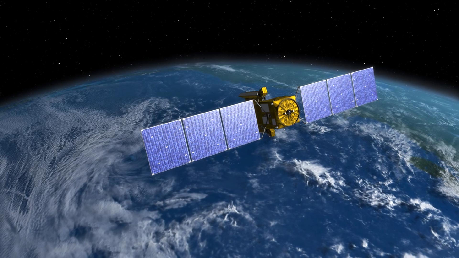
    Designed to make the first-ever global survey of Earth’s surface water, the Surface Water and Ocean Topography, or SWOT, satellite will collect detailed measurements of how water bodies on Earth change over time. Credit: NASA/JPL-Caltech

    SWOT’s Contribution to Water Monitoring

    Since December 2022, SWOT has been measuring the height of nearly all water on Earth’s surface, developing one of the most detailed, comprehensive views yet of the planet’s ocean and freshwater lakes and rivers. Not only can the satellite detect the extent of the water on Earth’s surface, as other satellites can, but SWOT can also provide water level data. Combined with other types of information, SWOT measurements can yield water depth data in features like lakes and rivers.

    “SWOT gives us information about flooding that we’ve never had before,” said Ben Hamlington, lead researcher for NASA’s sea level change team at the agency’s Jet Propulsion Laboratory in Southern California. Satellites can provide pictures showing how much of an area is flooded, but unless instruments are already installed on a river or at the coast, it’s difficult to know how conditions evolve during and after a flood. “Data from the SWOT satellite, combined with other information, is filling in this picture,” said Hamlington.

    The SWOT science team made the measurements using the KaRIn (Ka-band Radar Interferometer) instrument. With two antennas spread 33 feet (10 meters) apart on a boom, KaRIn produces a pair of data swaths as it circles the globe, bouncing radar pulses off water surfaces to collect surface-height measurements.

    NASA Earth Observatory image by Lauren Dauphin, using SWOT data provided by Benjamin Hamlington and courtesy of the SWOT science team.

    Never miss a breakthrough: Join the SciTechDaily newsletter.
    Follow us on Google and Google News.

    JPL NASA NASA Earth Observatory SWOT Weather
    Share. Facebook Twitter Pinterest LinkedIn Email Reddit

    Related Articles

    NASA’s Satellite Just Uncovered 100,000 Hidden Mountains Beneath the Ocean

    Mapping Earth’s Waterways From Space: How SWOT Transforms Flood Forecasting

    NASA Unveils Secrets of Death Valley’s Temporary Lake

    After Two Years of Drought Ends, Southeastern Australia Turns Green

    “Wedge Failure” Landslide in Alaska

    Muddy Flooding After Catastrophic Dam Failures in Michigan Seen From Space

    Scientists Concerned As Denman Glacier Retreats Both Above and Below the Water Line

    NASA Satellites View Super Typhoon Haiyan

    NASA Satellite Image Shows La Niña Peaking in Intensity

    Leave A Reply Cancel Reply

    • Facebook
    • Twitter
    • Pinterest
    • YouTube

    Don't Miss a Discovery

    Subscribe for the Latest in Science & Tech!

    Trending News

    Surgeons Warn: Don’t Ignore These Colorectal Cancer Symptoms, No Matter Your Age

    Scientists Unlock Hidden DNA From 1,300-Year-Old Manuscripts

    Scientists Discover Ultrasound May Stop Arthritis Before It Starts

    Scientists Discover Why the Same Volcano Erupted in Two Completely Different Ways

    Scientists Challenge a Fundamental Assumption About Consciousness

    A Giant Scorpion the Size of a Coffee Table Is Forcing Scientists To Rethink Evolution

    Hidden Virus May Have Infected 9.4 Million People – Scientists Say We’ve Missed Most Cases

    NASA Moon Base Could Become Earth’s First Defense Against Alien Microbes

    Follow SciTechDaily
    • Facebook
    • Twitter
    • YouTube
    • Pinterest
    • Newsletter
    • RSS
    SciTech News
    • Biology News
    • Chemistry News
    • Earth News
    • Health News
    • Physics News
    • Science News
    • Space News
    • Technology News
    Recent Posts
    • James Webb Uncovers the Atmosphere of a Hellish Lava World 41 Light-Years Away
    • Scientists Warn: Colorectal Cancer Is Rising Fast in Younger Adults, Reversing Decades of Progress
    • Could We Have Been Wrong About Fish Oil and Brain Health? New Study Raises Major Questions
    • Scientists Say Intermittent Fasting Could Make Weight Loss Easier
    • An Underground Mystery Had Engineers Stumped Until They Followed the Rain
    Copyright © 1998 - 2026 SciTechDaily. All Rights Reserved.
    • Science News
    • About
    • Contact
    • Editorial Board
    • Privacy Policy
    • Terms of Use

    Type above and press Enter to search. Press Esc to cancel.