Close Menu
    Facebook X (Twitter) Instagram
    SciTechDaily
    • Biology
    • Chemistry
    • Earth
    • Health
    • Physics
    • Science
    • Space
    • Technology
    Facebook X (Twitter) Pinterest YouTube RSS
    SciTechDaily
    Home»Earth»After Two Years of Drought Ends, Southeastern Australia Turns Green
    Earth

    After Two Years of Drought Ends, Southeastern Australia Turns Green

    By Kasha Patel, NASA Earth ObservatoryJune 21, 2020No Comments3 Mins Read
    Facebook Twitter Pinterest Telegram LinkedIn WhatsApp Email Reddit
    Share
    Facebook Twitter LinkedIn Pinterest Telegram Email Reddit
    Southeastern Australia Turns Green
    Left: May 25, 2018. Right: June 5, 2020.

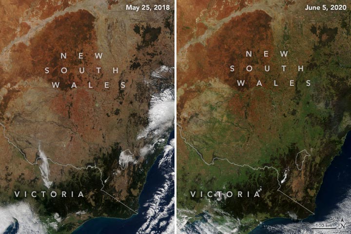
    As the 2019–2020 summer brought record heat to Australia, New South Wales appeared to be heading into its third year of severe drought. From January 2017 through October 2019, the southeast Australian state experienced its lowest amount of rainfall in nearly a century. During that time, farmlands were parched, lakes dried up, and millions of fish died.

    Southeastern Australia June 5 2020
    June 5, 2020.

    After more than 34 consecutive months of dry conditions, steady and occasionally heavy rain finally arrived in New South Wales. From January to May 2020, southeastern Australia received above-average rainfall and even broke records in Victoria. According to the Australian Bureau of Meteorology (BOM), April and May 2020 was the first period since 2016 with close to average rainfall in New South Wales and the Murray–Darling Basin. The BOM predicts the upcoming winter (June to August) will also be wetter than average for western New South Wales and parts of South Australia.

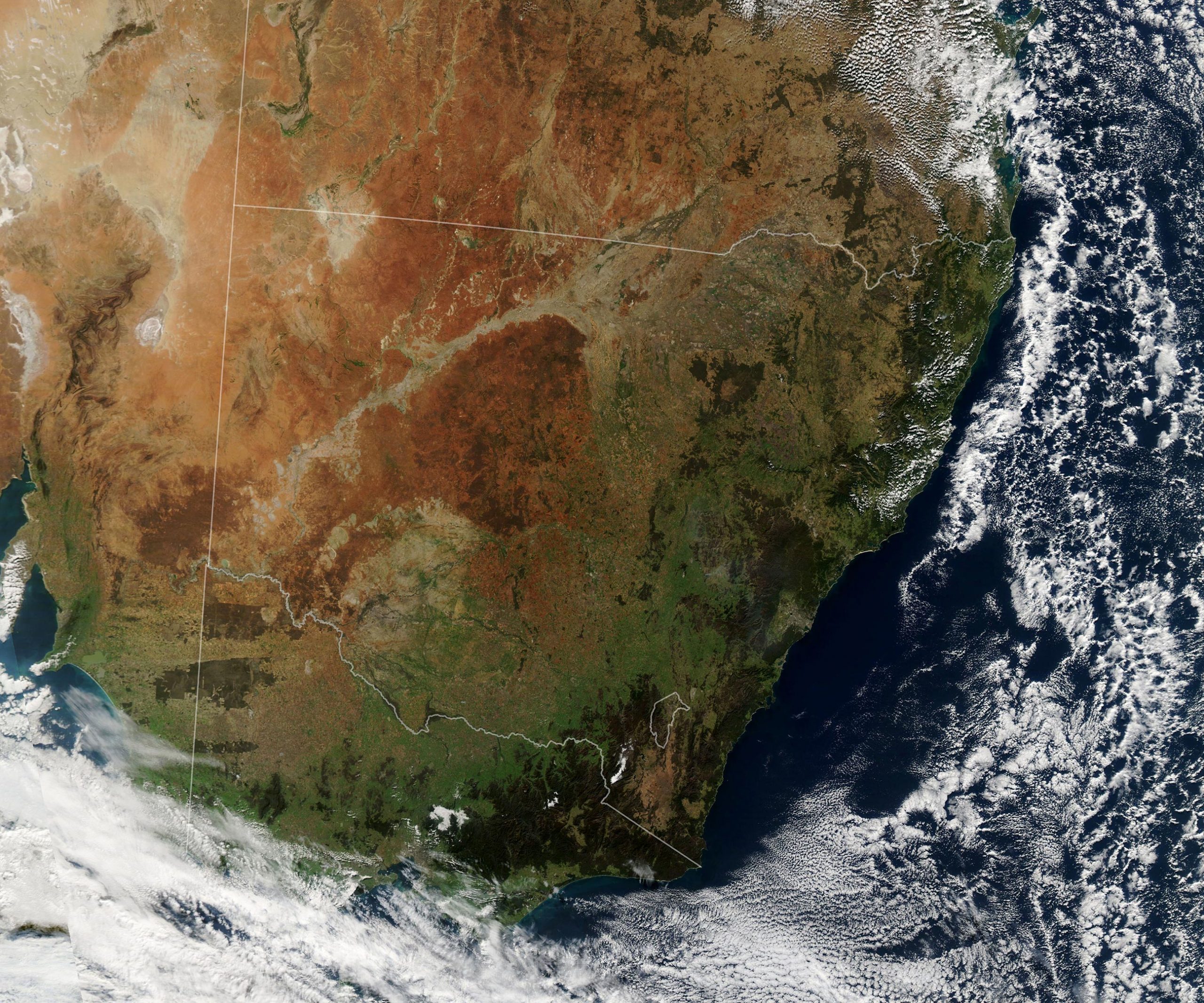
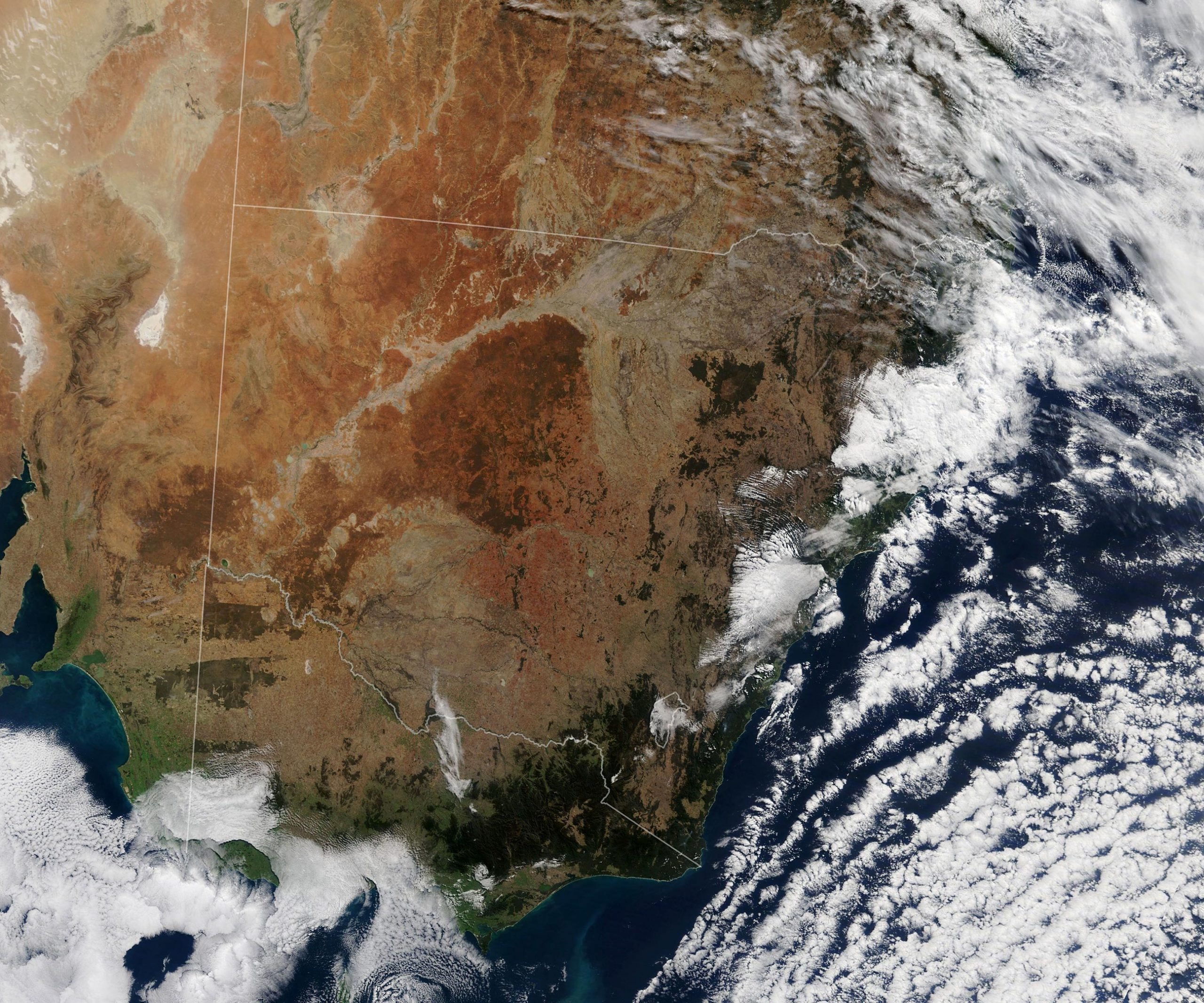
    The natural-color images above (top) show the greening of the landscape in southeastern Australia in June 2020 (right) compared to May 2018 (left). The images were acquired by the Moderate Resolution Imaging Spectroradiometer (MODIS) on NASA’s Aqua satellite.

    Southeastern Australia May 25 2018
    May 25, 2018.

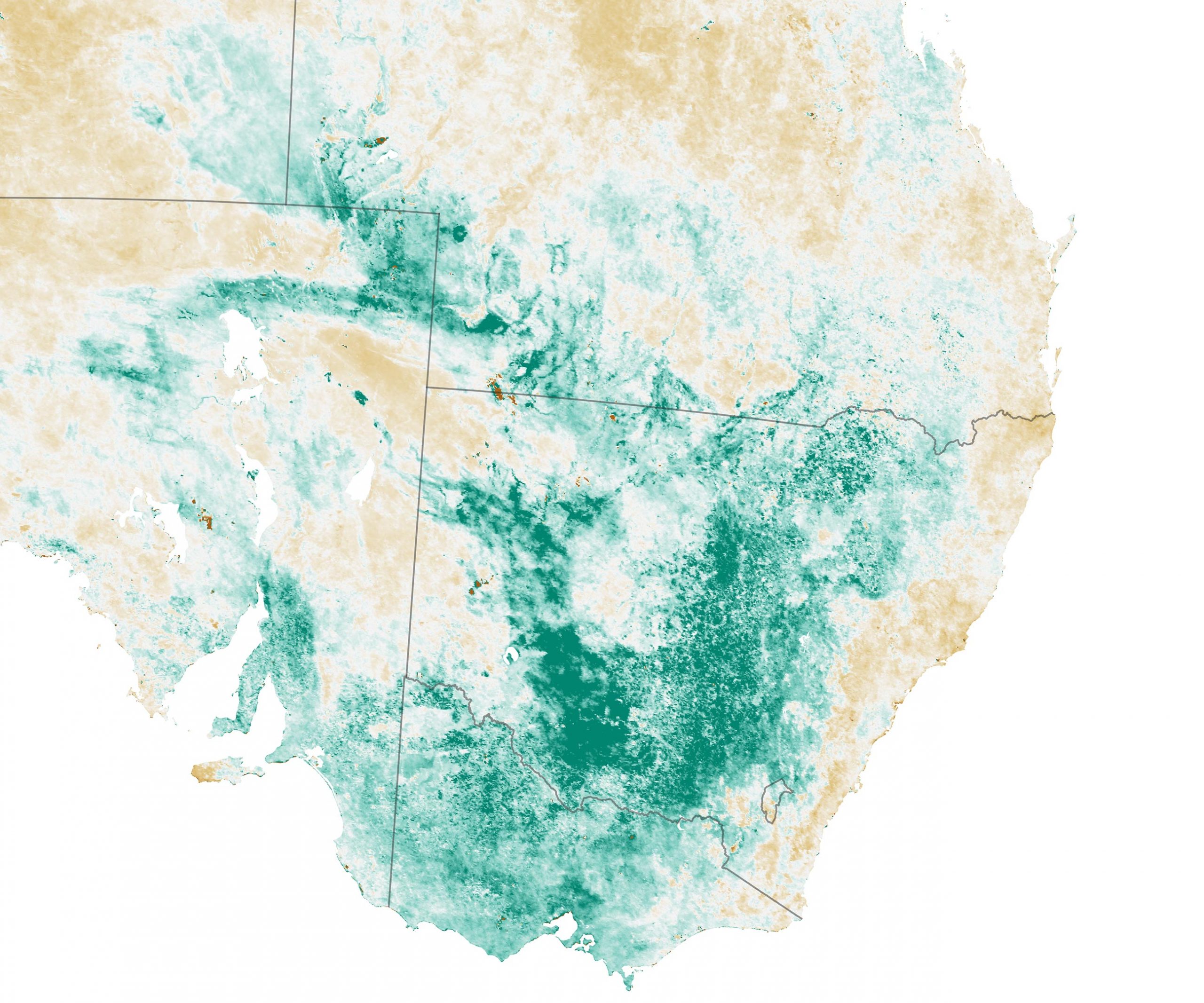
    The map below shows Normalized Difference Vegetation Index (NDVI) anomalies; NDVI is a measure of the “greenness” of vegetation. The map depicts the health and abundance of vegetation as observed from May 16 to June 14, 2020, compared to the long-term average (2000-2010) for the month. Brown areas show where plants were more stressed than normal, and greens indicate vegetation that was healthier than normal.

    Southeastern Australia NDVI Anomaly
    May 16 – June 14, 2020.

    Victoria also experienced record-breaking rain at the beginning of 2020. From January to April, Melbourne received around 400 millimeters (16 inches) of rain—nearly eight times more rainfall than last year during this time period. This is Melbourne’s wettest start of the year since 1924. The BOM predicts Victoria may experience drier than normal weather for the upcoming winter though.

    The wet start to 2020 has alleviated short-term water deficiencies in eastern Australia and helped provide a better start to the winter farming season. However, the rainfall has not yet compensated for the effects of the long-term drought, which is still evident in the Murray-Darling Basin. The recent rain has improved water flow in the area, but storage levels are still very low. The BOM stated that it will take several significant rainfall events to erase the long-term rain deficiencies across the region.

    NASA Earth Observatory images by Lauren Dauphin, using MODIS data from NASA EOSDIS/LANCE and GIBS/Worldview.

    Never miss a breakthrough: Join the SciTechDaily newsletter.
    Follow us on Google and Google News.

    NASA NASA Earth Observatory Weather
    Share. Facebook Twitter Pinterest LinkedIn Email Reddit

    Related Articles

    Excessive Rainfall in China: Three Gorges Dam and Other Yangtze River Dams Spill Water

    Brace for an Active 2020 Hurricane Season

    Incredible Rare Peek at Patagonia in Winter

    “Godzilla” Dust Cloud Described As “Amazing” by NASA Astronaut Aboard Space Station

    Satellite Maps Shows Signs of Drought in European Groundwater

    Meteorologists Shocked as Heat and Fire Scorches Siberia

    Unusual “Volcano Track” Clouds Investigated

    “Wedge Failure” Landslide in Alaska

    Muddy Flooding After Catastrophic Dam Failures in Michigan Seen From Space

    Leave A Reply Cancel Reply

    • Facebook
    • Twitter
    • Pinterest
    • YouTube

    Don't Miss a Discovery

    Subscribe for the Latest in Science & Tech!

    Trending News

    Scientists Just Discovered a Hidden Freshwater World Beneath the Great Salt Lake

    Why Your Daily Shower Could Be Worsening the Water Crisis

    Scientists Discover New “Magic Mushroom” Species That Rewrites Evolutionary History

    Mystery Deepens: Astrophysicists Say Dark Matter May Not Be One Thing

    Your BMI Might Be Wrong: Study Finds Millions Are Misclassified

    A Simple Blood Test Could Predict Dementia Risk 25 Years Early

    3.5-Billion-Year-Old Rocks Rewrite the Story of Plate Tectonics

    Why Aging Lungs Turn Mild Infections Into Life-Threatening Illness

    Follow SciTechDaily
    • Facebook
    • Twitter
    • YouTube
    • Pinterest
    • Newsletter
    • RSS
    SciTech News
    • Biology News
    • Chemistry News
    • Earth News
    • Health News
    • Physics News
    • Science News
    • Space News
    • Technology News
    Recent Posts
    • Scientists Discover How to Stop Vision Loss Before It Starts
    • Antarctica’s Ancient Ice Cycles Once Controlled Life in Distant Oceans
    • Warming Waters Are Supercharging an Invasive Predator in Alaska
    • The Mediterranean Isn’t Safe: Scientists Warn of Inevitable Tsunami
    • This Deadly Parasite Stays Invisible by Shredding Its Own Genes
    Copyright © 1998 - 2026 SciTechDaily. All Rights Reserved.
    • Science News
    • About
    • Contact
    • Editorial Board
    • Privacy Policy
    • Terms of Use

    Type above and press Enter to search. Press Esc to cancel.