New Zealand’s Whakaari/White Island, a continuously active volcano, was recently photographed by Landsat 9 during a phase of increased activity. Although only minor ash emissions have been reported, the situation is closely monitored to ensure safety as the volcano shows signs of potential escalation.
Whakaari/White Island, a partially submerged volcano in New Zealand’s Bay of Plenty, is a constantly active and occasionally explosive stratovolcano located off the coast of North Island. Its name reflects its nature: Te Puia o Whakaari, a Māori phrase meaning “dramatic volcano,” combined with White Island, a name given by British explorer James Cook in 1769 after observing its almost continuous steam emissions.
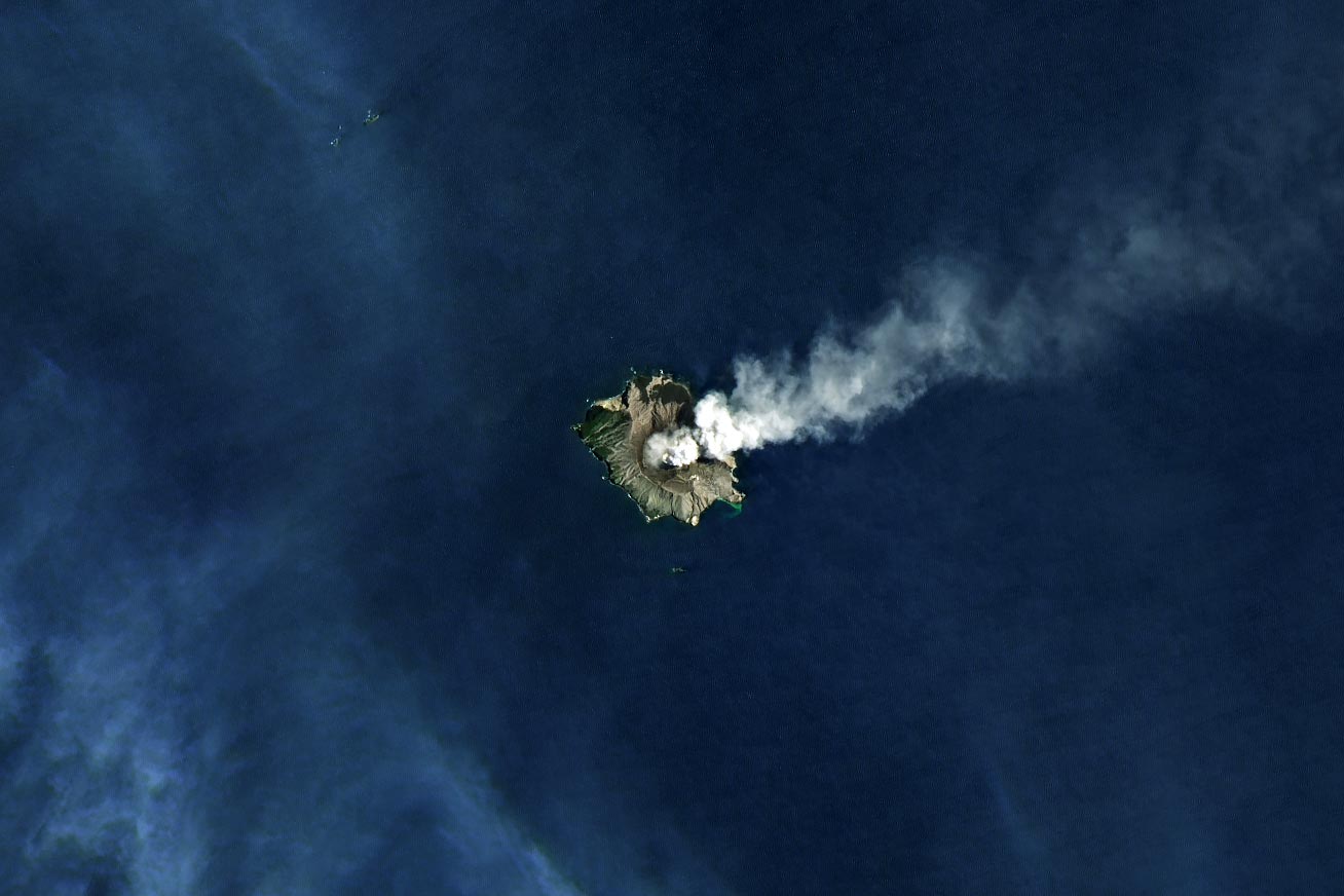
On January 7, 2025, Landsat 9’s Operational Land Imager-2 (OLI-2) acquired a striking image of Whakaari during a relatively calm phase. However, by January 13, GeoNet, New Zealand’s hazard monitoring agency, reported a period of “heightened unrest.” Over the previous two to three weeks, the volcano had been emitting weak-to-moderate steam and gas plumes along with small amounts of ash. As a result, authorities raised the aviation color code to orange, signaling a potential risk to air traffic, though prevailing winds have kept ash away from the mainland.
“Currently, this activity is not affecting air traffic as the dominant wind is blowing the ash away from the mainland and the plume is very low elevation—a few thousand feet,” said Craig Miller, a geophysicist at GNS Science. He added that while this type of passive ash emission is technically an eruption, events need to be more explosive to be classified as a minor eruption (level 3 on the regional system for Volcanic Alert Levels).
GeoNet geologists think magma is quite close to the surface based on high vent temperatures. When magma is near the surface, it becomes easier for rising gases to pull small bits of cooled magma into the plume as ash fragments, he said. Sometimes hot gases rising through the vent also cause bits of the crater wall to flake off into the plume and become an additional source of ash, he added.
NASA Earth Observatory image by Michala Garrison, using Landsat data from the U.S. Geological Survey.
Never miss a breakthrough: Join the SciTechDaily newsletter.
Follow us on Google and Google News.
1 Comment
Interesting and educational would like to see more of things like this