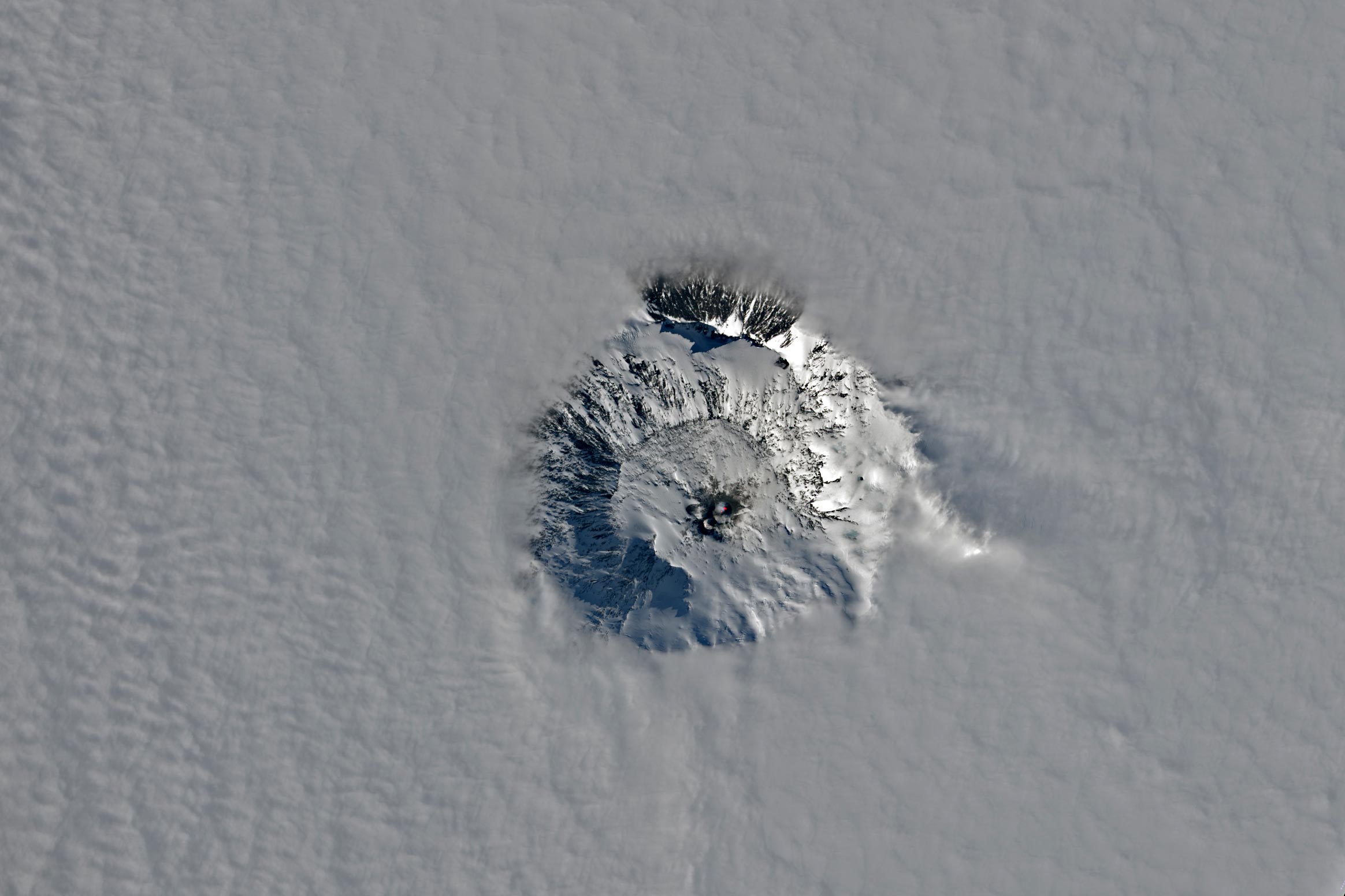
The fiery and icy upper reaches of the Antarctic volcano pierced through a canopy of clouds.
On a late spring day in 2023, the summit crater of Mount Erebus, the world’s southernmost active volcano, emerged majestically above the clouds. Captured by Landsat 9’s Operational Land Imager-2 (OLI-2), this stunning view of the stratovolcano was taken on November 25.
Geographical and Geological Significance
Mount Erebus forms part of the Ross Island volcanoes, located off the coast of West Antarctica. Standing tall at 3,794 meters (12,450 feet) above sea level, this towering presence dominates the landscape near McMurdo Station, situated only 35 kilometers (22 miles) away. The volcanic activity in this region is attributed to the rift zone where extension has caused the Earth’s crust to thin, facilitating the ascent of magma through crustal faults to the surface.
Understanding the Volcanic Phenomena
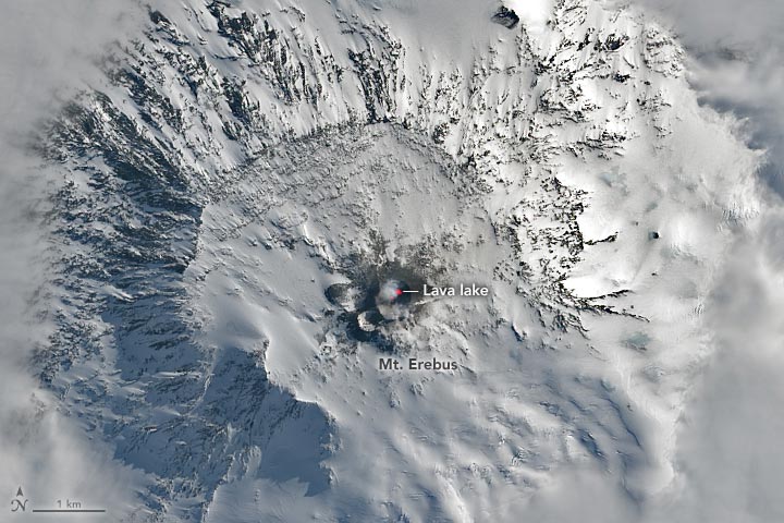
In the detailed view (above), the Landsat image includes the shortwave infrared signal (red) produced by heat from a lava lake in the summit crater. The lake has been active since at least 1972 and is one of only a few long-lived lava lakes on Earth. It constantly churns and occasionally spews bombs of molten rock in Strombolian eruptions. Geologists want to learn why an active lava lake has persisted here for so long. Recent research suggests one reason could be the magma’s low water content, which makes it less volatile as it approaches the surface.
Historical Context
Erebus was active prior to the emergence of this lava lake, including in 1841 when British Royal Navy officer James Clark Ross first sighted it during his Antarctic exploration. Mount Erebus and neighboring Mount Terror were named for warships retrofitted for use in that expedition and numerous other polar voyages.
NASA Earth Observatory images by Lauren Dauphin, using Landsat data from the U.S. Geological Survey.
Never miss a breakthrough: Join the SciTechDaily newsletter.
Follow us on Google and Google News.
4 Comments
One of many volcanoes in western Antarctica, most of which are under ice, along with many sea mounts. Yet, they are routinely dismissed as contributing anything to the melting observed there, in contrast to east Antarctica which is not melting.
Does not fit the climate change narrative. Stay on topic, we have a world to steer into submission.
They will see in time. The volcanoes have been taking it easy on us. Signs of their awakening are growing. It is a shame their influence is discounted so much. Esp in Antarctica but also in the ocean in general
Everything flows down hill with any weight to it. Things flow up hill or into the air. Things head towards the path of least resistance. Flowing down with the least resistance , could signify the weakest path of downhill. volcanos to the north have to much resistance so their pressures to the north again follow path of least resistance.. ???? Balancing on the axis of the poles could it be the force directed of it’s pressure release to keep our silly ass sore butts in a balance of existence.??