The new findings are ubiquitous, even among Earth’s northernmost glaciers.
- New study documents how Greenland’s peripheral glaciers have changed from 1890 to 2022
- Using satellite images and a unique archive of historical aerial photos, researchers compiled the most complete picture of Greenland’s outlying glaciers to date
- Researchers found glacier retreat accelerated dramatically in the 21st century
Widespread and Rapid Retreat of Greenland’s Glaciers
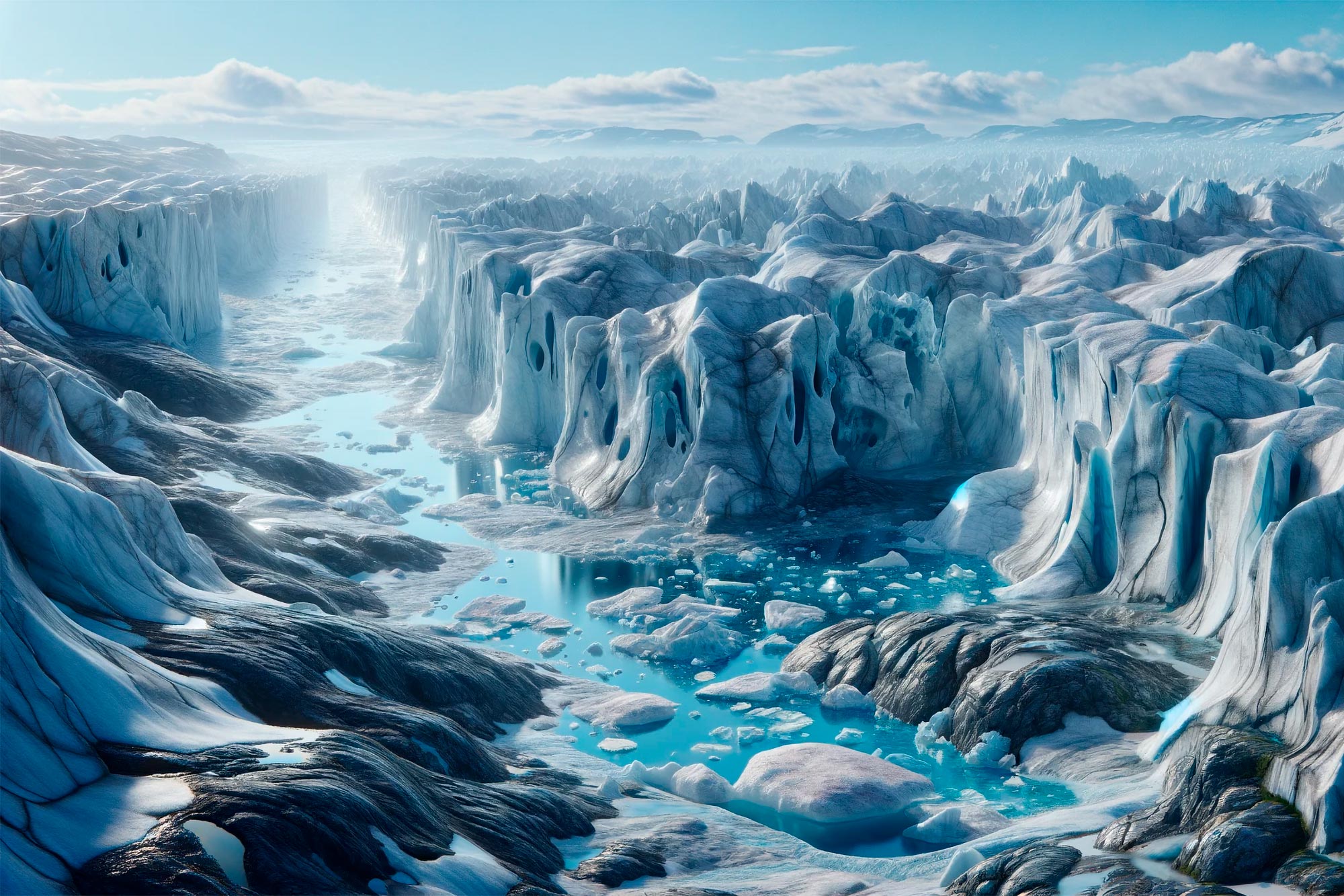
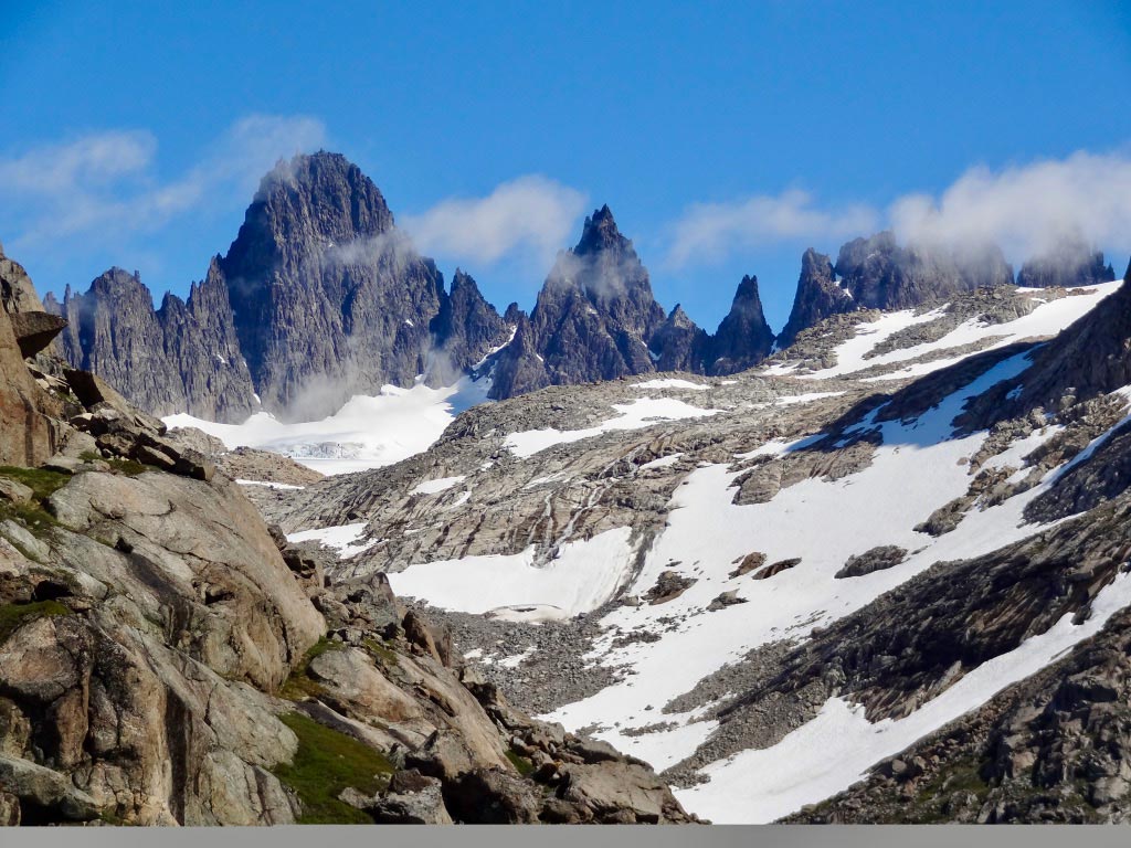
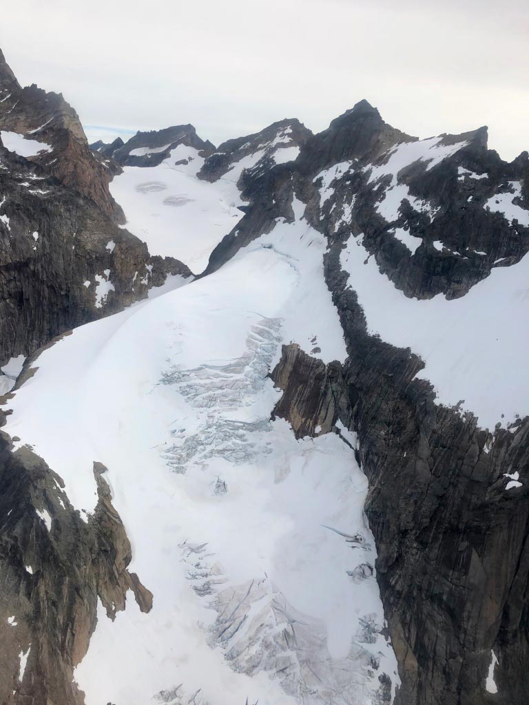
Greenland’s thousands of peripheral glaciers have entered a new and widespread state of rapid retreat, a Northwestern University and University of Copenhagen study has found.
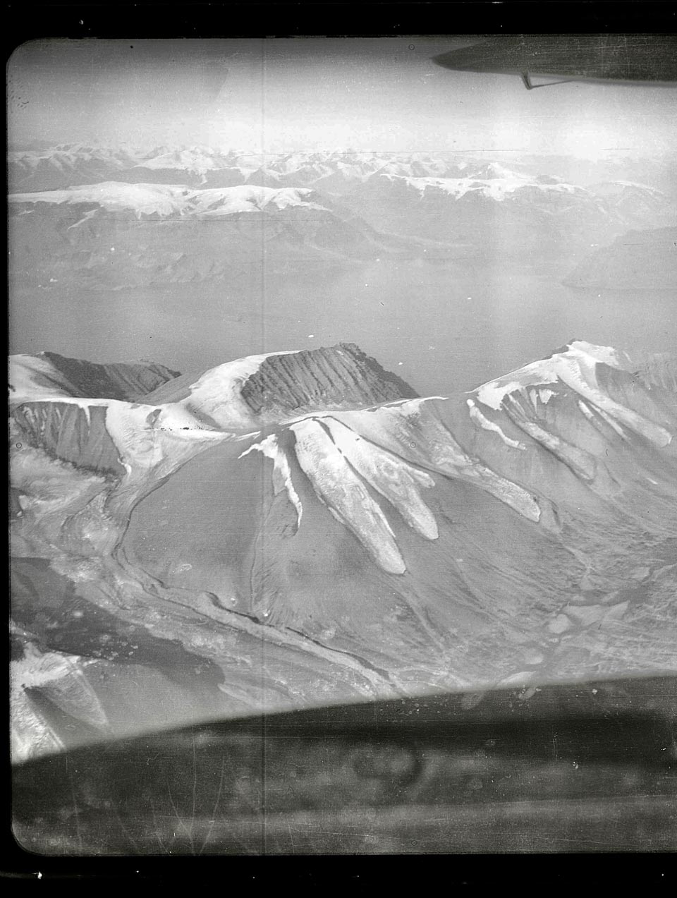
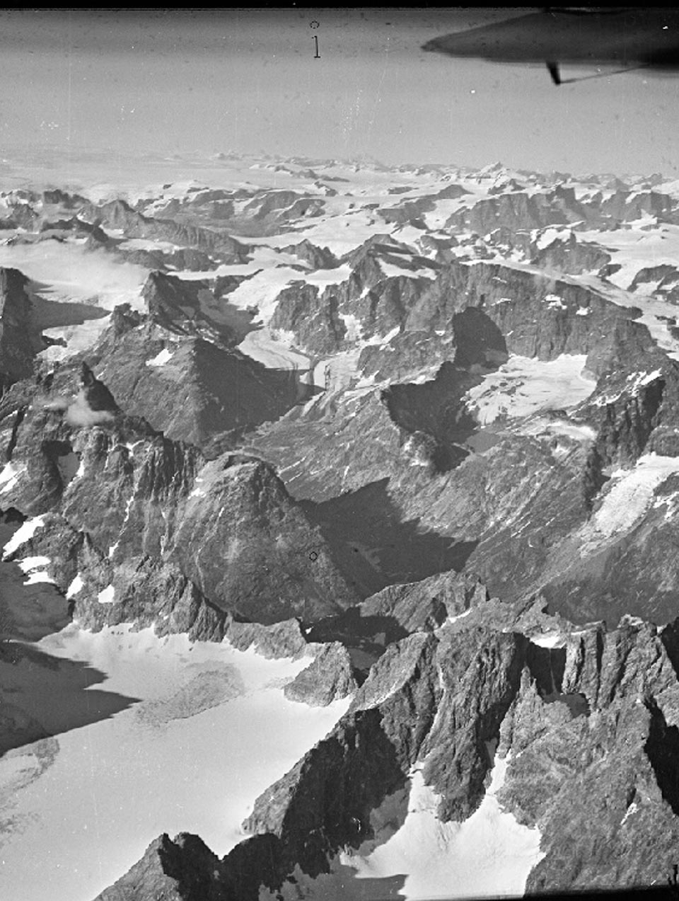
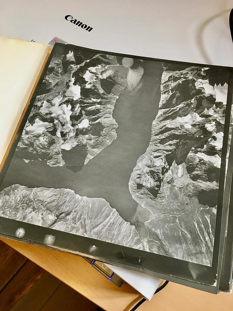
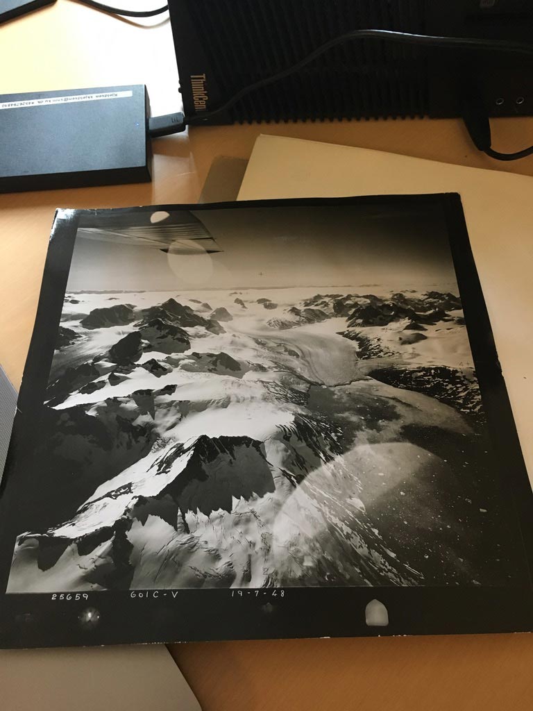
To piece together the magnitude of glacier retreat, the research team combined satellite images with historical aerial photographs of Greenland’s coastline, which is dotted with thousands of glaciers that are separate from the island’s massive central ice sheet. With these one-of-a-kind data, the researchers documented changes in the lengths of more than 1,000 of the country’s glaciers over the past 130 years.
Accelerated Retreat in the 21st Century
Although glaciers in Greenland have experienced retreat throughout the last century, the rate of their retreat has rapidly accelerated over the last two decades. According to the multiyear collaborative effort between the United States and Denmark, the rate of glacial retreat during the 21st century is twice as fast as retreat during the 20th century. And, despite the range of climates and topographical characteristics across Greenland, the findings are ubiquitous, even among Earth’s northernmost glaciers.
The findings underscore the region’s sensitivity to rising temperatures due to human-caused climate change.
The study was recently published in the journal Nature Climate Change.
“Our study places the recent retreat of peripheral glaciers across Greenland’s diverse climate zones into a century-long perspective and suggests that their rate of retreat in the 21st century is largely unprecedented on a century timescale,” said Laura Larocca, the study’s first author. “The only major possible exception are glaciers in northeast Greenland, where it looks like recent increases in snowfall might be slowing retreat.”
Importance of Slowing Global Warming
The study finds that climate change explains the accelerated glacier retreat and that glaciers across Greenland respond quickly to changing temperatures. This highlights the importance of slowing global warming.
“Our activities over the next couple of decades will greatly affect these glaciers. Every bit of temperature increase really matters,” Larocca said.
Unique Data Collection Methodology
“This work is based on vast analyses of satellite imagery and digitization of thousands of historical aerial photographs — some taken during early mapping expeditions of Greenland from open-cockpit airplanes,” said Northwestern’s Yarrow Axford, a senior author on the study. “Those old photos extend the dataset back prior to the satellite era, when widespread observations of the cryosphere are rare. It’s quite extraordinary that we can now provide long-term records for hundreds of glaciers, finally giving us an opportunity to document Greenland-wide glacier response to climate change over more than a century.”
Axford is the William Deering Professor of Geological Sciences at Northwestern’s Weinberg College of Arts and Sciences. When the research began, Larocca was a Ph.D. candidate in Axford’s laboratory. Now, Larocca is a NOAA Climate & Global Change Postdoctoral Fellow hosted at Northern Arizona University. She will join Arizona State University’s School of Ocean Futures as an assistant professor in January 2024.
Focus on Peripheral Glaciers
While climate change’s effects on Greenland are well studied, most researchers focus on the Greenland Ice Sheet, which covers roughly 80% of the country. But fluctuations in Greenland’s peripheral glaciers — the smaller ice masses distinct from the ice sheet that dot the country’s coastline — are widely undocumented, in part due to a lack of observational data.
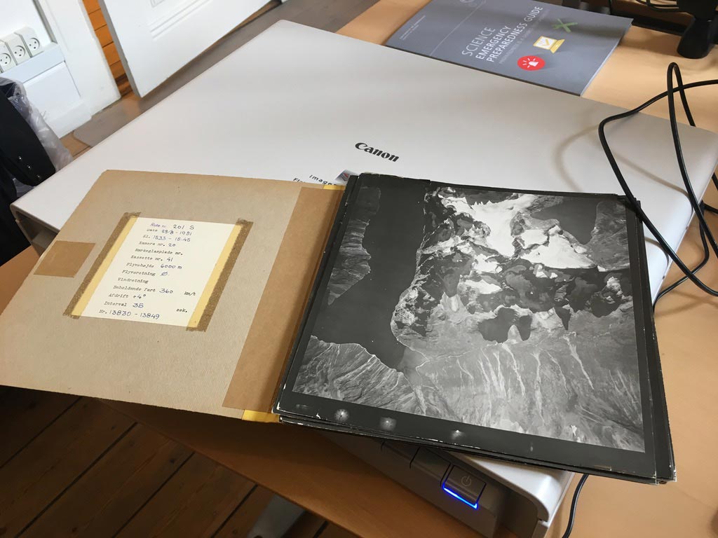
Prior to the launch of Earth-observing satellites in the 1970s, researchers did not have a full understanding of how temperature changes affected Greenland’s glaciers. Widespread and detailed observational records simply did not exist — or so researchers thought. A breakthrough came about 15 years ago when long-forgotten aerial photographs of Greenland’s coastline were rediscovered in a castle outside Copenhagen. Now housed within the Danish National Archives, the images enabled study senior author Anders Bjørk, an assistant professor at the University of Copenhagen, to begin constructing the glaciers’ history.
“Starting in the 1930s, Danish pilots clad in polar bear-fur suits set out on aerial mapping campaigns of Greenland and ended up collecting over 200,000 photos of the island’s coastline,” Larocca said. “They also unintentionally captured the state of Greenland’s peripheral glaciers.”
Extensive Effort in Data Processing
In previous studies, Bjørk and his collaborators digitized and analyzed photos to study 361 glaciers in the southeast, northwest, and northeast regions of Greenland. In the new study, Larocca, Axford, and their team added records for 821 more glaciers in the south, north, and west regions and extended Bjørk’s records to the present day.
As a part of this effort, the team digitized thousands of paper-copy aerial photographs taken from open-cockpit planes and collected imagery from multiple satellites. The researchers also removed terrain distortion and used geo-referencing techniques to place the photos at the correct locations on Earth.
“There really aren’t any automated processes to digitize all these photos,” said Larocca, who began the project in 2018. “A project like this takes a lot of people and a lot of manual labor to scan and digitize all these analog air photos. Then, we had to do a lot of preprocessing work before making our measurements.”
Historical Clues and Recent Findings
Larocca, Axford, and their team also extended records further back in time by leveraging clues hidden within the landscape. When glaciers grow larger and then retreat, they leave behind a terminal moraine (sediment transported and deposited by a glacier, often in the form of a long ridge). Locating these moraines enabled the researchers to map older glacier extents before pilots took their first flyover photos in the early 1930s.
Using the late 20th-century imagery as a baseline, Larocca, Axford, and their team also calculated the percentage of length that glaciers have lost over the past 20 years. They found that, on average, glaciers in south Greenland lost 18% of their lengths, while glaciers in other regions lost between 5-10% of their lengths over the past 20 years.
Broader Implications of Melting Glaciers
As global temperatures increase, it has become more imperative than ever to better understand how these melting glaciers will affect rising sea levels and reliable sources of fresh water.
“Peripheral glaciers only represent about 4% of Greenland’s total ice-covered area, but they contribute 14% of the island’s current ice loss — a disproportionately large portion,” Larocca said. “If you look globally at all glaciers that are distinct from the Greenland and Antarctic Ice Sheet, they have contributed roughly 21% of observed sea level rise over the last two decades. So, these smaller ice masses are an important part of the sea level problem. Millions of people worldwide also rely on glaciers for fresh water, agriculture, and hydropower, so it’s deeply concerning that we’re allowing this to continue. The choices we make over the next few years will make a huge difference to how much ice we lose.”
For more on this research, see Greenland Glaciers Melting 5x Faster Than 20 Years Ago.
Reference: “Greenland-wide accelerated retreat of peripheral glaciers in the twenty-first century” by L. J. Larocca, M. Twining–Ward, Y. Axford, A. D. Schweinsberg, S. H. Larsen, A. Westergaard–Nielsen, G. Luetzenburg, J. P. Briner, K. K. Kjeldsen and A. A. Bjørk, 9 November 2023, Nature Climate Change.
DOI: 10.1038/s41558-023-01855-6
The study was supported by the National Science Foundation’s (NSF) Geography and Spatial Sciences Program, NSF Polar Programs, the University Corporation for Atmospheric Research’s Cooperative Programs for the Advancement of Earth System Science and the Villum Foundation.
Never miss a breakthrough: Join the SciTechDaily newsletter.
Follow us on Google and Google News.
1 Comment
Melting is expected during an interglacial.
“Millions of people worldwide also rely on glaciers for fresh water, agriculture, and hydropower, so it’s deeply concerning that we’re allowing this to continue.”
The other side of that coin is that if it were to stop warming, then there would be less meltwater available. The real problem is that there are so many people in the world that there is little excess water and a change in melting rates either way will create shortages. Turning colder would be an immediate problem, while continued warming is a future problem.