
A Scottish crannog older than Stonehenge has been mapped in new detail using a shallow-water 3D imaging technique.
Archaeologists at the University of Southampton have excavated and documented a large wooden platform concealed beneath what now looks like a stone island in a Scottish loch.
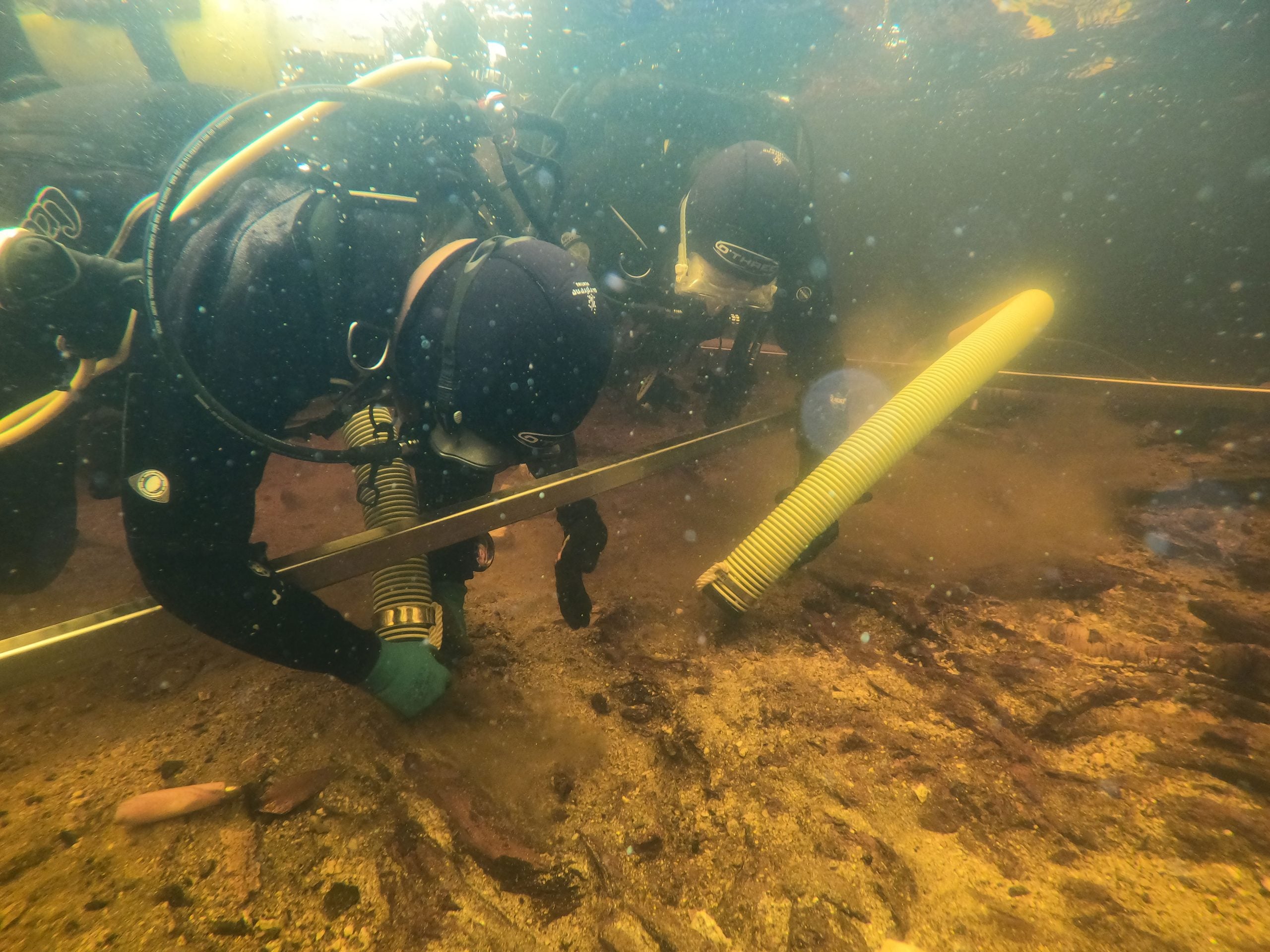
Using stereophotogrammetry, they recorded the artificial island above and below the waterline as one continuous structure. This gave them a view of the site that neither land survey nor underwater survey could have produced on its own.
A hidden island gains detail
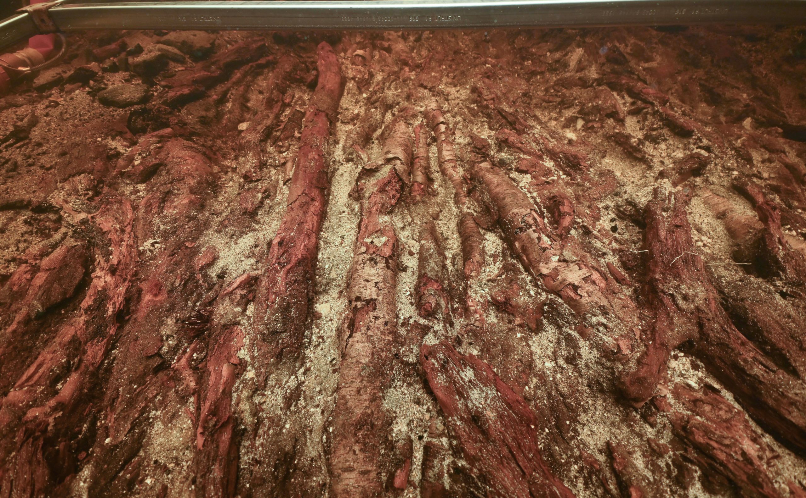
Working with the University of Reading, the researchers studied the ‘crannog’ in Loch Bhorgastail on the Isle of Lewis and revealed a structure built more than 5,000 years ago. Their fieldwork exposed layers of timber and brushwood beneath the island’s stone covering, as well as hundreds of submerged pieces of Neolithic pottery in the water around it.
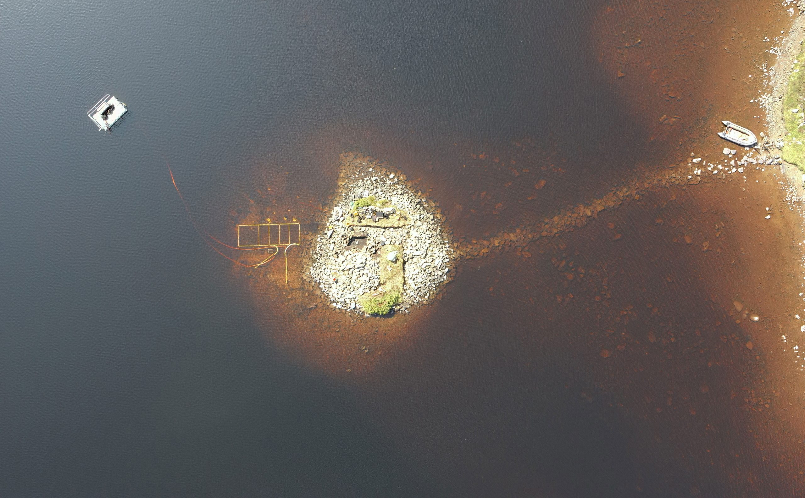
University of Southampton archaeologist Dr. Stephanie Blankshein explains: “Crannogs are small artificial islands that are typically thousands of years old. Hundreds exist in the lochs of Scotland and many remain unexplored or undiscovered.
“While crannogs were long thought to have been built, used and re-used, mainly between the Iron Age and the post-medieval period, we now know that some were first constructed much earlier during the Neolithic between 3800 and 3300 BC.”
Older than Stonehenge
Across several years of fieldwork, the archaeologists used excavation, coring, advanced surveying, and radiocarbon dating to reconstruct the development of the Loch Bhorgastail crannog.
The site was first created more than 5,000 years ago, making it older than famous monuments such as Stonehenge. It began as a circular wooden platform about 23 meters wide, covered with brushwood. Roughly 2,000 years later, during the Middle Bronze Age, people added another layer of brushwood and stone. About 1,000 years after that, the site saw another phase of activity during the Iron Age. An underwater stone causeway connects the island to the loch shore.
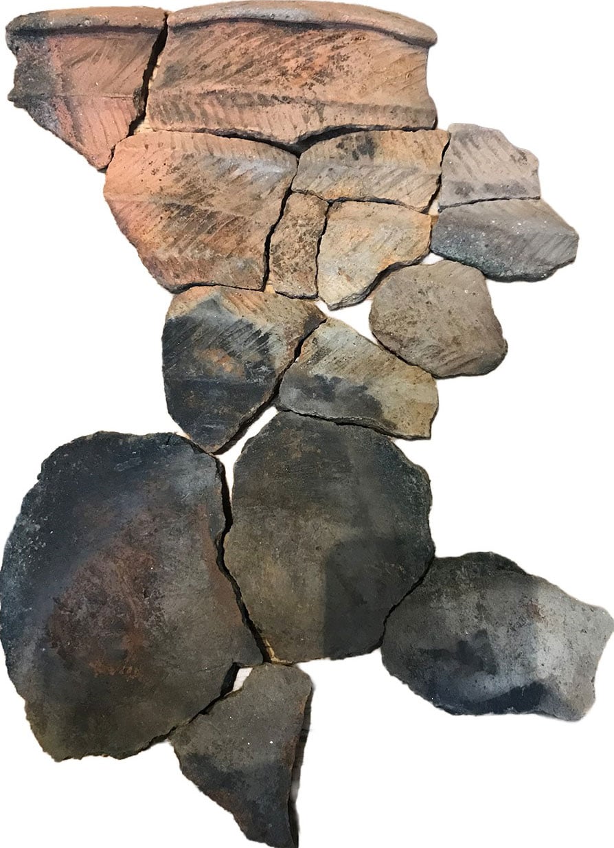
Over time, archaeologists have found hundreds of fragments of Neolithic pottery, including pieces from different jars and bowls, scattered in the water nearby. This indicates that people first established the site during the Neolithic, before the Bronze Age.
“While we still don’t know exactly why these islands were built, the resources and labor required to construct them suggests, not only complex communities capable of such feats, but also the great significance of these sites. Large quantities of pottery, often still containing food residue, and worked stone found on and around the islands, suggest their use for communal activities such as cooking or feasting,” says Dr Blankshein.
Seeing clearly in shallow water
During fieldwork in 2021, the archaeologists developed and tested a new way to use stereophotogrammetry in shallow water. They applied the image capture method to study the loch bed around the crannog. Their technique is detailed in a newly published article in the journal Advances in Archaeological Practice.
Photogrammetry is an established method for creating 3D digital imagery from multiple 2D photographs. Images are taken from many angles and then combined by specialist software to produce a high-resolution digital model.
Using photogrammetry successfully in shallow water is difficult, as Principal Investigator and Director of the Southampton Marine and Maritime Institute, Professor Fraser Sturt, explains: “Fine sediments, choppy conditions, floating vegetation, and distorted or reflected light all hinder shallow water imaging. Photogrammetry is very effective in deep water but runs into problems at depths of less than a meter. This problem is a well- known frustration for archaeologists.”
To address the problem, the researchers used two small waterproof cameras with strong low-light performance and a wide field of view. The cameras were fixed at a set distance apart on a frame, creating a stereo system that produced precise overlapping images and helped compensate for missing or disrupted data.
A diver moved the cameras through the water while their position was controlled with centimeter-level accuracy, matching the precision achieved by an aerial drone.
“By combining stereophotogrammetry, drone technology, and some innovative post-processing of the data, we have managed to set out an accessible approach that is portable and cost-effective,” says Dr. Blankshein, lead author on the paper.
A tool for submerged sites
The survey is the first publication from the University of Southampton’s Coastal & Inland Waters Heritage Science Facility. The work has added new clues to the mysterious history of crannog structures, and the team hopes the method can support future investigations of similar sites.
Reference: “At the Water’s Edge: Photogrammetry in Extreme Shallow-Water Environments” by Stephanie Blankshein, Felix Pedrotti, Fraser Sturt and Duncan Garrow, 27 April 2026, Advances in Archaeological Practice.
DOI: 10.1017/aap.2025.10145
The work presented in this article was generously funded by the Arts and Humanities Research Council (AH/S010157/1).
Never miss a breakthrough: Join the SciTechDaily newsletter.
Follow us on Google and Google News.