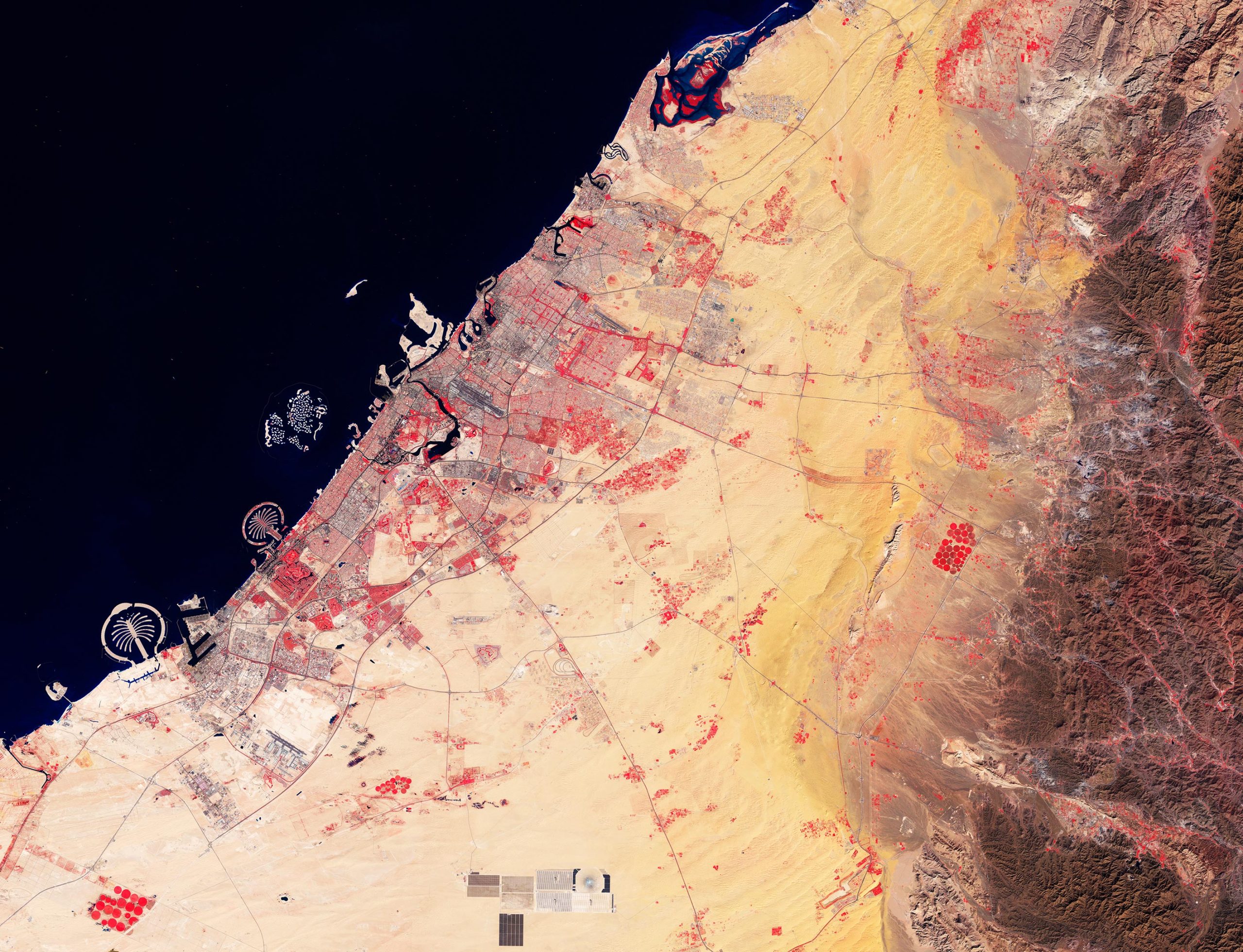
Highlighting Dubai’s development and artificial islands, a false-color Sentinel-2 image reveals the city’s rapid urban expansion and distinctive coastal features, including the Palm Islands and Jebel Ali Port, through advanced imaging techniques.
This false-color image acquired by the Copernicus Sentinel-2 mission shows the city of Dubai and its surroundings in the United Arab Emirates.
Dubai is one of the seven emirates that make up the United Arab Emirates (UAE). Located southeast of the Persian Gulf on the Arabian Peninsula, Dubai lies within the Arabian Desert. Identified as one of the fastest-growing cities, Dubai has grown from covering only 54 sq km in 1975 to 977 sq km in 2015.
Architectural Marvels and Land Reclamation
Dubai’s artificial islands along the coast are clear to see. The most iconic are the two massive palm-shaped islands, Palm Jebel Ali, which is the larger, and Palm Jumeirah, about 15 km east. Further north are the World Islands – a collection of 300 islets shaped into the continents of the world and surrounded by an oval-shaped breakwater.
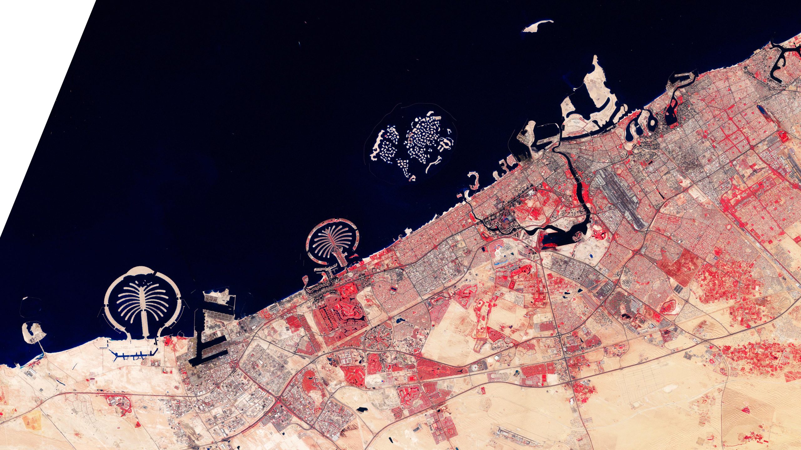
The fork-shaped structure adjacent to Palm Jebel Ali is the busy commercial port of Jebel Ali, which is itself artificial and reputedly the largest human-made harbor in the world.
The network of artificial islands that has reshaped this segment of the Gulf coast is the world’s largest land reclamation effort. The relatively shallow depth of the Gulf and the wide continental shelf off the Dubai coast made the construction of these wonders possible.
Advanced Imaging Techniques and Environmental Insights
In this image, which was captured on January 23, 2024, information from Copernicus Sentinel-2’s near-infrared channel has been used to highlight vegetation in bright red and water bodies in different shades of blue.
Deeper water bodies, such as the Gulf and Dubai Creek – the natural saltwater inlet snaking through Downtown Dubai – are visible in dark blue, while lakes and lagoons appear in electric blue.
The red vegetated areas dotted throughout mainly denote golf courses, gardens, parks, and agricultural fields. These fields use traditional and center-pivot irrigation systems that are easy to spot from their circular shape.
Color variations in the image represent different types of surface. Sand dunes in shades of yellow are prevalent in the center while rugged terrain and mountainous rims spread out in brown across the right of the image.
Never miss a breakthrough: Join the SciTechDaily newsletter.
Follow us on Google and Google News.