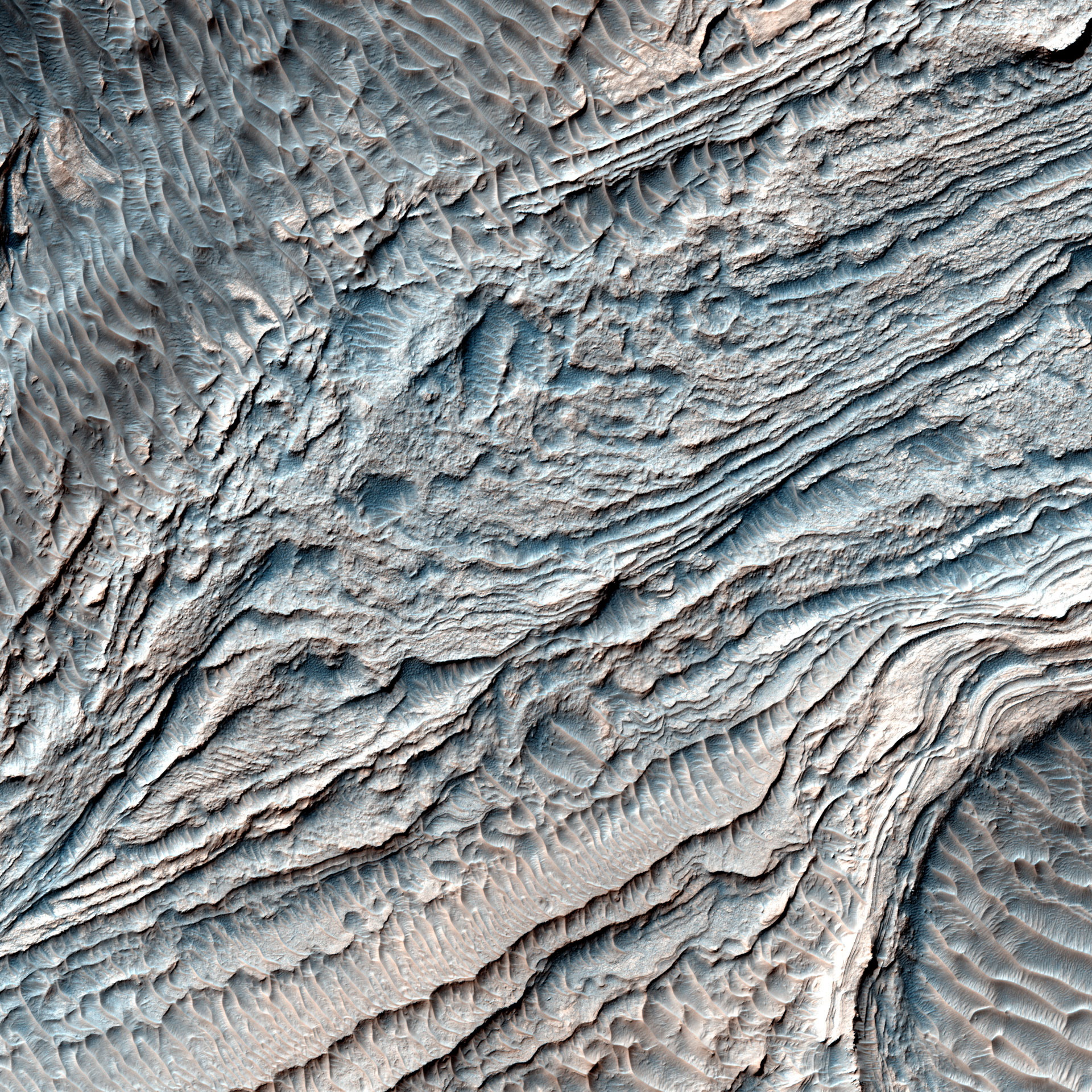
This newly released image from the high resolution imaging science experiment on NASA’s Mars Reconnaissance Orbiter gives astronomers a view of the layered deposits in Melas Basin.
A group of steeply inclined light-toned layers is bounded above and below by unconformities (sudden or irregular changes from one deposit to another) that indicate a “break” where erosion of pre-existing layers was taking place at a higher rate than deposition of new materials.
The layered deposits in Melas Basin may have been deposited during the growth of a delta complex. This depositional sequence likely represents a period where materials were being deposited on the floor of a lake or running river.
This is a stereo pair with PSP_007878_1700.
The map is projected here at a scale of 25 centimeters (9.8 inches) per pixel. The original image scale is 28.9 centimeters (11.4 inches) per pixel (with 1 x 1 binning); objects on the order of 87 centimeters (34.2 inches) across are resolved. North is up.
Never miss a breakthrough: Join the SciTechDaily newsletter.
Follow us on Google and Google News.