New research uncovers how ancient tides shaped the rise of Sumer.
A newly released study questions established beliefs about how urban civilization first emerged in ancient Mesopotamia, proposing that Sumer’s development resulted from the complex interaction of rivers, tides, and sediment deposits at the northern edge of the Persian Gulf.
Published in PLOS ONE, the research was conducted by Liviu Giosan, Senior Scientist Emeritus in Geology & Geophysics at the Woods Hole Oceanographic Institution (WHOI), and Reed Goodman, Assistant Professor of Environmental Social Science at the Baruch Institute of Social Ecology and Forest Science (BICEFS), Clemson University.
The study presents a new paleoenvironmental model proposing that tidal forces shaped the earliest stages of Sumerian agriculture and the rise of complex societies. These findings contribute to the ongoing Lagash Archaeological Project, a joint effort between Iraqi archaeologists and the Penn Museum at the University of Pennsylvania.
“Our results show that Sumer was literally and culturally built on the rhythms of water,” said Giosan. “The cyclical patterns of tides together with delta morphodynamics -how the form or shape of a landscape changes over time due to dynamic processes – were deeply woven into the myths, innovations, and daily lives of the Sumerians.”
The Cradle of Civilization Reimagined
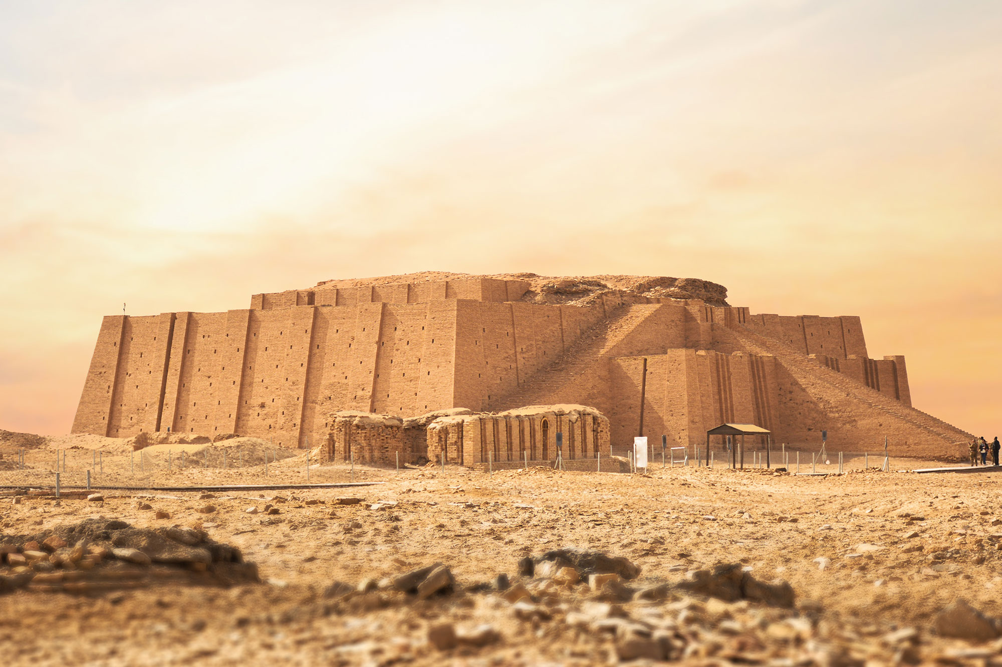
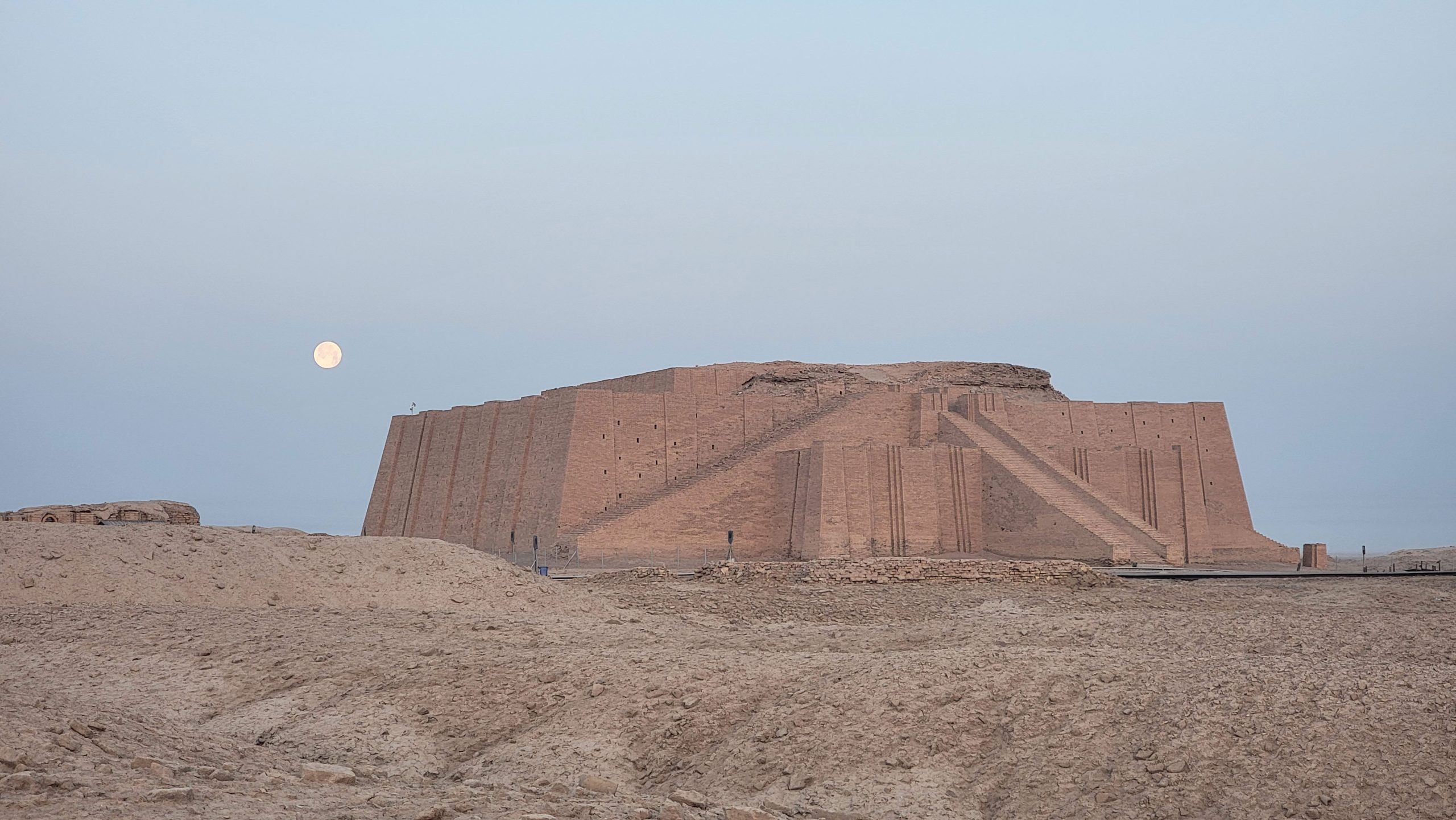
Sumer was an ancient civilization located in southern Mesopotamia, in what is now modern-day Iraq. It is often considered the cradle of civilization due to its numerous innovations, including the invention of writing, the wheel, and organized intensive agriculture. Sumerian society was structured into city-states like Ur, Uruk, or Lagash, each with its own ruler and religious institutions.
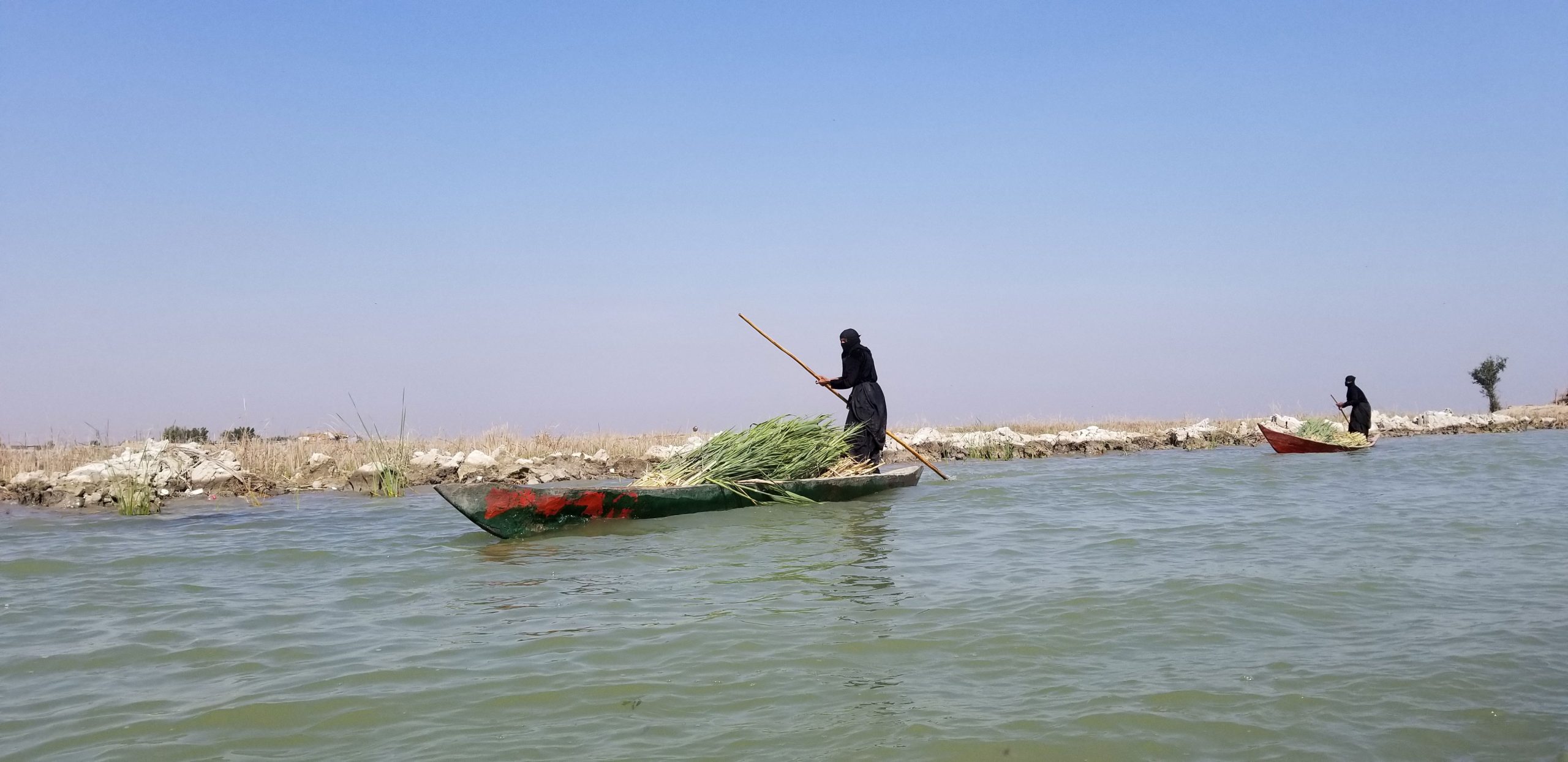
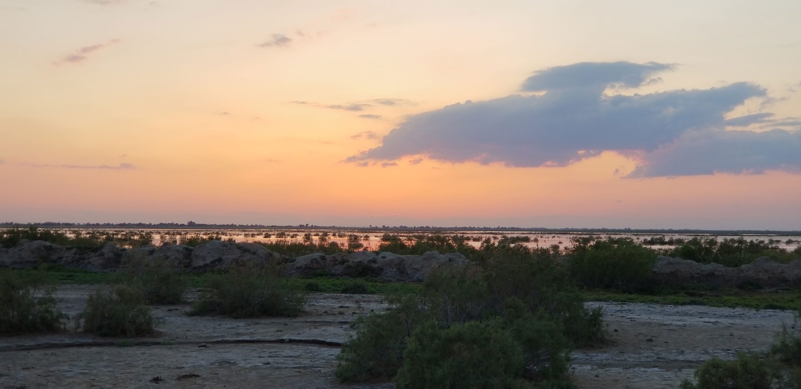
The study shows that from about 7000 to 5000 years ago, the Persian Gulf extended farther inland, and tides pushed freshwater twice daily far into the lower reaches of the Tigris and Euphrates. The scholars propose that the early communities must have harnessed this dependable hydrology using short canals to irrigate crops and date groves, enabling high-yield agriculture without the need for large-scale infrastructure.
As rivers built deltas at the head of the Gulf, tidal access to the interior was cut off. The resulting loss of tides likely triggered an ecological and economic crisis—one that required an ambitious societal response. The extensive works for irrigation and flood protection that followed ultimately came to define the golden age of Sumer.
“We often picture ancient landscapes as static,” says Goodman. “But the Mesopotamian delta was anything but. Its restless, shifting land demanded ingenuity and cooperation, sparking some of history’s first intensive farming and pioneering bold social experiments.”
Myth, Culture, and Environmental Legacy
Beyond the environmental drivers, the study also explores the cultural impacts of this watery foundation, connecting the flood myths of Mesopotamia and the water-centered Sumerian pantheon.
“The radical conclusions of this study are clear in what we’re finding at Lagash,” adds Holly Pittman, Director of the Penn Museum’s Lagash Archaeological Project. “Rapid environmental change fostered inequality, political consolidation, and the ideologies of the world’s first urban society.”
Using ancient environmental and landscape data, new samples from the archaeological site of ancient Lagash, and detailed satellite maps, the authors were able to recreate what the coast of Sumer looked like long ago and imagine how its inhabitants responded to its shape-shifting nature.
“Our work highlights both the opportunities and perils of social reinvention in the face of severe environmental crisis,” concluded Giosan. “Beyond this modern lesson, it is always surprising to find real history hidden in myth — and truly interdisciplinary research like ours can help uncover it.”
Reference: “Morphodynamic Foundations of Sumer” by Liviu Giosan and Reed Goodman, 20 August 2025, PLOS ONE.
DOI: 10.1371/journal.pone.0329084
This research was funded by the National Science Foundation (NSF), the National Ocean Sciences Accelerator Mass Spectrometry Facility (NOSAMS), the Woods Hole Oceanographic Institution (WHOI) and the Penn Museum. Additional support for Giosan was provided by STAR-UBB and ICUB in Romania. Goodman finalized his contribution to this study as a part of his postdoctoral studies at the Institute for the Study of the Ancient World of New York University.
Never miss a breakthrough: Join the SciTechDaily newsletter.
Follow us on Google and Google News.
23 Comments
more information please
The linked paper provides that.
glad to see this article. it is moving us in the right direction, now, to try & figure out the true age of the sphinx. the sphinx has weathered with water marks that are at least 10k years old. keep investigating please.
Wow scientist really need to take thee Bible seriously. Could it be a world wide flood.no. howe would a flood put sea life on mountain tops and tidal wave marks all over the globe that’s nonsense. But we think a rivers globally overflowed 40 times there size once.
Look up plate tectonics and continental drift.
Various myth texts are not fact sources, the specific myth complex you refer to is a good example: about half is outright wrong (migrations that didn’t happen, say) and about half can’t be tested.
I recently learned that the water rise that myth complex refer to comes from its Egyptian part of its syncretic rise, as they now have similarly found the sun god geographical context. That in turn went straight into both of the myth complex else sequence conflicting stories, with a notion of “raising waters” above “mountain tops” (which in reality was a 75ish meter high mound in the Nile stream).
“Presenting the results of the first comprehensive geoarchaeological survey of the area, the authors show that Karnak was built upon a fluvial terrace segment surrounded by river channels in an island configuration potentially recalling the ‘primeval mound’ of Egyptian creation myths.” “Nonetheless, the choice of location does foretell the later, more developed, Egyptian cosmogony. The Middle Kingdom Coffin Texts and later documents clearly develop the idea of high ground—the ‘primeval mound’—rising from the inundation, embodied as the Waters of Chaos/‘Nun’ (Bickel Reference Bickel1994: 29–31, 68–69). During the early Middle Kingdom, Karnak would have recreated this cosmogony each year: as the annual flood abated, the mound upon which Karnak was built would have appeared to rise from the receding water.” [“Conceptual origins and geomorphic evolution of the temple of Amun-Ra at Karnak (Luxor, Egypt)”, Aniquity, Published online by Cambridge University Press: 06 October 2025.]
In case it is unclear, the “syncretic rise” refers to the myth complex, as evidenced by the near source texts found in the Dead Sea Scrolls about 2,300 years ago, and its origin after the Hellenistic Conquest raised the area. Likely because of the troubled societies that resulted, they took part of their new myths from the conqueror (Greek mythology) and part from the old area myths (Egyptian mythology). It is not reflecting Euphrates and Tigris floodings – at least as far as I know – but the coeval Nile civilization (and at a temple locale, not as general societal context).
Typo: razed, not “raised”.
Remember when early science called everybody ancient history “mythology” ha ha ha things turning out to be true and facts what the ancients said, the ancients PRE-Abrahamic long before the Bible tell great tales of great floods and waters rising to mountain tops.. not MYTH, but facts !
Great articles 🙏
It seems unlikely at this point that Sumer was the cradle of civilization when you consider sites much older like Gobekli Tepe.
Couldn’t agree more! In fact as more and more discoveries reveal that homosapiens have been around for about 500,000 years we could theorize that there have been even old civilizations.
Theorize all you want.
You wouldn’t have written that comment without Sumerian innovation.
chill
Dang right
Civilizations has arisen independently many times over as the human population became dense enough. That is why the text refers explicitly to the *Mesopotamian* civilization.
Did I miss where the article mentioned what the “long-held assumption” was?
I was looking for the same information… Usually, an article has a ‘Title’ that gives a potential reader of such article an idea of what may be learned from giving up a little time to gain a little more knowledge of the subject…a
I agree with you…
Rachel Blake on October 23, 2025 8:36 pm
Did I miss where the article mentioned what the “long-held assumption” was?
Titles are seldom a product of the author of a piece, for mass media journals they are decided by an editor. If we are lucky they are informative instead of sensational click bait.
The Science piece is better, since its lede has one of the author’s describe the “chicken-and-egg” problems with earlier assumptions:
“The textbook tale of the birth of civilization goes something like this: In the flat, dry space between the Tigris and Euphrates rivers in modern-day Iraq, large-scale irrigation projects opened desert land to agriculture. About 5000 years ago, people known as Sumerians used the resulting food surplus to found early urban centers including Ur, Uruk, and Lagash. Those cities, in turn, formed the blueprints for complex states we know today.
But the story contains a chicken-or-egg–style conundrum, says Reed Goodman, an archaeologist at Clemson University. “How are you getting so many people living together before you have the governments necessary to operate full-fledged irrigation systems?”
A paper published recently in the journal PLOS ONE proposes a solution: Early Mesopotamians harnessed the regular rise and fall of the Tigris to irrigate their crops thousands of years before the first cities appeared.”
[But note also the criticism that I described in an earlier comment.]
Look up plate tectonics and continental drift.
The author’s notions got some partial criticism:
“But once people put down roots and invested in their cities, Goodman argues, they were reluctant to move—even as tidal irrigation became less reliable. Rather than relocate, people redoubled their efforts to engineer the landscape and store food. The social effects were profound. “Highly organized cities emerge as a response to trying to preserve this landscape,” Goodman says. “Around 2500 B.C.E., the first kings in Lagash start talking about building large-scale canals.”
That part of the theory hasn’t won everyone over. City University of New York archaeologist Stephanie Rost, who was not involved with the new study, says early irrigation projects were effective enough—and simple enough—that they can’t explain the rise of complex states alone. “At the time of the rise of the first cities and states, I don’t think irrigation systems were large scale,” Rost says. “Irrigation plays a role, but it’s not a prime mover.” Instead, the wealth of natural resources provided by the area’s wetlands alone might have been enough to support the first experiments with urbanism and early statehood.
Jotheri, meanwhile, cautions that it’s hard to extrapolate regionwide claims from a single site. And as a third-generation farmer from southern Iraq, he adds that seawater and freshwater tend to mix more easily than the paper suggests, meaning early farmers might have had to contend with brackish water. “It’s not as simple as they wrote,” Jotheri says, “but it’s amazing—after more than 100 years, they have a new idea for us to discuss.””
[Science, 22 Oct 2025]
I find it very interesting that scientists ignore the translations of the Sumerian clay tablets. So much is explained there. I can see why religions ignore them but why scientists? I started here
http://www.michaeltellinger.com
and then went to
https://sitchin.com