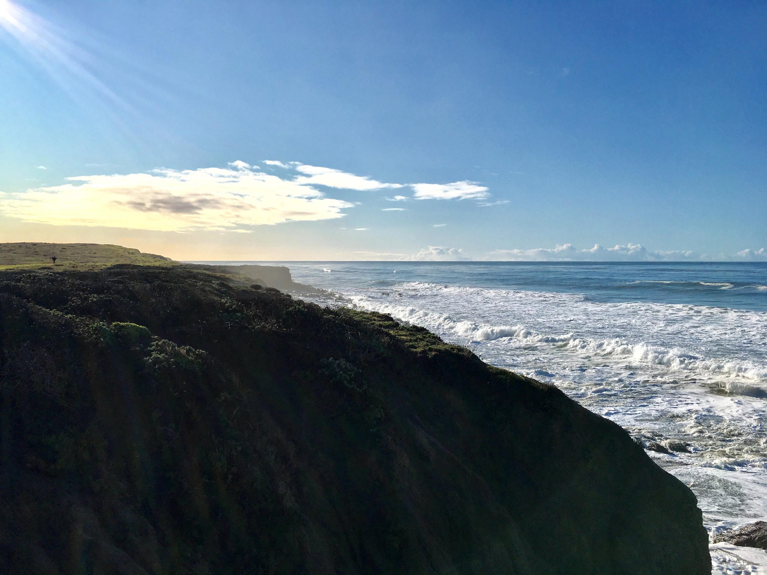
Sea level rise isn’t just about melting ice caps—it’s also about shifting land. A NASA-led study shows that parts of California’s coastline are sinking faster than the ocean is rising, amplifying local sea level rise.
Using satellite data, researchers pinpointed areas where land movement—caused by human activities like groundwater extraction and natural forces like tectonics—is altering the coastline in unpredictable ways. In places like San Francisco Bay, subsidence could push sea levels more than double previous estimates. Some regions, like Santa Barbara, are actually rising, but human activity adds major uncertainties to predictions.
Tracking Sea Level Rise: The Land’s Role
Predicting sea level rise isn’t just about measuring how high the ocean gets — it also depends on how the land beneath our feet moves. A NASA-led study focusing on California shows that even small shifts in land elevation can have a big impact on local sea levels in the coming decades.
By 2050, California’s sea levels are projected to rise between 6 and 14.5 inches (15 to 37 centimeters) above year 2000 levels, driven mainly by melting glaciers, ice sheets, and warming ocean waters. However, coastal communities must also consider how the land itself is shifting. This study highlights the importance of accounting for land movement when planning for future sea level changes, and its findings are being incorporated into updated state guidance.
Sinking Cities and Shifting Ground
“In many parts of the world, like the reclaimed ground beneath San Francisco, the land is moving down faster than the sea itself is going up,” said lead author Marin Govorcin, a remote sensing scientist at NASA’s Jet Propulsion Laboratory in Southern California.
The study reveals that vertical land motion varies widely in both speed and scale. It can be influenced by human activities such as groundwater pumping and wastewater injection, as well as natural forces like tectonic activity. Researchers demonstrated that satellite observations provide more precise estimates of these land movements and their effects on local sea levels. Unlike tide gauge models, which have limited coverage, satellite data can capture land shifts across entire regions, offering a clearer picture of the dynamic forces shaping coastlines.

Mapping California’s Rising and Sinking Coastline
Researchers from JPL and the National Oceanic and Atmospheric Administration (NOAA) used satellite radar to track more than a thousand miles of California coast rising and sinking in new detail. They pinpointed hot spots — including cities, beaches, and aquifers — at greater exposure to rising seas now and in coming decades.
To capture localized motion inch by inch from space, the team analyzed radar measurements made by ESA’s (the European Space Agency’s) Sentinel-1 satellites, as well as motion velocity data from ground-based receiving stations in the Global Navigation Satellite System. Researchers compared multiple observations of the same locations made between 2015 to 2023 using a processing technique called interferometric synthetic aperture radar (InSAR).
San Francisco Bay: A Case Study in Subsidence
Homing in on the San Francisco Bay Area — specifically, San Rafael, Corte Madera, Foster City, and Bay Farm Island — the team found the land subsiding at a steady rate of more than 0.4 inches (10 millimeters) per year due largely to sediment compaction. Accounting for this subsidence in the lowest-lying parts of these areas, local sea levels could rise more than 17 inches (45 centimeters) by 2050. That’s more than double the regional estimate of 7.4 inches (19 centimeters) based solely on tide gauge projections.
Not all coastal locations in California are sinking. The researchers mapped uplift hot spots of several millimeters per year in the Santa Barbara groundwater basin, which has been steadily replenishing since 2018. They also observed uplift in Long Beach, where fluid extraction and injection occur with oil and gas production.
The scientists further calculated how human-induced drivers of local land motion increase uncertainties in the sea level projections by up to 15 inches (40 centimeters) in parts of Los Angeles and San Diego counties. Reliable projections in these areas are challenging because the unpredictable nature of human activities, such as hydrocarbon production and groundwater extraction, necessitating ongoing monitoring of land motion.
Aquifers, Droughts, and Landslides
In the middle of California, in the fast-sinking parts of the Central Valley (subsiding as much as 8 inches, or 20 centimeters, per year), land motion is influenced by groundwater withdrawal. Periods of drought and precipitation can alternately draw down or inflate underground aquifers. Such fluctuations were also observed over aquifers in Santa Clara in the San Francisco Bay Area, Santa Ana in Orange County, and Chula Vista in San Diego County.
Along rugged coastal terrain like the Big Sur mountains below San Francisco and Palos Verdes Peninsula in Los Angeles, the team pinpointed local zones of downward motion associated with slow-moving landslides. In Northern California they also found sinking trends at marshlands and lagoons around San Francisco and Monterey bays, and in Sonoma County’s Russian River estuary. Erosion in these areas likely played a key factor.

Monitoring Land Motion From Space
Scientists, decision-makers, and the public can monitor these and other changes occurring via the JPL-led OPERA (Observational Products for End-Users from Remote Sensing Analysis) project. The OPERA project details land surface elevational changes across North America, shedding light on dynamic processes including subsidence, tectonics, and landslides.
The OPERA project will leverage additional state-of-the-art InSAR data from the upcoming NISAR (NASA-Indian Space Research Organization Synthetic Aperture Radar) mission, expected to launch within the coming months.
Reference: “Variable vertical land motion and its impacts on sea level rise projections” by Marin Govorcin, David P. S. Bekaert, Benjamin D. Hamlington, Simran S. Sangha and William Sweet, 29 January 2025, Science Advances.
DOI: 10.1126/sciadv.ads8163
Never miss a breakthrough: Join the SciTechDaily newsletter.
Follow us on Google and Google News.
4 Comments
Subsidence and changing sea levels are why there are drowned villages in the English Channel.
It’s why people walked to North America from current day Russia.
It has nothing to do, and there is no political or scientific solution to it. It simply is.
If it were a threat, beachfront property would be cheap. So the proponents of switching
to a post industrial society should explain sea level rise to the realtors who sell beach front
property, and tell them that it’s prices way too high
Sea level is rising but the most stable and long term gauges show that the rate is very low and not accelerating.
The big thing is that the largest amount of CO2 added to the atmosphere (99%) is from natural sources not from human activity.
Furthermore, any heat gain from CO2 is miniscule and is pretty much saturated at this point so more is meaningless.
The variability of the sun is what determines the warmth of the atmosphere. And, CO2 doesn’t warm the atmosphere the heat from the ground does.
The global warming/climate change scam will be rent asunder with the coming Grand Solar Minimum (GSM) and that’ll be when we start hoping that more CO2 will increase the temperature. It won’t but we’ll likely get to the point where people are encouraged to burn hydrocarbons just in case.
Climate modeling is impossible and would prove nothing even if it could be done.
The climate is a bounded chaotic system with infinite elements (practically every atmospheric molecule) and thus cannot be modeled with any fidelity to reality.
Ground level dropping due to water & oil extraction is purely human-caused so has obvious political & scientific solutions, if another source of water is available.
There are maps of vertical land movement covering the whole world. Eg the east coast of US is mainly rising a few mm per year so is currently keeping pace with global sea level rise which has risen to a global average of 4mm per year. The NE coast is rising up to 10mm/y in one place, the land is still rebounding from having a mile of ice melted off it. Same with the north of Europe.
East coast of US is sinking 2-3 mm/y in most places, on top of the 4mm/y of global sea level rise.
So the Obama’s Hamptons house will need some work later this century to stop the sea eroding the edge of the property, unless it is solid rock underneath. The house is only 3m above sea level I think, so may need to move up the hill this century. Especially if the sand bar that protects from big ocean waves gets eaten by the rising sea & bigger storms.
Insurance companies are increasingly refusing to insure houses at risk from sea level rise. Same as houses that can no longer be defended from wildfires.
I think we should know about our world what will be in coming a couple of years.