Hydrologist Shemin Ge emphasizes learning from past errors in managing the Colorado River’s water resources. Highlighting the overlooked work of Eugene Clyde La Rue, she urges the inclusion of scientific data and Indigenous perspectives in revising water allocations by 2026, in light of current challenges and the impacts of climate change.
When it comes to the Colorado River, history often repeats itself—but it doesn’t have to.
That’s the take-home message from University of Colorado at Boulder hydrologist Shemin Ge, who recently presented a little-known piece of history from the river at the American Geophysical Union (AGU) meeting in San Francisco.
The story of hydrologist Eugene Clyde La Rue, Ge said, may help to explain the current water crisis facing many states in the American West.
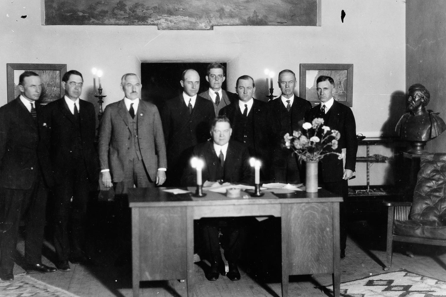
Ge’s presentation centers around a decision made in 1922, when the seven men who made up the Colorado River Commission came to an agreement to divvy up water on the Colorado River. This waterway winds over 1,450 miles and through seven states. The commission relied on an estimate from the U.S. Reclamation Service suggesting that 16.4 million acre-feet of water ran through the river at Lees Ferry, Arizona, every year. (An acre-foot equals the amount of water you’d need to submerge an acre of land to a depth of 1 foot).
But, Ge said, the commission also failed to consider a second, less convenient study from 1916. Relying on his own field data, La Rue, working for the U.S. Geological Survey, had calculated that the Colorado River discharged just 15 million acre-feet of water.
“It’s intriguing how such good work at the time was ignored, whether it was intentional or just out of ignorance,” said Ge, professor in the Department of Geological Sciences at CU Boulder.
She worries it may be happening again.
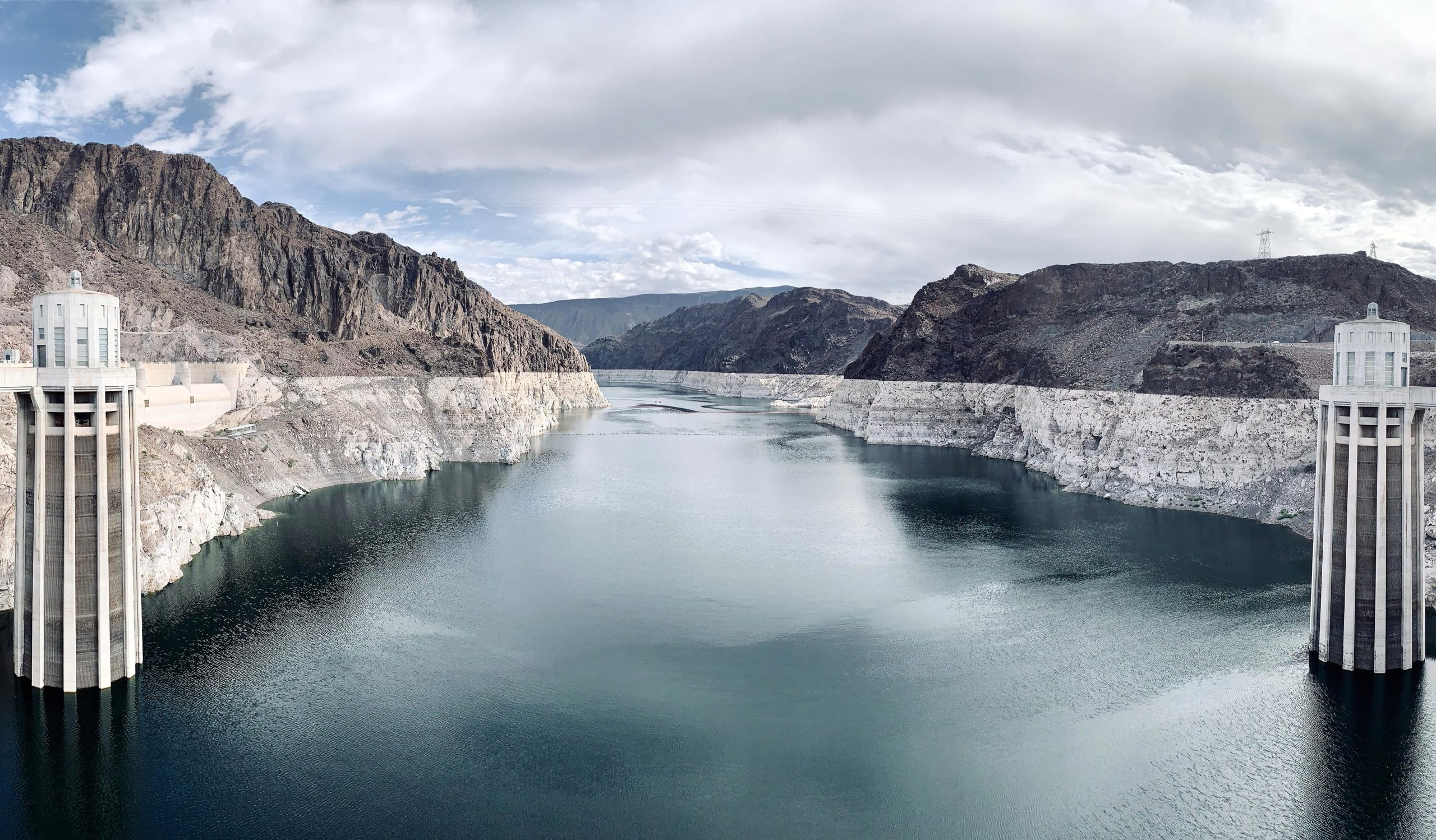
In 2022, Lake Mead and Lake Powell, the two main reservoirs on the Colorado River, dried up to levels never seen before, raising concerns that they could be heading for a “dead pool” state, in which water could flow in but not out of the reservoirs.
Currently, the seven states within the Colorado River Compact are working to revise a suite of agreements and guidelines by 2026. Ge hopes that, this time, leaders will work closely with scientists and a range of community members, particularly Indigenous groups, all to build a Law of the River that accounts for how much water actually exists in the West, now and in the future.
That will become more important, she said, as climate change continues to melt the West’s dwindling snowpacks.
“There’s so much we can learn from history to improve how we’re managing our water,” Ge said. “Right now, I don’t think we’re doing enough.”
Traveling the River
She first learned about La Rue’s story from the 2019 book, “Science Be Dammed” by Eric Kuhn and John Fleck. She and her colleagues wrote about their insights this summer in the magazine “Eos.”
Think of it as a tale of two estimates.
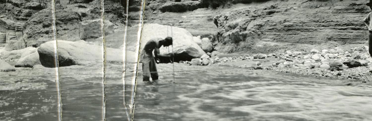
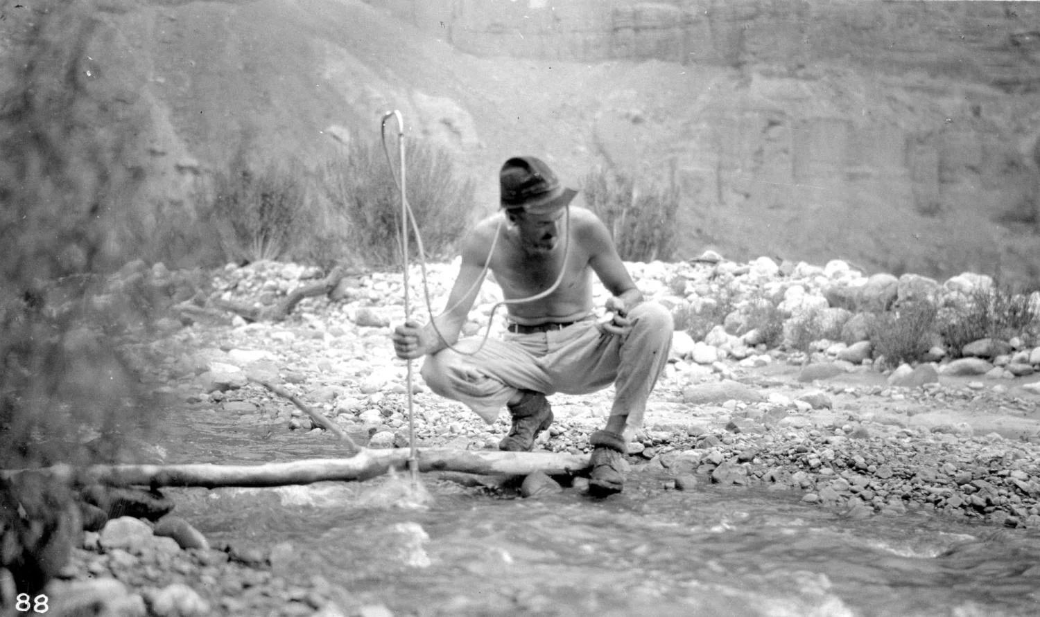
Beginning in 1914, La Rue hiked across much of the river and its tributaries, collecting first-hand data on the flow of water. That included taking measurements of the depth of the river and its flow speed.
“We still do this in our intro to geology courses,” Ge said. “It’s very low tech, but elegant.”
To come to its 16.4 million acre-feet assessment, in contrast, the Colorado River Commission, led by Secretary of Commerce and future President Herbert Hoover, relied on a much less rigorous study: measurements taken at just one site near Yuma, Arizona, hundreds of miles south of Lees Ferry.
“They took the larger number,” Ge said. “A larger number probably made the allocations easier to negotiate because there was more water to divvy up.”
The 40 million people who depend on the Colorado River for their water today may be paying the price.
Learning From the Past
Today, research pegs the flow of the Colorado River at around 13 million acre-feet per year, making even La Rue’s modest estimates seem like a fantasy.
The Colorado River Compact, however, continues to allot water based on the 16.4 million acre-feet value: Colorado, New Mexico, Utah, and Wyoming together claim 7.5 million acre-feet. Arizona, California, and Nevada get the same, and Mexico supposedly draws 1.4 million.
Ge hopes that, in the lead up to 2026, those seven states will do what Hoover couldn’t—draw on the best available science to develop realistic estimates of how much water will likely flow down the river decades from now. She added that Indigenous groups need to be an important part of that process. Several tribes hold some of the most senior rights to water in the western U.S., but lack the infrastructure to access much of their share.
“We’re not talking enough about how much water is in the Colorado River,” Ge said. “We talk about droughts, infrastructure, and water conservation. But shouldn’t the first order of business be to see how much water we actually have? It’s much less than we think.”
Never miss a breakthrough: Join the SciTechDaily newsletter.
Follow us on Google and Google News.
2 Comments
As a hydrologist in Virginia, I run across this still. People don’t look at how the numbers were gotten but just the numbers. You can find all kinds of so-called experts but how did they come up with the figures. I have been measuring streams for over thirty years and people in my agency don’t know what the handful of people in the state do how we do and the standards we follow. I have even been to court over the amount of water in a stream and both sides have no clue how the numbers are produced. History will always repeat itself. You can’t beat good science and accurate science. Checks and balances.
They always pick a number that justifies what they want to build.