
This satellite image shows Adam’s Bridge, , a natural chain of limestone shoals, stretches 48 km between Rameswaram Island in India and Mannar Island in Sri Lanka. Credit: Contains modified Copernicus Sentinel data (2024), processed by ESA
Adam’s Bridge connects India and Sri Lanka through a series of limestone shoals extending from Rameswaram Island to Mannar Island. Once a solid land bridge, it has eroded over time but still supports rich biodiversity and provides critical habitat for marine and bird species.
This Copernicus Sentinel-2 satellite image shows Adam’s Bridge, a chain of shoals linking India and Sri Lanka.
Adam’s Bridge stretches 48 km (30 miles) between Rameswaram Island, off the southeast coast of India, and Mannar Island, off the northwest coast of Sri Lanka. The bridge separates the Gulf of Mannar (south), an inlet of the Indian Ocean, from the Palk Strait (north), an inlet of the Bay of Bengal.
Geological Insights and Historical Significance
There are numerous theories about how the bridge was formed. However, geologic evidence suggests that these limestone shoals are the remnants of land that once connected India and Sri Lanka. According to records, this natural bridge was traversable until the 15th century, after which it was gradually eroded by storms over the years.
Some of the sandbanks are dry and, as the light color of the water indicates, the sea here is very shallow, only 1–10 m (1-33 feet) deep.
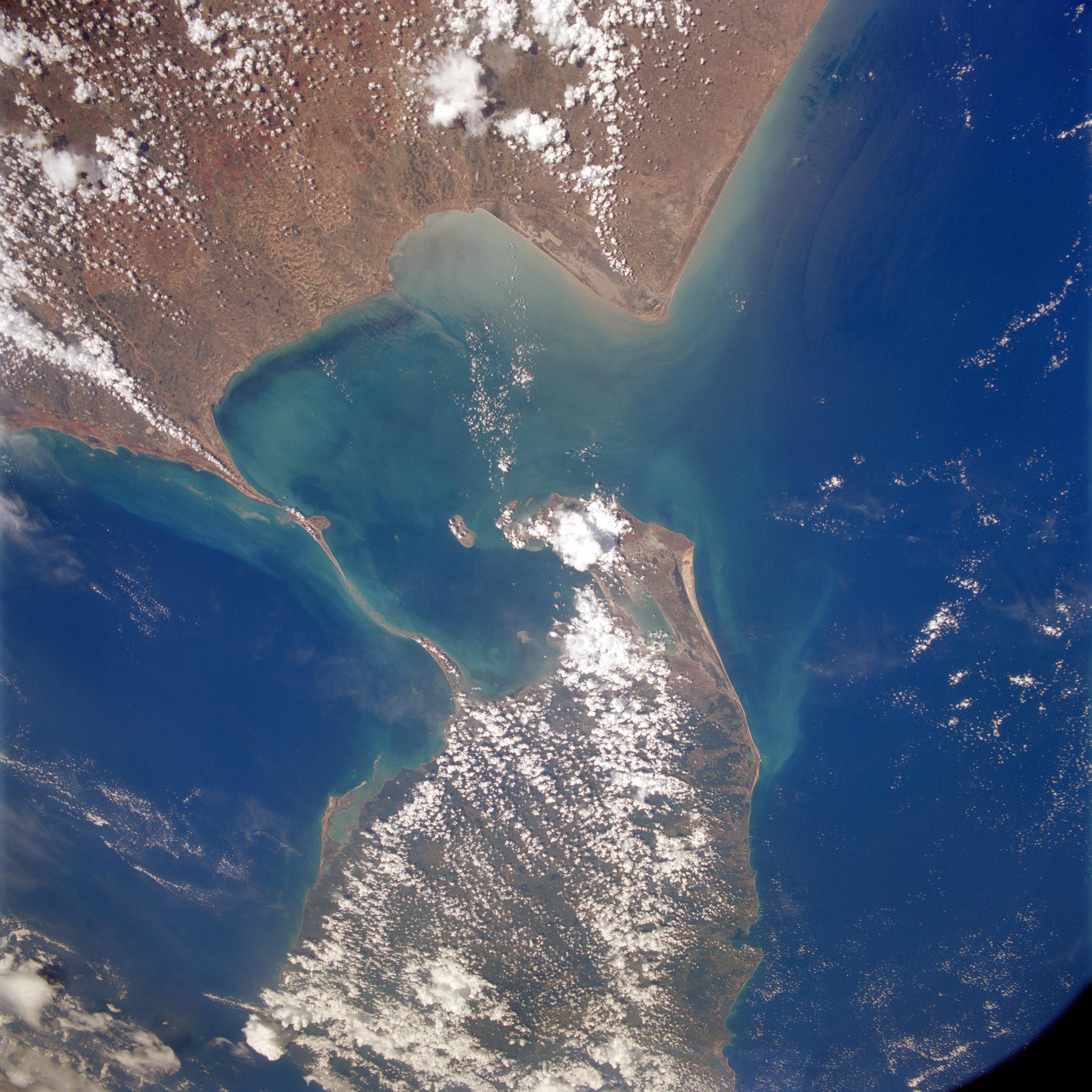
The Adam’s Bridge as seen between India and Sri Lanka, from Space Shuttle Endeavour during STS-59. Credit: NASA
Connection and Accessibility
Mannar Island covers about 130 sq km (50 sq miles) and is connected to mainland Sri Lanka by a road bridge and a railway bridge, both visible at the southern end of the island.
On the opposite side of Adam’s Bridge, Rameswaram Island, also known as Pamban Island, can be accessed from the Indian mainland by the 2-km-long (1.2-mile-long) Pamban Bridge. The two main towns on the island are Pamban, on the western edge, and Rameswaram, around 10 km east of Pamban.
Ecological Importance
Both sections of Adam’s Bridge are part of protected national parks in their respective countries. The sand dunes serve as breeding grounds for birds such as the brown noddy, while numerous species of fish and sea grasses thrive in the shallow waters. Sea life around Adam’s Bridge include dolphins, dugongs, and turtles.
Adam’s Bridge Overview
Adam’s Bridge, also known as Rama Setu, is a chain of natural limestone shoals located between Pamban Island, also known as Rameswaram Island, off the southeastern coast of Tamil Nadu, India, and Mannar Island, off the northwestern coast of Sri Lanka. Geological evidence suggests that this bridge is a former land connection between India and Sri Lanka.
The bridge is approximately 50 kilometers (30 miles) long and varies in width. It is submerged under shallow waters, which vary in depth. According to satellite imagery, the bridge’s structure resembles a series of sandbanks and islets along its length, connected by shallow ridges.
According to Hindu mythology, Adam’s Bridge was constructed by the vanara (monkey) army of Lord Rama, hero of the epic Ramayana, to reach Lanka and rescue his wife Sita from the demon king Ravana. This mythical association makes it an area of historical and religious significance.
In more recent times, Adam’s Bridge has gained attention due to proposals to dredge a part of it for the Sethusamudram Shipping Canal Project, which aims to create a navigable route around the Indian Peninsula. However, this project has faced opposition from environmentalists and some religious groups who view the bridge as a sacred site.


A 2024 book, ADAM’S BRIDGE: SACRALITY, PERFORMANCE, AND HERITAGE OF AN OCEANIC MARVEL by Arup K. Chaatterjee is the best single source of documented facts about this magnificent geo-heritage site situated between India and Sri Lanka.