Illustration of NASA’s Ice, Cloud and land Elevation Satellite-2 (ICESat-2), a mission to measure the changing height of Earth’s ice. Credit: NASA
Following the strongest solar storm in twenty years, NASA’s ICESat-2 satellite was put into a safe hold on May 10 due to atmospheric drag from the expanded atmosphere. Recovery actions have since raised its orbit, with operations anticipated to restart on June 17.
Impact of Solar Storm on ICESat-2 Satellite
The lidar instrument on NASA’s ICESat-2 satellite is scheduled to resume collecting data around June 17, after going into a safe hold on May 10 due to impacts from the strongest solar storm to hit Earth in two decades. The storm did not cause any detectable damage to the satellite or its instrument.
Between May 7 and May 11, strong solar flares and coronal mass ejections were released from the Sun and sparked a geomagnetic storm at Earth that caused our planet’s atmosphere to expand in places. This created unexpected drag on ICESat-2, rotating the satellite, and triggering the satellite to enter safe hold, which turned off ICESat-2’s science instrument.
Resuming Operations at Higher Altitude
The ICESat-2 team has conducted two thruster burns to raise the spacecraft’s altitude, allowing it to now drift back to its normal orbit around 310 miles (500 kilometers) above Earth. Once there, the team will return the Advanced Topographic Laser Altimeter System instrument to science mode, to continue measuring the height of Earth’s ice, water, forests, and land cover.
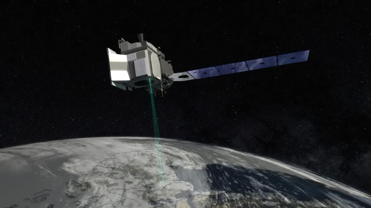
An artist’s rendering of ICESat-2. The satellite went into a safe hold following solar storms in May 2024, and is expected to return to science mode in mid-June. Credit: NASA’s Goddard Space Flight Center
About NASA’s ICESat-2
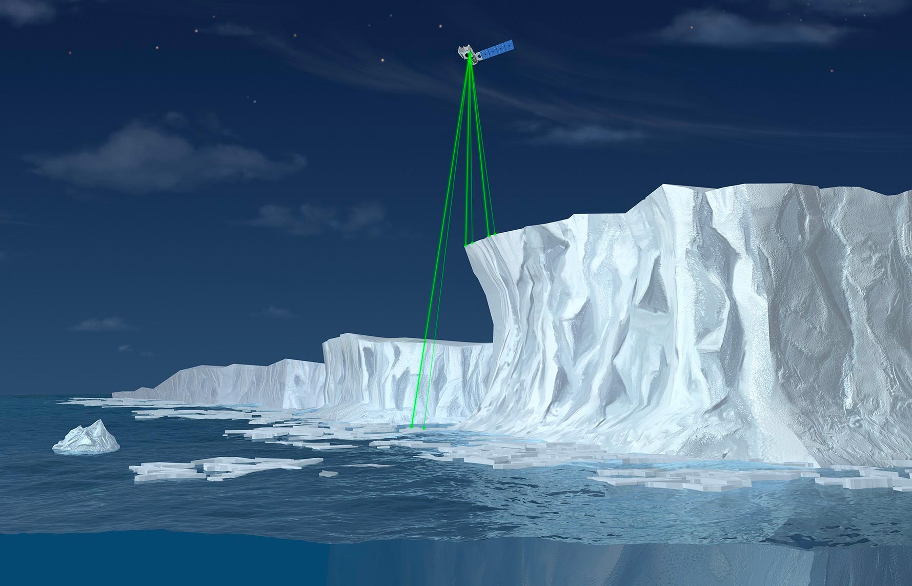
ICESat-2, short for Ice, Cloud, and land Elevation Satellite-2, is a NASA satellite mission designed to measure ice sheet elevation and sea ice thickness, as well as land topography and vegetation characteristics. Launched in September 2018, the satellite employs a sophisticated laser altimeter system called ATLAS (Advanced Topographic Laser Altimeter System) to provide precise and detailed measurements of Earth’s surface.
ICESat-2’s high-resolution data helps scientists understand changes in ice sheets, glaciers, and sea ice that result from climate change, enhancing our ability to accurately predict future sea level rise and assess changes in Earth’s ecosystems. This satellite is a critical tool in NASA’s Earth Observing System, contributing valuable data for environmental research and climate science.


Be the first to comment on "NASA’s ICESat-2 Satellite Survives Strongest Solar Storm in 20 Years"