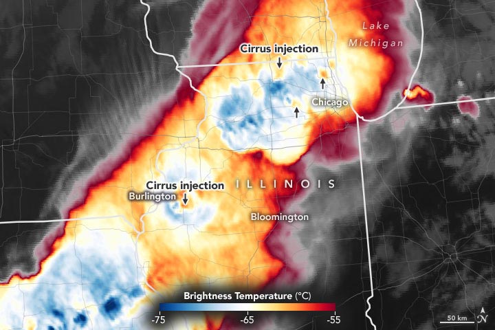
Severe thunderstorms can draw plumes of cirrus clouds into the stratosphere, a sign that tornadoes, large hail, or damaging winds may be coming soon.
After a group of tornadoes emerged from a squall line on June 20, 2021, and one touched down in the Chicago suburb of Naperville, the effects on the ground were obvious. The EF-3 tornado had 140-mile-per-hour (225 kph) winds that toppled thousands of trees, injured 11 people, and cut electricity to tens of thousands. The tornado damaged at least 230 houses, including one that collapsed.
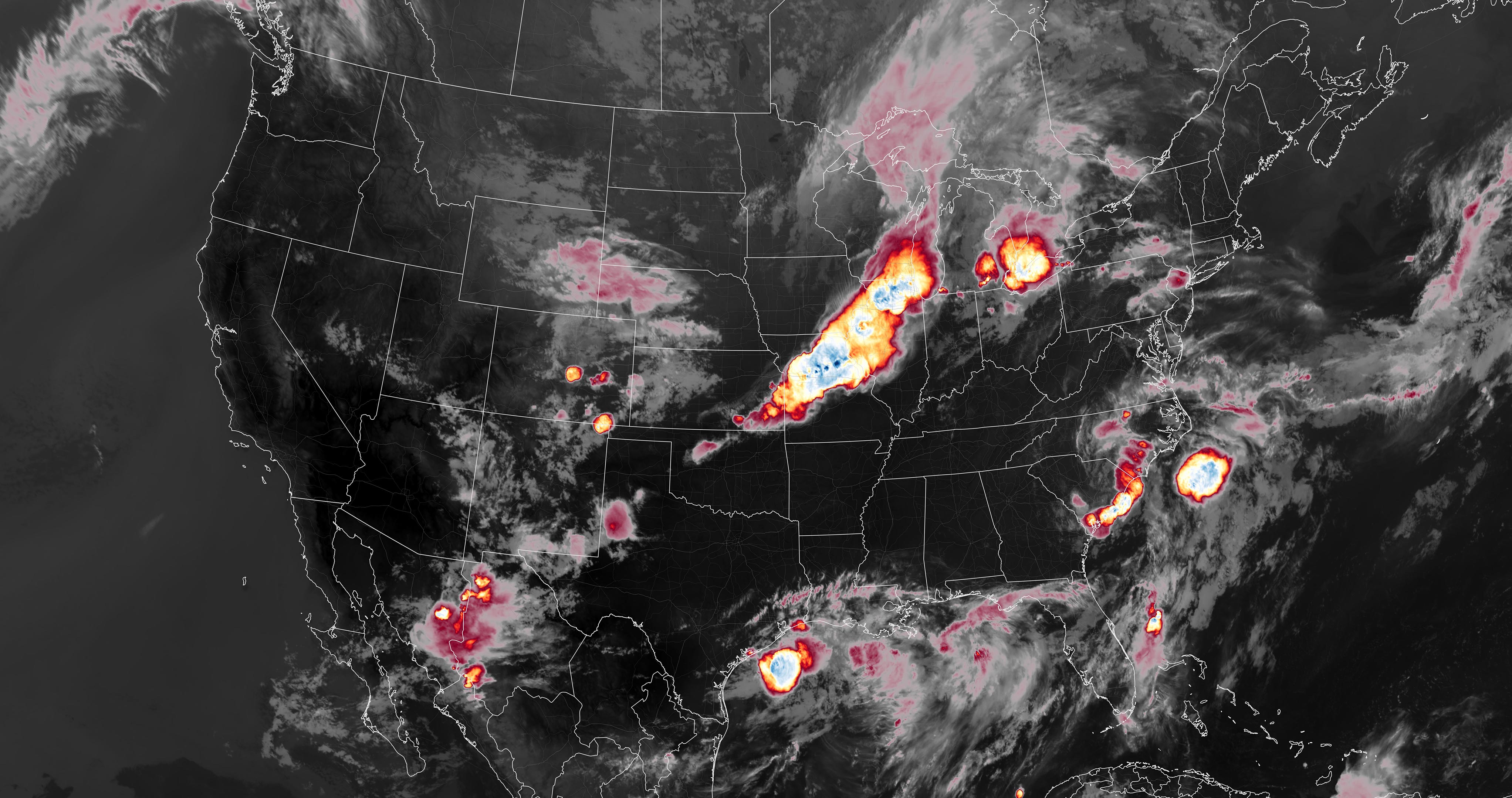
From a satellite perspective, the dynamics of the storm system were more subtle, but they offered at least one early clue that the squall line had a good chance of unloading destructive weather. The cloud temperature data above, from the Advanced Baseline Imager (ABI) on the GOES-R satellite, was collected about 45 minutes before the tornado touched down. Warmer air is red and cooler air is blue.
“Notice the plumes of warm air downwind of updrafts—the cold overshooting cloud tops,” said Kristopher Bedka of NASA’s Langley Research Center. “Those are what we call ‘above-anvil cirrus plumes’ (AACPs)—cirrus clouds that were injected into the stratosphere.”
Most thunderstorms can grow up to the tropopause, the boundary between the troposphere and the stratosphere. When strong storms reach the tropopause, their tops flatten out, giving them an anvil-like appearance. Above-anvil cirrus plumes form when especially intense updrafts puncture the tropopause and airflow draws cirrus cloud tops into the stratosphere. Cirrus plumes are typically warmer than underlying anvil clouds because the air in the stratosphere increases with altitude.
“Detecting an AACP isn’t a guarantee that you’ll get a tornado or other severe weather like we saw with the Naperville event, but our analysis of more than 400 of these events observed by either GOES-14 or GOES-16 showed about three-quarters of the time these cirrus plumes appeared 10 minutes or more before the most severe weather hits,” said Bedka. “Cirrus plumes routinely occur atop the world’s most intense storms, and tracking them can provide valuable lead time that saves lives and property.”
NASA Earth Observatory images by Joshua Stevens, using GOES 16 imagery courtesy of NOAA and the National Environmental Satellite, Data, and Information Service (NESDIS).
Never miss a breakthrough: Join the SciTechDaily newsletter.
Follow us on Google and Google News.
1 Comment
Storm chasers and watchers have known of this phenomenon for decades now. You can actually see this from the ground if the storm is far enough away for you to see the top of the ‘anvil.’ I suppose I am happy that it should be tracked more in the future, but I am concerned that it hasn’t already been tracked.