New research shows storms in the Southern Ocean are producing more rainfall, revealing a major shift in one of Earth’s most important climate systems.
Macquarie Island sits in the remote Southern Ocean roughly halfway between Tasmania and Antarctica. Visitors arriving on this narrow and windswept island quickly notice the abundant wildlife. Elephant seals lie across dark coastal beaches, king penguins move in groups up green slopes, and albatrosses glide over the open, treeless highlands.
A closer look, however, reveals that the landscape is shifting. Parts of the island’s slopes are becoming increasingly waterlogged, and distinctive megaherbs such as Pleurophyllum and Stilbocarpa are gradually disappearing from areas where they once thrived.
For years, researchers suspected that rising rainfall was responsible for these ecological changes. New research published in Weather and Climate Dynamics now confirms that increasing precipitation is a major factor. The findings also suggest that the changes seen on this isolated UNESCO World Heritage site reflect a much larger climate story unfolding across the Southern Ocean.
A major – but little observed – climate player
The Southern Ocean itself is a major—but still poorly observed—component of the global climate system. It plays a critical role in regulating Earth’s climate.
It absorbs much of the excess heat trapped by greenhouse gases and a large share of the carbon dioxide emitted by human activity.
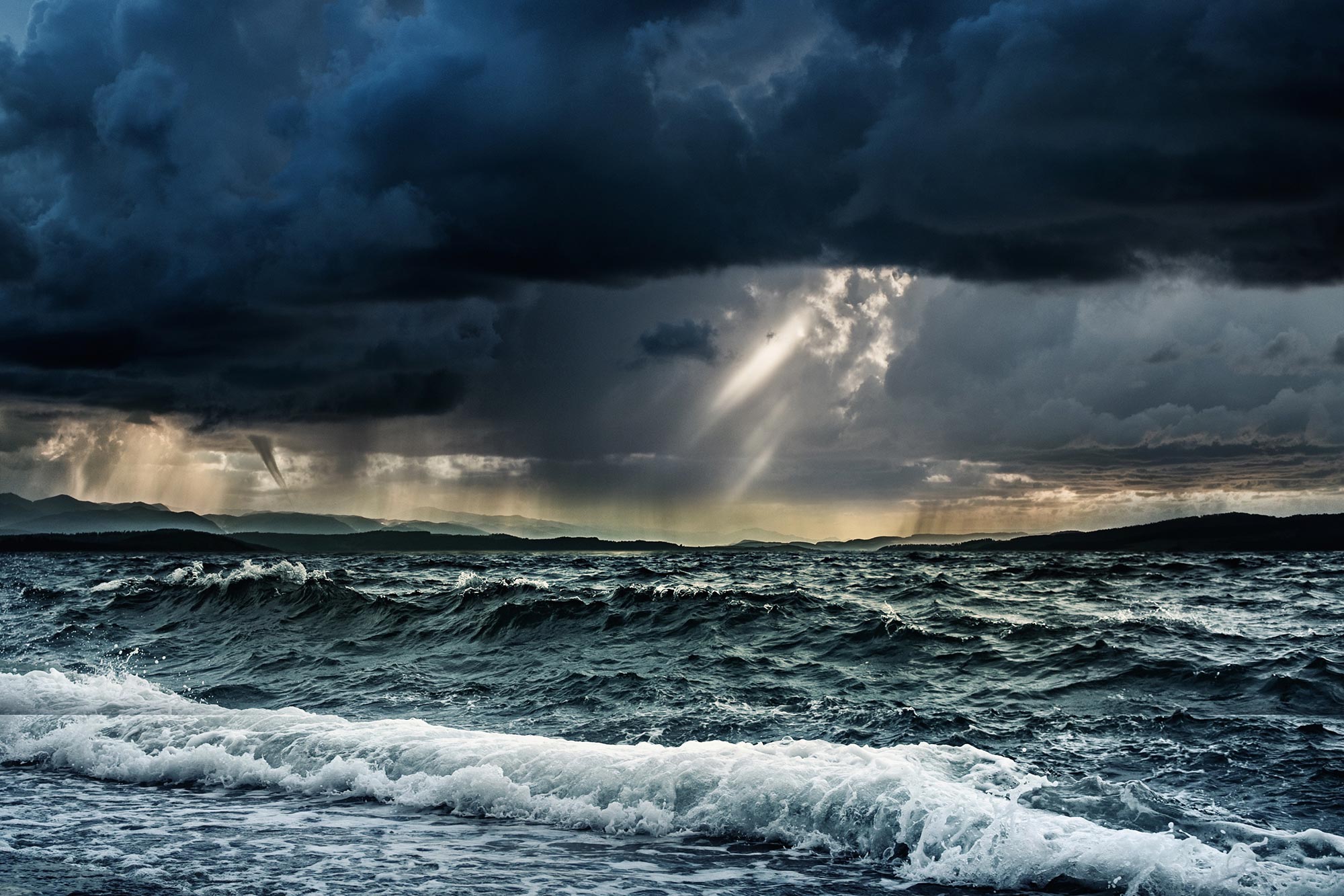
Storms in the Southern Ocean also influence weather patterns across Australia, New Zealand, and the globe.
Yet it is also one of the least observed places on Earth.
With almost no land masses, only a handful of weather stations, and ubiquitous cloud cover, satellites and simulations struggle to capture what is actually happening there.
That makes Macquarie Island’s climate record from the Bureau of Meteorology and the Australian Antarctic Division exceptionally valuable, providing one of the very few long-term “ground truth” records anywhere in the Southern Ocean.
These high-quality records of the observed daily rainfall and meteorology date back more than 75 years and are commonly used to validate satellite products and numerical simulations.
Long-term data reveals rising rainfall
Earlier work has found rainfall at Macquarie Island had risen sharply over recent decades, and ecologists documented waterlogging that harms native vegetation.
But no one has explained how the island’s weather patterns are changing, or directly compared the field observations to our best reconstructions of past weather to assess Southern Ocean climate trends.
To fill this gap, we analyzed 45 years (1979–2023) of daily rainfall observations and compared them to a widely used reconstruction of earlier weather, known as the ERA5 reanalysis.
We wanted to understand the meteorology behind the increase in rainfall – that is, whether it was caused by more storms or more intense rainfall during storms. To do this we placed each day in the dataset into one of five synoptic regimes based on pressure, humidity, winds, and temperature.
These regimes included low-pressure systems, cold-air outbreaks, and warm-air advection (the warm air that moves poleward ahead of a cold front).
Storms are producing more rain
Our analysis showed that annual rainfall on Macquarie Island has increased 28% since 1979 – around 260 millimeters per year.
The ERA5 reanalysis, in contrast, shows only an 8% increase — missing most of this change.
The storm track’s gradual move toward Antarctica is well established, and our results show how this larger change is shaping Macquarie Island’s weather today.
Crucially, we found that these changes are not causing the increase in rainfall, as one wet regime (warm air advection) was largely replacing another (low pressure).
Instead, storms now produce more rain when they occur.
Why does this matter beyond one island?
If the rainfall intensification we see at Macquarie Island reflects conditions across the Southern Ocean storm belt – as multiple lines of evidence indicate — the consequences are profound.
A wetter storm track means more fresh water entering the upper ocean. This strengthens the different layers in the oceans and reduces the amount of mixing that occurs. In turn, this alters the strength of ocean currents.
Our estimate suggests that in 2023, this additional precipitation equates to roughly 2,300 gigatonnes of additional freshwater per year across the high-latitude Southern Ocean – an order of magnitude greater than recent Antarctic meltwater contributions. And this difference continues to grow.
More rainfall will also affect the salinity of water on the ocean’s surface, which influences the movement of nutrients and carbon. As a result, this could change the productivity and chemistry of the Southern Ocean – one of the world’s most important carbon sinks – in still-uncertain ways.
This increase in rainfall requires a matching increase in evaporation, which cools the ocean, just like our bodies cool when our sweat evaporates. Over the cloudy Southern Ocean, this evaporation is the primary means of cooling the ocean.
Our analysis indicates the Southern Ocean may be cooling itself by 10–15% more than it did in 1979 – simply through the energy cost of evaporation that fuels the extra rainfall. This evaporation is spread over the broader Southern Ocean.
In effect, the Southern Ocean may be “sweating” more in response to climate change.
A signal from the planet’s stormiest ocean
Macquarie Island is just one tiny speck of land in Earth’s stormiest ocean.
But its long-term rainfall record suggests the Southern Ocean – the engine room of global heat and carbon uptake – is changing faster and more dramatically than we thought.
The next challenge is to determine how far this signal extends across the storm track, and what it means for the climate system we all depend on.
Reference: “Intensifying precipitation over the Southern Ocean challenges reanalysis-based climate estimates – Insights from Macquarie Island’s 45-year record” by Zhaoyang Kong, Andrew T. Prata, Peter T. May, Ariaan Purich, Yi Huang and Steven T. Siems, 3 December 2025, Weather and Climate Dynamics.
DOI: 10.5194/wcd-6-1643-2025
This research has been supported by the ARC SRIEAS Securing Antarctica’s Environmental Future (SAEF) (grant no. SR200100005) and the ARC Centre of Excellence for 21st Century Weather (grant no. CE230100012).
Disclosure: Steven Siems receives funding from the Australian Research Council.
Adapted from an article originally published in The Conversation. ![]()
Never miss a breakthrough: Join the SciTechDaily newsletter.
Follow us on Google and Google News.
4 Comments
“It absorbs much of the excess heat trapped by greenhouse gases and a large share of the carbon dioxide emitted by human activity.”
How is “excess” defined? I doubt that one could find agreement even on what the optimum average global temperature of Earth is — or even what the important metrics are and how they should be weighted.
One frequently reads about concerns of drought resulting from a warming Earth. This article clearly makes the point that the climate impacts of a warming Earth are more nuanced than universal drought.
“With almost no land masses, only a handful of weather stations, and ubiquitous cloud cover, …”
One rarely hears about the “ubiquitous cloud cover” in polar regions. It is one of the reasons that Vikings reputedly used a ‘Sunstone’ to locate polarized light in the sky while sailing on a sea whose clouds hid the sun, even when it was actually above the horizon.
One also reads claims about how polar “dark water” (Albedo Effect) contributes to absorption of sunlight — sunlight that is the opposite of “ubiquitous” when hidden behind ubiquitous clouds. It seems to never get mentioned, let alone explained, how sunlight filtered through clouds significantly warms polar waters. Then there is the concern that the water only looks dark because any light that falls on sediment-free water is reflected specularly, which means one can only see the reflected light in a viewing geometry that looks at the sun, at approximately the same viewing angle as the solar angle of incidence. Actually the dark appearance of water indicates a high reflectivity because little light makes it into the water.
There are so many things that are taken for granted in the debate about anthropogenic global warming, and contribute to conjecture because they aren’t discussed openly.
“As a result, this COULD change the productivity and chemistry of the Southern Ocean …”
Where would alarmist climatologists be if the word “could” didn’t exist in the English language? They would have to invent it, or god forbid, actually assign a numeric estimate to the probability of occurrence, along with a margin of error. Actually, a numeric probability is preferable, even with the existence of the word “could,” because all the word actually means is that it is not impossible. That is, it only discriminates between those events that are possible or impossible. The language of science is mathematics, not ambiguous words that only give one a binary choice between can and can’t. If they don’t know enough to estimate a numeric probability, they should make that explicit.
thanks