
On November 22, 2020, Cyclone Gati became the strongest storm to hit Somalia since satellite records began five decades ago. Gati made landfall with maximum sustained winds of 170 kilometers (105 miles) per hour, a category 2 storm on the Saffir-Simpson scale. The storm brought more than a year’s worth of rain to the region in two days. Local authorities report at least eight people were killed and thousands have been displaced.
The natural-color image above shows Gati before making landfall over Ras Hafun (the easternmost point in Africa) on November 22. The image was acquired by the Visible Infrared Imaging Radiometer Suite (VIIRS) on the Suomi NPP satellite.
In 12 hours, Gati’s winds intensified from 65 kilometers (40 miles) to 185 kilometers (115 miles) per hour—the largest 12-hour increase for any tropical storm ever recorded in the Indian Ocean. The storm rapidly intensified due to its small size, warm Indian Ocean waters, and low wind shear. Although the storm slightly weakened before landfall, Gati brought exceptional amounts of rain to northern Somalia.
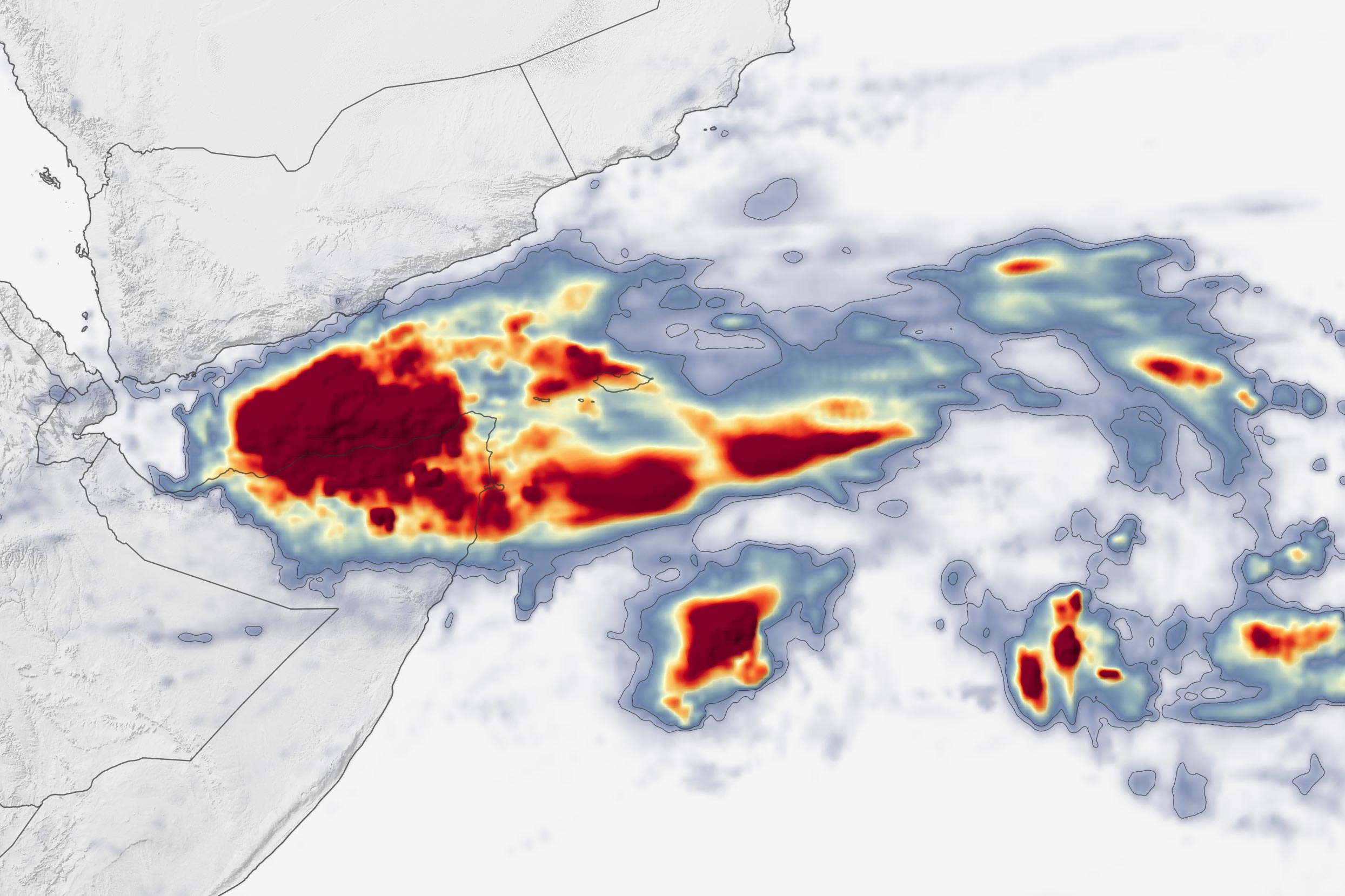
The map above shows rainfall accumulation from November 21-23, 2020. These data are remotely-sensed estimates that come from the Integrated Multi-Satellite Retrievals for GPM (IMERG), a product of the Global Precipitation Measurement (GPM) mission. Local rainfall amounts can be significantly higher when measured from the ground.
Much of northern Somalia, which typically receives about 10 centimeters (four inches) of rain in an entire year, received at least that much in two days. The city of Bosaso reported 12.8 centimeters (5 inches) in 24 hours. Heavy rains and strong winds caused flash floods along coastal and inland areas and destroyed buildings. Villages in the Iskushuban district, which includes Ras Hafun, were hit hardest. Gati has since weakened and moved into the Gulf of Aden.
NASA Earth Observatory images by Lauren Dauphin, using IMERG data from the Global Precipitation Mission (GPM) at NASA/GSFC and VIIRS data from NASA EOSDIS/LANCE and GIBS/Worldview and the Suomi National Polar-orbiting Partnership.
Never miss a breakthrough: Join the SciTechDaily newsletter.
Follow us on Google and Google News.