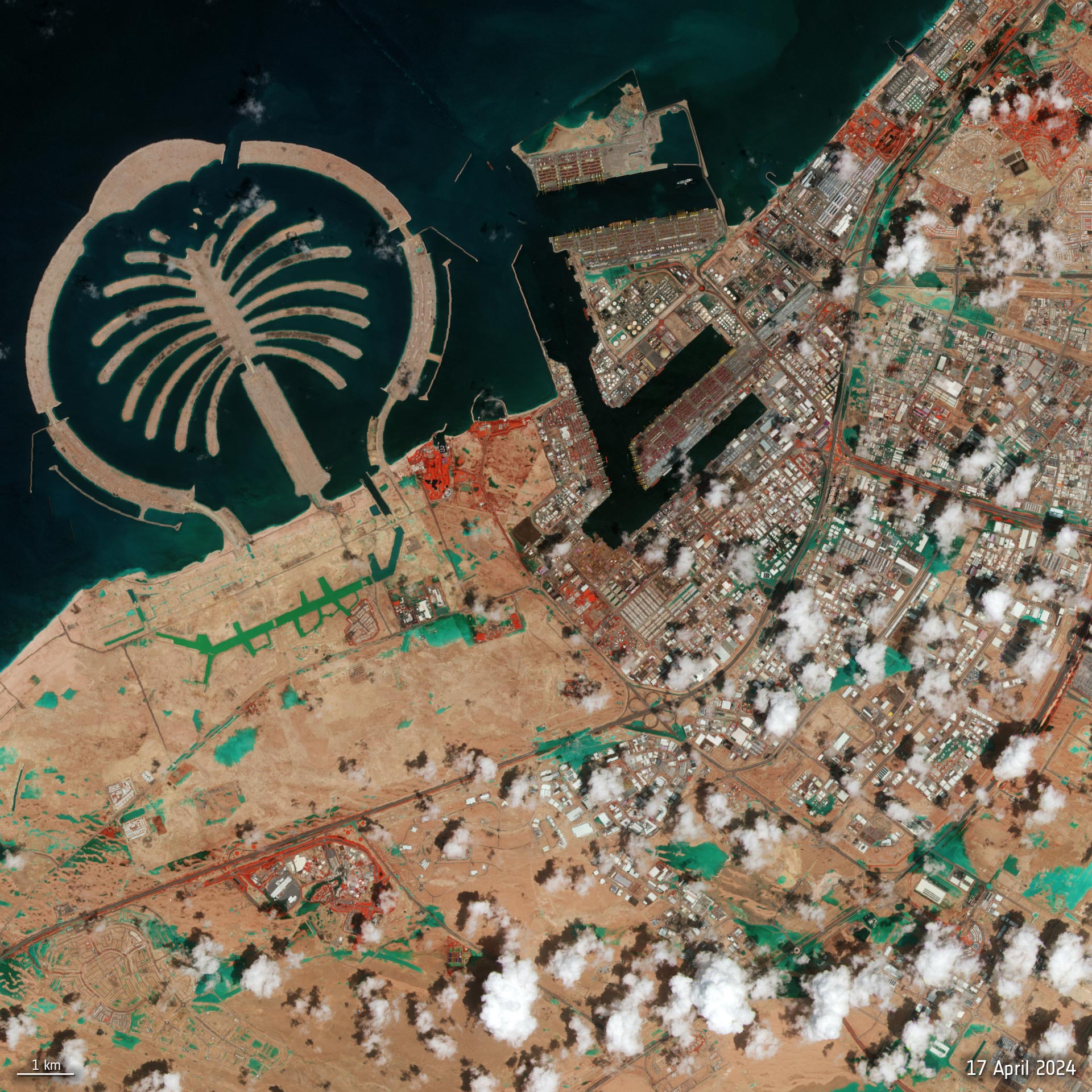
Recent torrential rains in Dubai caused widespread flooding, submerging roads and affecting flights. Over 250 mm (~10 inches) of rain fell across the UAE in less than 24 hours, as depicted in a false-color satellite image from Copernicus Sentinel-2, which highlights flooded areas and vegetation.
Dubai has been hit with torrential rain that flooded the desert city – submerging roads and vehicles and disrupting flights. More than 250 mm of precipitation was said to have fallen across the United Arab Emirates in less than 24 hours.
This Copernicus Sentinel-2 image, captured on April 17, is a false-color composite that highlights flooded areas in turquoise. Red patches in the image indicate vegetation.
Sentinel-2 provides crucial data for flood monitoring and management, enabling timely and accurate assessment of flood extent and severity through high-resolution satellite imagery.
Never miss a breakthrough: Join the SciTechDaily newsletter.
Follow us on Google and Google News.