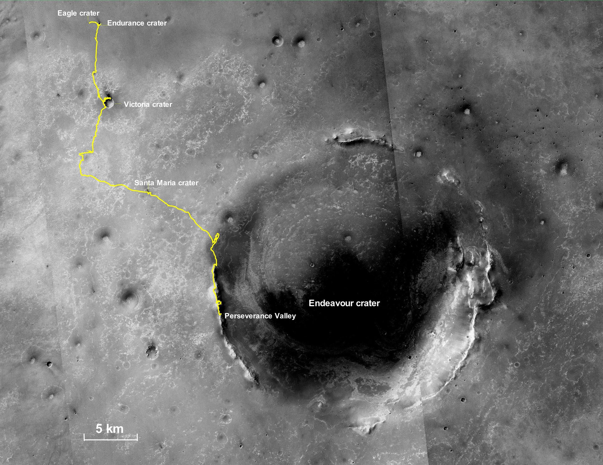
This final traverse map for NASA’s Opportunity rover shows where the rover was located within Perseverance Valley on June 10, 2018, the last date it made contact with its engineering team.
Visible in this map is a yellow traverse route beginning at Opportunity’s landing site, Eagle Crater, and ranging 28.06 miles (45.16 kilometers) to its final resting spot on the rim of Endeavour Crater. The rover was descending down into the crater in Perseverance Valley when the dust storm ended its mission.
Drive along with the NASA’s Opportunity Mars rover and hear the voices of scientists and engineers behind the mission. Designed to run for 90 days, the exploration spanned more than 15 years from 2004 to 2019. Along the way, it discovered definitive proof of liquid water on ancient Mars and set the off-world driving record. For more information on the Mars Exploration Rovers and all of NASA’s Mars missions.
Never miss a breakthrough: Join the SciTechDaily newsletter.
Follow us on Google and Google News.