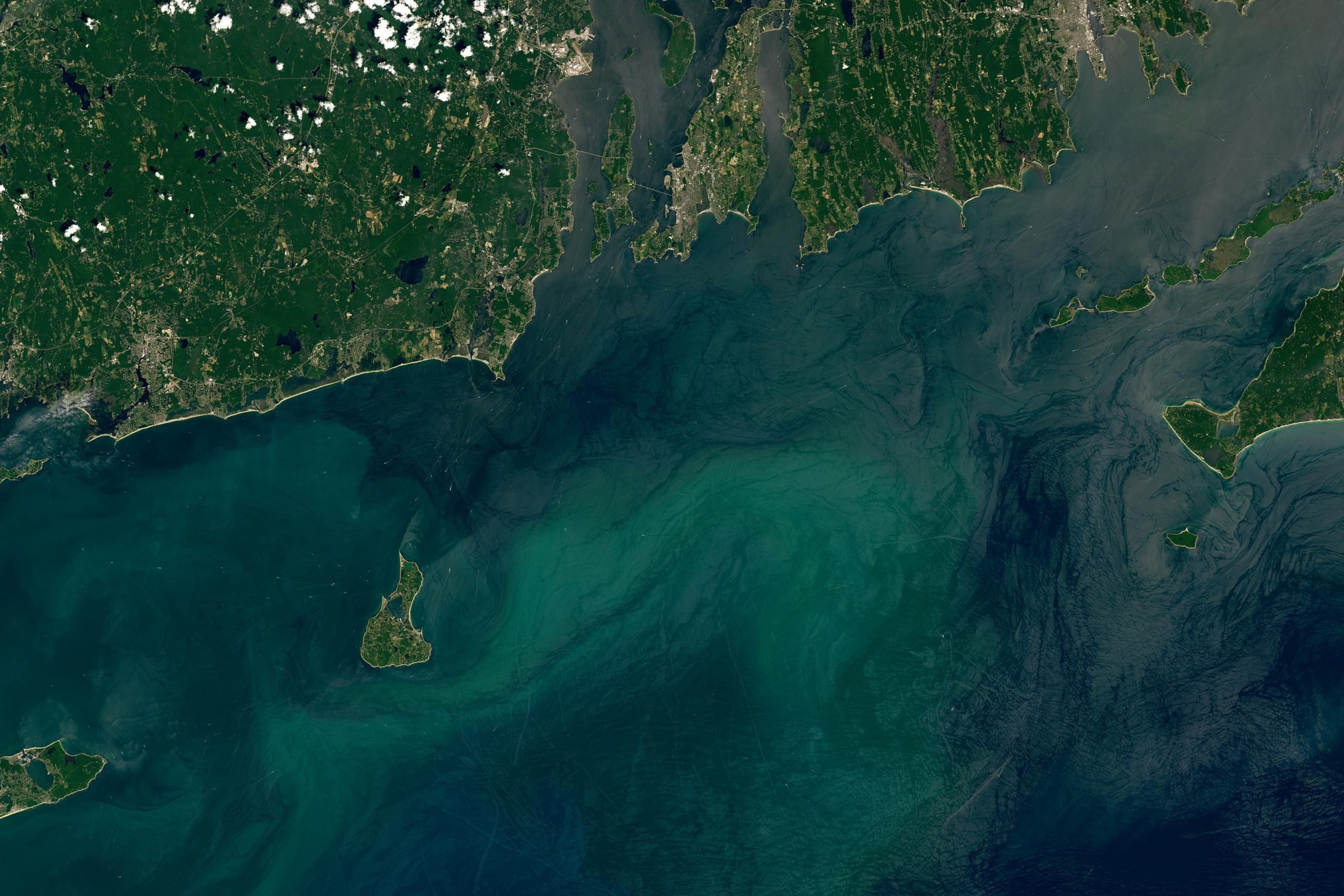
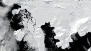
Block Island and the southern mainland of Rhode Island captured on July 3, 2024, by the Operational Land Imager on Landsat 8.
Block Island, shaped by glacial movements, hosts significant natural and human-made features including popular harbors and an offshore wind farm.
The conservation efforts on the island help protect numerous species, including the threatened American burying beetle.
Formation and Geography of Southern New England Islands
Roughly 20,000 years ago, the Laurentide Ice Sheet smothered what is now southern New England beneath a thick layer of ice. The leading edge of this hulking mass plowed into the landscape as it advanced, depositing piles of debris called terminal moraines at its southernmost extent. These piles of glacial till became the foundation for the archipelago of islands that now flank southern New England: Long Island, Nantucket, Martha’s Vineyard, and Block Island.
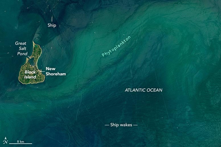
Block Island captured on July 3, 2024, by the Operational Land Imager on Landsat 8.
Observing Block Island Today
Block Island is visible in these images, acquired on July 3, 2024, by the OLI (Operational Land Imager) on Landsat 8. The pear-shaped island, located about 9 miles (14 kilometers) south of mainland Rhode Island, is about 6 miles long and 3.5 miles wide. Roughly 1,400 people live on Block Island, mostly in the town of New Shoreham. A combination of sunglint and a phytoplankton bloom made the wakes trailing behind the many boats near the island especially visible at the time of this image.
Evolution of Great Salt Pond
Great Salt Pond, once a freshwater pond, became tidal in 1905 when the U.S. Army Corps of Engineers dug a 0.6-mile-long channel to the ocean. The channel helped turn Great Salt Pond (also called New Harbor) into one of the most popular harbors in the Northeast, attracting about 1,500 boats to its three marinas on any given day in the summer. The smaller Old Harbor on the east side of the island is protected by a breakwater and serves as the main entry point for ferries arriving from Rhode Island, Connecticut, Massachusetts, and New York. The harbor also contains slips for commercial and charter fishing boats.
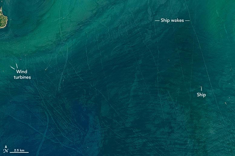
Wind turbines and ship wakes off the southern mainland of Rhode Island captured on July 3, 2024, by the Operational Land Imager on Landsat 8.
Renewable Energy and Conservation on Block Island
Five wind turbines form a line several miles southeast of Block Island. The turbines, installed in 2016 as part of the first offshore wind farm in the United States, replaced five diesel generators. Now, just 10 percent of the electricity they generate powers all of Block Island. The rest is exported to the mainland.
Conservation areas span about 40 percent of the island, including much of the land north of Great Salt Pond. The Block Island National Wildlife Refuge is one such area and hosts more than 70 species of migratory songbirds, as well as the largest colony of gulls in Rhode Island. The refuge also provides habitat for the American burying beetle, a large black-and-orange beetle that feeds on carrion. When the beetle was listed as endangered in 1989, the community on Block Island was just one of two populations known to remain in the United States. The beetles were recategorized as threatened in 2020.
NASA Earth Observatory images by Lauren Dauphin, using Landsat data from the U.S. Geological Survey.


Be the first to comment on "Hidden Wonders: A Piece of Rhode Island in the Atlantic"