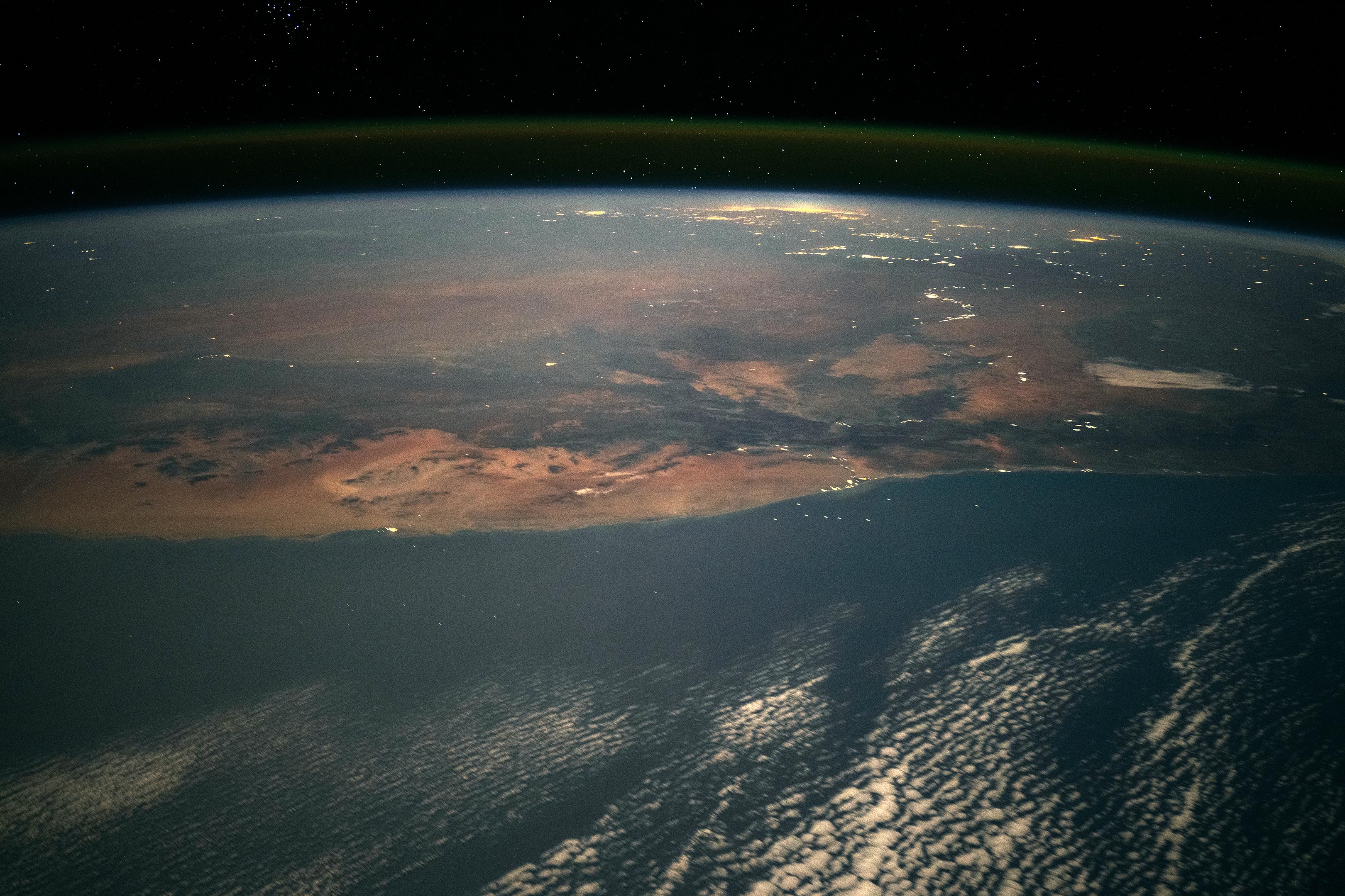
An astronaut on the ISS captured a nighttime image showcasing over 1,300 kilometers of the southern African landscape from Namibia to South Africa.
The photo highlights coastal and inland areas, illustrating the stark contrasts in climate and population density. The coast is characterized by the dry Namib Desert, influenced by the cold Benguela Current, while inland areas show vibrant urban centers like the Pretoria-Witwatersrand-Vereeniging conglomeration, home to over 8 million people and significant mining operations, including gold and platinum.
An astronaut aboard the International Space Station (ISS) captured this nighttime image of Namibia and South Africa. Taken at a highly oblique angle with a short focal-length lens, the photo reveals the sweeping landscapes visible from orbit. The view stretches from Namibia’s coastal cities to a cluster of major South African cities glowing near the horizon, spanning more than 1,300 kilometers (800 miles) of southern Africa’s terrain.
In the foreground, moonlight brightens the tops of offshore clouds. Along the coast, a clear, cloud-free zone appears due to the Benguela Current, which brings cold, deep Atlantic water to the surface. This cooler water prevents cloud formation and reduces rainfall, creating the arid climate responsible for the Namib Desert’s vast “sand sea” and iconic dunes, frequently photographed by astronauts.
Population density in southern Africa mirrors the region’s rainfall distribution, with small and sparsely populated communities along the hyper-arid coast and major groups of cities inland where rainfall is plentiful. Southern Africa’s largest river, the Orange River, is marked by the lights of several towns that draw water from its channel.
Many clusters of lights in this view are related to towns whose economies are based on mining. In the foreground, Oranjemund and neighboring towns lie at the point where the Orange River enters the Atlantic Ocean. These towns, along with the small coastal town of Lüderitz, are renowned diamond mining centers. The twin towns of Springbok and Okiep, farther south, are centers of copper mining.
The large cluster of lights near the horizon comes from cities in the wetter inland part of South Africa. The largest grouping is the Pretoria-Witwatersrand-Vereeniging conglomeration of cities, where more than 8 million people live. The origin of this major industrial region was the rich gold fields of the Witwatersrand. Rustenburg, the city farthest north in the cluster of lights, is centered on South Africa’s rich platinum mines. The city of Gaborone is Botswana’s capital and a major center for diamond mining corporations. Bloemfontein (top right) is the capital city of the Free State province of South Africa.
Astronaut photograph ISS071-E-523401 was acquired on August 21, 2024, with a Nikon Z9 digital camera using a focal length of 50 millimeters. It is provided by the ISS Crew Earth Observations Facility and the Earth Science and Remote Sensing Unit, Johnson Space Center. The image was taken by a member of the Expedition 71 crew. The image has been cropped and enhanced to improve contrast, and lens artifacts have been removed. The International Space Station Program supports the laboratory as part of the ISS National Lab to help astronauts take pictures of Earth that will be of the greatest value to scientists and the public, and to make those images freely available on the Internet.
Never miss a breakthrough: Join the SciTechDaily newsletter.
Follow us on Google and Google News.